


<< Our Photo Pages >> La Pierre Plantée (Les Bels) - Modern Stone Circle etc in France in Midi:Tarn (81)
Submitted by johnstone on Friday, 23 November 2018 Page Views: 753
Modern SitesSite Name: La Pierre Plantée (Les Bels)Country: France
NOTE: This site is 6.048 km away from the location you searched for.
Département: Midi:Tarn (81) Type: Modern Stone Circle etc
Nearest Town: Castres Nearest Village: Navès
Latitude: 43.553530N Longitude: 2.211000E
Condition:
| 5 | Perfect |
| 4 | Almost Perfect |
| 3 | Reasonable but with some damage |
| 2 | Ruined but still recognisable as an ancient site |
| 1 | Pretty much destroyed, possibly visible as crop marks |
| 0 | No data. |
| -1 | Completely destroyed |
| 5 | Superb |
| 4 | Good |
| 3 | Ordinary |
| 2 | Not Good |
| 1 | Awful |
| 0 | No data. |
| 5 | Can be driven to, probably with disabled access |
| 4 | Short walk on a footpath |
| 3 | Requiring a bit more of a walk |
| 2 | A long walk |
| 1 | In the middle of nowhere, a nightmare to find |
| 0 | No data. |
| 5 | co-ordinates taken by GPS or official recorded co-ordinates |
| 4 | co-ordinates scaled from a detailed map |
| 3 | co-ordinates scaled from a bad map |
| 2 | co-ordinates of the nearest village |
| 1 | co-ordinates of the nearest town |
| 0 | no data |
Internal Links:
External Links:
I have visited· I would like to visit
johnstone visited on 13th Sep 2018 - their rating: Cond: 4 Amb: 3 Access: 5
 (PID:188968)")
It’s a rather white piece of concrete (?), rectangular and sheer standing, obviously representing a menhir of about 1.5 m.
Planted in the middle of hedges in the shape of a star.
A souvenir of the original monolith which was crashed by a van and stood at the carpool place next to the road to Les Bels.
You may be viewing yesterday's version of this page. To see the most up to date information please register for a free account.
 (PID:237330)")
 (PID:188967)")
Do not use the above information on other web sites or publications without permission of the contributor.
Nearby Images from Flickr


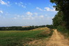

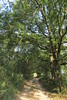

The above images may not be of the site on this page, but were taken nearby. They are loaded from Flickr so please click on them for image credits.
Click here to see more info for this site
Nearby sites
Click here to view sites on an interactive map of the areaKey: Red: member's photo, Blue: 3rd party photo, Yellow: other image, Green: no photo - please go there and take one, Grey: site destroyed
Download sites to:
KML (Google Earth)
GPX (GPS waypoints)
CSV (Garmin/Navman)
CSV (Excel)
To unlock full downloads you need to sign up as a Contributory Member. Otherwise downloads are limited to 50 sites.
Turn off the page maps and other distractions
Nearby sites listing. In the following links * = Image available
4.5km ESE 109° Pisse Lièvre tumulus Chambered Tomb
10.6km WSW 244° Menhir des Rivals* Standing Stone (Menhir)
11.2km ESE 122° Grotte de Lacalm* Cave or Rock Shelter
11.5km NE 54° Roc de Baptistou* Rock Outcrop
11.6km NE 54° Chaos de la Rouquette* Rock Outcrop
11.7km NE 55° Rocher Le Sabot de la Rouquette* Rock Outcrop
11.7km NE 55° Rocher tremblant de la Rouquette (l'Oeuf)* Rock Outcrop
11.8km SE 134° Dolmen de Récuquelle 1* Natural Stone / Erratic / Other Natural Feature
12.0km SE 133° Dolmen de Recuquelle 2* Natural Stone / Erratic / Other Natural Feature
12.4km ENE 63° Roc de Ruscayrolles Rock Outcrop
12.6km NE 43° Le Grain de Campsoleil* Rock Art
14.1km ENE 61° Rocher Tremblant de Lascombes* Rock Outcrop
15.2km NE 49° Le Roc du Verdier* Rock Outcrop
15.3km ENE 76° Statue-menhir du Vergnas* Sculptured Stone
15.6km SW 220° Grotte du Calel* Cave or Rock Shelter
15.8km ENE 67° Rocher l’Hamburger* Rock Outcrop
15.9km ENE 68° Le Châpeau de Napoleon (Sidobre)* Rock Outcrop
16.0km ENE 68° Chaos de la Balme* Rock Outcrop
16.3km WSW 239° Menhirs des Lattes* Standing Stones
16.4km NE 45° Le Rocher Tremblant de la Barque* Rock Outcrop
16.6km SW 222° Berniquaut Oppidum Ancient Village or Settlement
16.6km SW 218° Menhir de Jacournassy* Standing Stone (Menhir)
16.7km SW 219° Peyre-Ficade la Privade * Standing Stone (Menhir)
16.9km ESE 123° Pierre Plantée d'Hautpoul* Standing Stone (Menhir)
17.0km ENE 59° Rocher Tremblant de Sept Faux* Rock Outcrop
View more nearby sites and additional images


 We would like to know more about this location. Please feel free to add a brief description and any relevant information in your own language.
 Wir möchten mehr über diese Stätte erfahren. Bitte zögern Sie nicht, eine kurze Beschreibung und relevante Informationen in Deutsch hinzuzufügen.
 Nous aimerions en savoir encore un peu sur les lieux. S'il vous plaît n'hesitez pas à ajouter une courte description et tous les renseignements pertinents dans votre propre langue.
 Quisieramos informarnos un poco más de las lugares. No dude en añadir una breve descripción y otros datos relevantes en su propio idioma.