<< Our Photo Pages >> Otradnoe - Barrow Cemetery in Russia
Submitted by Ogneslav on Sunday, 06 July 2014 Page Views: 2201
Neolithic and Bronze AgeSite Name: Otradnoe Alternative Name: Georgenswalde, ОтрадноеCountry: Russia Type: Barrow Cemetery
Nearest Town: Svetlogorsk Nearest Village: Otradnoe
Latitude: 54.939710N Longitude: 20.122720E
Condition:
| 5 | Perfect |
| 4 | Almost Perfect |
| 3 | Reasonable but with some damage |
| 2 | Ruined but still recognisable as an ancient site |
| 1 | Pretty much destroyed, possibly visible as crop marks |
| 0 | No data. |
| -1 | Completely destroyed |
| 5 | Superb |
| 4 | Good |
| 3 | Ordinary |
| 2 | Not Good |
| 1 | Awful |
| 0 | No data. |
| 5 | Can be driven to, probably with disabled access |
| 4 | Short walk on a footpath |
| 3 | Requiring a bit more of a walk |
| 2 | A long walk |
| 1 | In the middle of nowhere, a nightmare to find |
| 0 | No data. |
| 5 | co-ordinates taken by GPS or official recorded co-ordinates |
| 4 | co-ordinates scaled from a detailed map |
| 3 | co-ordinates scaled from a bad map |
| 2 | co-ordinates of the nearest village |
| 1 | co-ordinates of the nearest town |
| 0 | no data |
Internal Links:
External Links:
")
You may be viewing yesterday's version of this page. To see the most up to date information please register for a free account.
")
")
")
")
Do not use the above information on other web sites or publications without permission of the contributor.
Nearby Images from Flickr

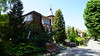
The above images may not be of the site on this page, but were taken nearby. They are loaded from Flickr so please click on them for image credits.
Click here to see more info for this site
Nearby sites
Click here to view sites on an interactive map of the areaKey: Red: member's photo, Blue: 3rd party photo, Yellow: other image, Green: no photo - please go there and take one, Grey: site destroyed
Download sites to:
KML (Google Earth)
GPX (GPS waypoints)
CSV (Garmin/Navman)
CSV (Excel)
To unlock full downloads you need to sign up as a Contributory Member. Otherwise downloads are limited to 50 sites.
Turn off the page maps and other distractions
Nearby sites listing. In the following links * = Image available
3.4km E 90° Svetlogorsk* Hillfort
5.6km E 82° The Lie Stone* Natural Stone / Erratic / Other Natural Feature
6.5km ENE 76° Pionersky* Hillfort
6.9km ENE 78° Rantawa Museum* Museum
22.4km E 92° Kaup Barrows* Barrow Cemetery
22.5km E 84° Zelenogradsk Museum of Regional Studies* Museum
35.5km ENE 72° Curonian Spit Museum* Museum
35.7km SE 135° Kaliningrad Regional Museum of History and Art* Museum
47.8km ESE 124° Waldau Castle Museum* Museum
78.6km SSE 150° Grodzisko Bezledy Hillfort
79.4km SSW 193° Kurhany Piórkowo Barrow Cemetery
79.9km SSE 157° Grodzisko Wiewiórki Hillfort
88.8km SSE 153° Grodzisko Ardapy Promontory Fort / Cliff Castle
96.4km SSE 167° Grodzisko Łaniewo Hillfort
102.2km SSE 163° Grodzisko Jarandowo Hillfort
107.5km SSE 152° Bisztynek - Diabelski Kamień Natural Stone / Erratic / Other Natural Feature
114.4km SE 128° Grodzisko Bajory Wielkie Hillfort
116.1km SW 236° Gdansk* Sculptured Stone
116.3km W 263° Kurhan Mieroszyno Round Barrow(s)
116.4km S 169° Grodzisko Kabikiejmy Górne Promontory Fort / Cliff Castle
116.9km SE 142° Kurhan Tołkiny Round Barrow(s)
117.0km SSW 203° Grodzisko Kwietniewo Hillfort
122.2km E 81° Rambyno kalno akmuo* Marker Stone
124.7km W 260° Diabelski Kamień Natural Stone / Erratic / Other Natural Feature
124.9km W 260° Boża Stopka Rock Art
View more nearby sites and additional images


 We would like to know more about this location. Please feel free to add a brief description and any relevant information in your own language.
 Wir möchten mehr über diese Stätte erfahren. Bitte zögern Sie nicht, eine kurze Beschreibung und relevante Informationen in Deutsch hinzuzufügen.
 Nous aimerions en savoir encore un peu sur les lieux. S'il vous plaît n'hesitez pas à ajouter une courte description et tous les renseignements pertinents dans votre propre langue.
 Quisieramos informarnos un poco más de las lugares. No dude en añadir una breve descripción y otros datos relevantes en su propio idioma.