

, Aubrey Burl")
<< Text Pages >> Grodzisko Udórz - Hillfort in Poland in Slaskie
Submitted by SolarMegalith on Monday, 20 September 2010 Page Views: 2512
Iron Age and Later PrehistorySite Name: Grodzisko UdórzCountry: Poland
NOTE: This site is 11.355 km away from the location you searched for.
Voivodeship: Slaskie Type: Hillfort
Nearest Town: Wolbrom Nearest Village: Udórz
Latitude: 50.444060N Longitude: 19.767490E
Condition:
| 5 | Perfect |
| 4 | Almost Perfect |
| 3 | Reasonable but with some damage |
| 2 | Ruined but still recognisable as an ancient site |
| 1 | Pretty much destroyed, possibly visible as crop marks |
| 0 | No data. |
| -1 | Completely destroyed |
| 5 | Superb |
| 4 | Good |
| 3 | Ordinary |
| 2 | Not Good |
| 1 | Awful |
| 0 | No data. |
| 5 | Can be driven to, probably with disabled access |
| 4 | Short walk on a footpath |
| 3 | Requiring a bit more of a walk |
| 2 | A long walk |
| 1 | In the middle of nowhere, a nightmare to find |
| 0 | No data. |
| 5 | co-ordinates taken by GPS or official recorded co-ordinates |
| 4 | co-ordinates scaled from a detailed map |
| 3 | co-ordinates scaled from a bad map |
| 2 | co-ordinates of the nearest village |
| 1 | co-ordinates of the nearest town |
| 0 | no data |
Internal Links:
External Links:
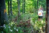
A Bronze Age hillfort is located on top of the hill and hidden in the forest West from village of Udórz.
The earthwork and ditch are still visible, while West from the hillfort there are ruins of an unfinished medieval castle. The site is connectd with Lusatian culture, the main Bronze Age culture which developed in the area of current Poland.
You may be viewing yesterday's version of this page. To see the most up to date information please register for a free account.
Do not use the above information on other web sites or publications without permission of the contributor.
Nearby Images from Flickr

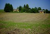
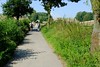
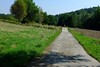
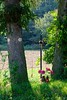
The above images may not be of the site on this page, but were taken nearby. They are loaded from Flickr so please click on them for image credits.
Click here to see more info for this site
Nearby sites
Click here to view sites on an interactive map of the areaKey: Red: member's photo, Blue: 3rd party photo, Yellow: other image, Green: no photo - please go there and take one, Grey: site destroyed
Download sites to:
KML (Google Earth)
GPX (GPS waypoints)
CSV (Garmin/Navman)
CSV (Excel)
To unlock full downloads you need to sign up as a Contributory Member. Otherwise downloads are limited to 50 sites.
Turn off the page maps and other distractions
Nearby sites listing. In the following links * = Image available
6.6km W 265° Smoleń - Zamek Pilcza* Ancient Village or Settlement
7.5km WSW 255° Jaskinia Na Biśniku Cave or Rock Shelter
20.2km NW 304° Jaskinia w Dziadowej Skale Cave or Rock Shelter
21.4km NW 320° Grodzisko Góra Słupsko* Hillfort
24.5km SW 224° Grodzisko Stary Olkusz* Hillfort
30.1km S 175° Jaskinia Wierzchowska Górna* Cave or Rock Shelter
30.3km S 183° Grodzisko Będkowice* Hillfort
30.4km S 175° Jaskinia Mamutowa* Cave or Rock Shelter
34.5km SSW 197° Grodzisko Bartlowa Góra - Czatkowice Hillfort
37.0km NW 318° Grodzisko Wały - Potok Złoty* Hillfort
41.6km ESE 104° Kurhan Szczotkowice Round Barrow(s)
42.1km ESE 112° Kurhan Pałecznica Round Barrow(s)
43.3km S 185° Grodzisko Mników Hillfort
44.6km SSE 164° Archaeological Museum of Kraków* Museum
45.0km SSE 165° Kraków - Wawel* Ancient Village or Settlement
46.2km NW 314° Jaskinia Komarowa Cave or Rock Shelter
46.7km SSE 153° Kopiec Wandy* Artificial Mound
47.1km SSE 163° Kopiec Krakusa* Artificial Mound
50.2km NW 316° Jaskinia Towarna Cave or Rock Shelter
50.5km S 184° Wołowice Flint Mine Ancient Mine, Quarry or other Industry
56.5km NW 319° Grodzisko Gąszczyk* Hillfort
60.5km NW 317° Wyczerpy Górne Bronze Age Settlement Ancient Village or Settlement
62.2km ESE 102° Kurhany Kolosy* Round Barrow(s)
62.4km SSE 152° Kurhany Jawczyce Barrow Cemetery
63.1km SSE 147° Kurhan Krakuszowice Round Barrow(s)
View more nearby sites and additional images


 We would like to know more about this location. Please feel free to add a brief description and any relevant information in your own language.
 Wir möchten mehr über diese Stätte erfahren. Bitte zögern Sie nicht, eine kurze Beschreibung und relevante Informationen in Deutsch hinzuzufügen.
 Nous aimerions en savoir encore un peu sur les lieux. S'il vous plaît n'hesitez pas à ajouter une courte description et tous les renseignements pertinents dans votre propre langue.
 Quisieramos informarnos un poco más de las lugares. No dude en añadir una breve descripción y otros datos relevantes en su propio idioma.