

<< Our Photo Pages >> Visoko Pyramid of the Moon - Natural Stone / Erratic / Other Natural Feature in Bosnia
Submitted by MichelDRN on Thursday, 24 August 2006 Page Views: 10947
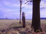
Natural PlacesSite Name: Visoko Pyramid of the Moon Alternative Name: Piramida MjesecaCountry: Bosnia
NOTE: This site is 14.316 km away from the location you searched for.
Type: Natural Stone / Erratic / Other Natural Feature
Nearest Town: Sarejevo Nearest Village: Visoko
Latitude: 43.972070N Longitude: 18.201790E
Condition:
| 5 | Perfect |
| 4 | Almost Perfect |
| 3 | Reasonable but with some damage |
| 2 | Ruined but still recognisable as an ancient site |
| 1 | Pretty much destroyed, possibly visible as crop marks |
| 0 | No data. |
| -1 | Completely destroyed |
| 5 | Superb |
| 4 | Good |
| 3 | Ordinary |
| 2 | Not Good |
| 1 | Awful |
| 0 | No data. |
| 5 | Can be driven to, probably with disabled access |
| 4 | Short walk on a footpath |
| 3 | Requiring a bit more of a walk |
| 2 | A long walk |
| 1 | In the middle of nowhere, a nightmare to find |
| 0 | No data. |
| 5 | co-ordinates taken by GPS or official recorded co-ordinates |
| 4 | co-ordinates scaled from a detailed map |
| 3 | co-ordinates scaled from a bad map |
| 2 | co-ordinates of the nearest village |
| 1 | co-ordinates of the nearest town |
| 0 | no data |
Internal Links:
External Links:
I have visited· I would like to visit
ModernExplorers visited on 2nd Aug 2012 - their rating: Cond: 3 Amb: 3 Access: 3 Is it a hill? is it a Pyramid??
There is enough evidence to suggest it is more than a hill. I was there for a 2 week volunteer program but I must return to investigate further.
Tiled terraces and a hill shaped like a pyramid
")
I assume that both so-said "pyramid of the sun" and "pyramid of the moon" are natural hills including curious but natural features.
The so-said "pyramid of the moon" is a hill based upon two lage circular features. A part of its front slope was shaped as terraces supported by some low walls, certainly for farming, as everywhere in the world.
What is confusing is that some places show regular kinds of pavements. But as they are multiple and each laying over the other, separated by natural ground, with no trace of human action, I assume that they are a natural curiosity. This opinion is reinforced by the fact that same layers of same schist stone can be observed in neighbouring quarries, where there is no "pyramid".
I believe that even before archeologists, geologists would say if these pavements are natural or made by man, ancient or... quite recent.
Also see the Megalithic Portal's site listing for the 'Pyramid of the Sun' for more complete information on these hills, the alternative archaeological theory proposed for them, and what our correspondents have found at the site.
You may be viewing yesterday's version of this page. To see the most up to date information please register for a free account.
")
")
")
")
")
")
")
Do not use the above information on other web sites or publications without permission of the contributor.
Click here to see more info for this site
Nearby sites
Click here to view sites on an interactive map of the areaKey: Red: member's photo, Blue: 3rd party photo, Yellow: other image, Green: no photo - please go there and take one, Grey: site destroyed
Download sites to:
KML (Google Earth)
GPX (GPS waypoints)
CSV (Garmin/Navman)
CSV (Excel)
To unlock full downloads you need to sign up as a Contributory Member. Otherwise downloads are limited to 50 sites.
Turn off the page maps and other distractions
Nearby sites listing. In the following links * = Image available
1.3km SW 224° Pyramid of Love* Natural Stone / Erratic / Other Natural Feature
1.7km W 269° Visoko Pyramid of Earth* Natural Stone / Erratic / Other Natural Feature
2.1km WNW 285° Visoko Pyramid of the Sun* Natural Stone / Erratic / Other Natural Feature
2.2km SW 223° Pyramid of Dragon* Natural Stone / Erratic / Other Natural Feature
4.3km NW 309° Ravne Tunnel Megaliths* Natural Stone / Erratic / Other Natural Feature
20.9km SE 128° Butmir* Ancient Village or Settlement
77.7km SSW 212° Zvonigrad* Hillfort
77.7km SSW 212° Zvonigrad - fortification wall* Hillfort
78.1km SSW 210° Polog.* Hillfort
91.0km SSW 207° Citluk-Greda-Illyrian observatory* Carving
99.0km SSW 193° Osanici Hillfort* Hillfort
104.5km SSW 202° Klepci tumuli 1* Round Barrow(s)
104.6km SSW 202° Klepci tumuli 2* Round Barrow(s)
109.5km SSW 205° Narona Town Wall* Hillfort
109.6km SSW 205° Narona Museum* Museum
123.9km WSW 255° Cetina Valley Ancient Village or Settlement
133.8km N 353° Galovo Ancient Village or Settlement
135.9km S 169° Crvena Stjena Cave or Rock Shelter
140.6km SW 220° Nakovana Cave* Cave or Rock Shelter
142.4km WSW 252° Klis Hillfort* Hillfort
145.6km SSE 157° Roman bridge over Moštanica Ancient Mine, Quarry or other Industry
146.2km WSW 251° Solin Town Gate* Ancient Village or Settlement
146.2km WSW 251° Salona Town wall* Hillfort
150.6km WSW 251° Diocletian's Palace* Ancient Palace
151.5km WSW 242° Brac Island* Ancient Village or Settlement
View more nearby sites and additional images


 We would like to know more about this location. Please feel free to add a brief description and any relevant information in your own language.
 Wir möchten mehr über diese Stätte erfahren. Bitte zögern Sie nicht, eine kurze Beschreibung und relevante Informationen in Deutsch hinzuzufügen.
 Nous aimerions en savoir encore un peu sur les lieux. S'il vous plaît n'hesitez pas à ajouter une courte description et tous les renseignements pertinents dans votre propre langue.
 Quisieramos informarnos un poco más de las lugares. No dude en añadir una breve descripción y otros datos relevantes en su propio idioma.