<< Text Pages >> Przodkowo Stone Circles - Stone Circle in Poland in Pomorskie
Submitted by SolarMegalith on Monday, 21 July 2008 Page Views: 2857
Neolithic and Bronze AgeSite Name: Przodkowo Stone CirclesCountry: Poland
NOTE: This site is 9.722 km away from the location you searched for.
Voivodeship: Pomorskie Type: Stone Circle
Nearest Town: Kartuzy Nearest Village: Przodkowo
Latitude: 54.383330N Longitude: 18.283330E
Condition:
| 5 | Perfect |
| 4 | Almost Perfect |
| 3 | Reasonable but with some damage |
| 2 | Ruined but still recognisable as an ancient site |
| 1 | Pretty much destroyed, possibly visible as crop marks |
| 0 | No data. |
| -1 | Completely destroyed |
| 5 | Superb |
| 4 | Good |
| 3 | Ordinary |
| 2 | Not Good |
| 1 | Awful |
| 0 | No data. |
| 5 | Can be driven to, probably with disabled access |
| 4 | Short walk on a footpath |
| 3 | Requiring a bit more of a walk |
| 2 | A long walk |
| 1 | In the middle of nowhere, a nightmare to find |
| 0 | No data. |
| 5 | co-ordinates taken by GPS or official recorded co-ordinates |
| 4 | co-ordinates scaled from a detailed map |
| 3 | co-ordinates scaled from a bad map |
| 2 | co-ordinates of the nearest village |
| 1 | co-ordinates of the nearest town |
| 0 | no data |
Internal Links:
External Links:
Stone Circle in Pomorskie
There was a group of stone circles near Przodkowo. Probably they were build around 1st-2nd century AD like better known stone circles in Odry or Grzybnica.
All the circles were destroyed around 1874.
You may be viewing yesterday's version of this page. To see the most up to date information please register for a free account.
Do not use the above information on other web sites or publications without permission of the contributor.
Nearby Images from Flickr
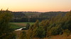
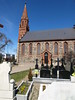

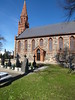
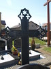

The above images may not be of the site on this page, but were taken nearby. They are loaded from Flickr so please click on them for image credits.
Click here to see more info for this site
Nearby sites
Click here to view sites on an interactive map of the areaKey: Red: member's photo, Blue: 3rd party photo, Yellow: other image, Green: no photo - please go there and take one, Grey: site destroyed
Download sites to:
KML (Google Earth)
GPX (GPS waypoints)
CSV (Garmin/Navman)
CSV (Excel)
To unlock full downloads you need to sign up as a Contributory Member. Otherwise downloads are limited to 50 sites.
Turn off the page maps and other distractions
Nearby sites listing. In the following links * = Image available
10.6km S 182° Kurhany Trątkownica* Barrow Cemetery
17.9km SE 128° Lublewo Gdańskie Stone Circles Stone Circle
20.1km WSW 245° Grodzisko Borzestowo Hillfort
23.0km E 99° Gdansk* Sculptured Stone
23.5km WNW 282° Potęgowo Megalithic Tomb Chambered Tomb
24.6km SW 232° Zgorzałe Stone Circles Stone Circle
25.6km SW 226° Kurchany Uniradze Barrow Cemetery
31.4km WSW 246° Kurhany Mściszewice* Barrow Cemetery
32.7km WSW 239° Wesiory* Stone Circle
33.0km SSW 197° Kurhany Nowy Barkoczyn Barrow Cemetery
33.8km S 169° Grodzisko Junkrowy Hillfort
34.6km W 273° Kurhany Siemirowice Barrow Cemetery
35.0km SW 231° Grodzisko Gostomie* Hillfort
35.5km W 272° Siemirowice 7 Chambered Tomb
35.5km W 272° Siemirowice 6* Chambered Tomb
35.6km W 272° Siemirowice 5* Chambered Tomb
35.6km W 272° Siemirowice 4* Chambered Tomb
35.7km W 272° Siemirowice 3* Chambered Tomb
35.8km W 272° Siemirowice 2* Chambered Tomb
35.8km W 272° Siemirowice 1* Chambered Tomb
36.8km W 279° Kurhany Cewice Barrow Cemetery
37.2km SSE 153° Grodzisko Siwiałka* Promontory Fort / Cliff Castle
38.5km N 353° Diabelski Kamień Natural Stone / Erratic / Other Natural Feature
38.9km N 353° Boża Stopka Rock Art
41.8km W 280° Kurhany Unieszynko Barrow Cemetery
View more nearby sites and additional images


 We would like to know more about this location. Please feel free to add a brief description and any relevant information in your own language.
 Wir möchten mehr über diese Stätte erfahren. Bitte zögern Sie nicht, eine kurze Beschreibung und relevante Informationen in Deutsch hinzuzufügen.
 Nous aimerions en savoir encore un peu sur les lieux. S'il vous plaît n'hesitez pas à ajouter une courte description et tous les renseignements pertinents dans votre propre langue.
 Quisieramos informarnos un poco más de las lugares. No dude en añadir una breve descripción y otros datos relevantes en su propio idioma.