<< Text Pages >> Grodzisko Magnice - Hillfort in Poland in Dolnoslaskie
Submitted by SolarMegalith on Wednesday, 20 April 2011 Page Views: 2487
Iron Age and Later PrehistorySite Name: Grodzisko MagniceCountry: Poland
NOTE: This site is 2.939 km away from the location you searched for.
Voivodeship: Dolnoslaskie Type: Hillfort
Nearest Town: Wrocław Nearest Village: Magnice
Latitude: 50.989660N Longitude: 16.961350E
Condition:
| 5 | Perfect |
| 4 | Almost Perfect |
| 3 | Reasonable but with some damage |
| 2 | Ruined but still recognisable as an ancient site |
| 1 | Pretty much destroyed, possibly visible as crop marks |
| 0 | No data. |
| -1 | Completely destroyed |
| 5 | Superb |
| 4 | Good |
| 3 | Ordinary |
| 2 | Not Good |
| 1 | Awful |
| 0 | No data. |
| 5 | Can be driven to, probably with disabled access |
| 4 | Short walk on a footpath |
| 3 | Requiring a bit more of a walk |
| 2 | A long walk |
| 1 | In the middle of nowhere, a nightmare to find |
| 0 | No data. |
| 5 | co-ordinates taken by GPS or official recorded co-ordinates |
| 4 | co-ordinates scaled from a detailed map |
| 3 | co-ordinates scaled from a bad map |
| 2 | co-ordinates of the nearest village |
| 1 | co-ordinates of the nearest town |
| 0 | no data |
Be the first person to rate this site - see the 'Contribute!' box in the right hand menu.
Internal Links:
External Links:
Hillfort in Dolnoslaskie
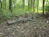
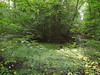
Remains of a hillfort scheduled in 2004, located on area 10/33, near ruins of a palace.
You may be viewing yesterday's version of this page. To see the most up to date information please register for a free account.
Do not use the above information on other web sites or publications without permission of the contributor.
Nearby Images from Flickr
The above images may not be of the site on this page, but were taken nearby. They are loaded from Flickr so please click on them for image credits.
Click here to see more info for this site
Nearby sites
Click here to view sites on an interactive map of the areaKey: Red: member's photo, Blue: 3rd party photo, Yellow: other image, Green: no photo - please go there and take one, Grey: site destroyed
Download sites to:
KML (Google Earth)
GPX (GPS waypoints)
CSV (Garmin/Navman)
CSV (Excel)
To unlock full downloads you need to sign up as a Contributory Member. Otherwise downloads are limited to 50 sites.
Turn off the page maps and other distractions
Nearby sites listing. In the following links * = Image available
5.2km SSW 194° Kurhan Kuklice Round Barrow(s)
18.2km WSW 237° Sobótka sculptered stone I* Sculptured Stone
18.4km N 7° Grodzisko Góra Kapliczna - Osobowice* Hillfort
18.9km N 4° Grodzisko Szwedzki Szaniec - Osobowice* Hillfort
19.2km SW 235° Sobótka Mnich II* Sculptured Stone
21.4km SW 232° Niedźwiedź i Panna z Rybą* Sculptured Stone
27.2km SSW 202° Grodzisko Przystronie Promontory Fort / Cliff Castle
28.5km NE 54° Kurhany Oleśniczka* Barrow Cemetery
32.0km ESE 103° Grodzisko Ryczyn Mały* Hillfort
32.2km ESE 102° Grodzisko Ryczyn Wielki* Hillfort
32.9km N 358° Kurhany Oborniki Slaskie (1)* Round Barrow(s)
33.5km ESE 105° Grodzisko Lipki* Hillfort
33.9km N 359° Grodzisko Oborniki Śląskie* Hillfort
36.6km N 352° Kurhany Oborniki Slaskie (2)* Round Barrow(s)
37.8km S 182° Grobowce Megalityczne Muszkowice* Long Barrow
38.0km S 181° Kurhany Muszkowice (3)* Barrow Cemetery
38.0km S 183° Kurhany Muszkowice (2)* Barrow Cemetery
39.4km S 184° Kurhany Muszkowice (1)* Barrow Cemetery
40.2km WSW 256° Grodzisko Nowy Jaworów* Hillfort
41.0km NNW 344° Grodzisko Bagno* Hillfort
41.9km SSE 155° Grodzisko Jagielnica* Hillfort
42.2km NNE 28° Kurhany Niedary* Barrow Cemetery
42.2km NNE 30° Kurhany Ludgierzowice* Barrow Cemetery
46.0km WNW 285° Grodzisko Mierczyce* Hillfort
51.7km WSW 253° Krzyż Pokutny Cisów* Ancient Cross
View more nearby sites and additional images


 We would like to know more about this location. Please feel free to add a brief description and any relevant information in your own language.
 Wir möchten mehr über diese Stätte erfahren. Bitte zögern Sie nicht, eine kurze Beschreibung und relevante Informationen in Deutsch hinzuzufügen.
 Nous aimerions en savoir encore un peu sur les lieux. S'il vous plaît n'hesitez pas à ajouter une courte description et tous les renseignements pertinents dans votre propre langue.
 Quisieramos informarnos un poco más de las lugares. No dude en añadir una breve descripción y otros datos relevantes en su propio idioma.