<< Text Pages >> Grodzisko Lubieszewo - Hillfort in Poland in Zachodniopomorskie
Submitted by SolarMegalith on Sunday, 17 August 2008 Page Views: 2991
Iron Age and Later PrehistorySite Name: Grodzisko LubieszewoCountry: Poland
NOTE: This site is 27.393 km away from the location you searched for.
Voivodeship: Zachodniopomorskie Type: Hillfort
Nearest Town: Drawsko Pomorskie Nearest Village: Lubieszewo
Latitude: 53.453170N Longitude: 15.939530E
Condition:
| 5 | Perfect |
| 4 | Almost Perfect |
| 3 | Reasonable but with some damage |
| 2 | Ruined but still recognisable as an ancient site |
| 1 | Pretty much destroyed, possibly visible as crop marks |
| 0 | No data. |
| -1 | Completely destroyed |
| 5 | Superb |
| 4 | Good |
| 3 | Ordinary |
| 2 | Not Good |
| 1 | Awful |
| 0 | No data. |
| 5 | Can be driven to, probably with disabled access |
| 4 | Short walk on a footpath |
| 3 | Requiring a bit more of a walk |
| 2 | A long walk |
| 1 | In the middle of nowhere, a nightmare to find |
| 0 | No data. |
| 5 | co-ordinates taken by GPS or official recorded co-ordinates |
| 4 | co-ordinates scaled from a detailed map |
| 3 | co-ordinates scaled from a bad map |
| 2 | co-ordinates of the nearest village |
| 1 | co-ordinates of the nearest town |
| 0 | no data |
Internal Links:
External Links:
Hillfort in Zachodniopomorskie
Hillfort located on the promontory of Lubie lake, 350 meters west from the buildings of PGR. The best preserved rampart is visible in eastern and southern part of the hillfort.
You may be viewing yesterday's version of this page. To see the most up to date information please register for a free account.
Do not use the above information on other web sites or publications without permission of the contributor.
Nearby Images from Flickr
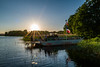
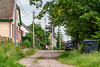
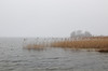
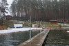
The above images may not be of the site on this page, but were taken nearby. They are loaded from Flickr so please click on them for image credits.
Click here to see more info for this site
Nearby sites
Click here to view sites on an interactive map of the areaKey: Red: member's photo, Blue: 3rd party photo, Yellow: other image, Green: no photo - please go there and take one, Grey: site destroyed
Download sites to:
KML (Google Earth)
GPX (GPS waypoints)
CSV (Garmin/Navman)
CSV (Excel)
To unlock full downloads you need to sign up as a Contributory Member. Otherwise downloads are limited to 50 sites.
Turn off the page maps and other distractions
Nearby sites listing. In the following links * = Image available
16.7km NNW 332° Grodzisko Żółte Promontory Fort / Cliff Castle
32.0km W 264° Linówko Chambered Tombs 1-10 Chambered Tomb
34.1km N 355° Grodzisko Cieszeniewo Hillfort
34.5km NNW 330° Grodzisko Lipce Hillfort
34.6km W 270° Grodzisko Długie Hillfort
37.2km NW 323° Bełczna Chambered Tombs Chambered Tomb
45.5km NW 326° Sosnkowo Chambered Tombs Chambered Tomb
52.5km ENE 70° Grodzisko Wilcze Laski Hillfort
53.5km NW 319° Łabuń Wielki Chambered Tombs 1-3 Chambered Tomb
53.6km WSW 240° Dolice Chambered Tomb* Chambered Tomb
54.7km WSW 237° Kurhan Mogilica Round Barrow(s)
54.9km WSW 257° Kurhany Ulikowo Barrow Cemetery
55.0km WNW 298° Jarchlino Chambered Tomb II Chambered Tomb
55.2km WNW 298° Jarchlino Chambered Tomb I Chambered Tomb
56.8km NNE 21° Tychowo - Głaz Trygława* Natural Stone / Erratic / Other Natural Feature
56.9km WSW 246° Krępcewo Chambered Tomb 1* Chambered Tomb
58.4km WSW 243° Morzyca Chambered Tomb Chambered Tomb
60.4km WSW 241° Grodzisko Moskorzyn* Hillfort
60.4km WSW 237° Pomietów nad Iną Chambered Tomb Chambered Tomb
60.9km WSW 250° Kurcewo Dolmen 1 Chambered Tomb
61.6km SW 231° Laskówko Chambered Tomb Chambered Tomb
61.6km SW 231° Warszyn Chambered Tomb 1 Chambered Tomb
61.7km WSW 238° Karsko Chambered Tomb 2* Chambered Tomb
61.7km WSW 238° Karsko Chambered Tomb 1* Chambered Tomb
62.1km WSW 250° Kurcewo Dolmen 2 Chambered Tomb
View more nearby sites and additional images


 We would like to know more about this location. Please feel free to add a brief description and any relevant information in your own language.
 Wir möchten mehr über diese Stätte erfahren. Bitte zögern Sie nicht, eine kurze Beschreibung und relevante Informationen in Deutsch hinzuzufügen.
 Nous aimerions en savoir encore un peu sur les lieux. S'il vous plaît n'hesitez pas à ajouter une courte description et tous les renseignements pertinents dans votre propre langue.
 Quisieramos informarnos un poco más de las lugares. No dude en añadir una breve descripción y otros datos relevantes en su propio idioma.