<< Our Photo Pages >> Krzyż Pokutny Cisów - Ancient Cross in Poland in Dolnoslaskie
Submitted by SolarMegalith on Friday, 23 November 2018 Page Views: 1130
Early Medieval (Dark Age)Site Name: Krzyż Pokutny Cisów Alternative Name: Cisów Penance CrossCountry: Poland
NOTE: This site is 10.081 km away from the location you searched for.
Voivodeship: Dolnoslaskie Type: Ancient Cross
Nearest Town: Świebodzice Nearest Village: Cisów
Latitude: 50.850594N Longitude: 16.257480E
Condition:
| 5 | Perfect |
| 4 | Almost Perfect |
| 3 | Reasonable but with some damage |
| 2 | Ruined but still recognisable as an ancient site |
| 1 | Pretty much destroyed, possibly visible as crop marks |
| 0 | No data. |
| -1 | Completely destroyed |
| 5 | Superb |
| 4 | Good |
| 3 | Ordinary |
| 2 | Not Good |
| 1 | Awful |
| 0 | No data. |
| 5 | Can be driven to, probably with disabled access |
| 4 | Short walk on a footpath |
| 3 | Requiring a bit more of a walk |
| 2 | A long walk |
| 1 | In the middle of nowhere, a nightmare to find |
| 0 | No data. |
| 5 | co-ordinates taken by GPS or official recorded co-ordinates |
| 4 | co-ordinates scaled from a detailed map |
| 3 | co-ordinates scaled from a bad map |
| 2 | co-ordinates of the nearest village |
| 1 | co-ordinates of the nearest town |
| 0 | no data |
Internal Links:
External Links:
I have visited· I would like to visit
SolarMegalith visited on 2nd Oct 2018 - their rating: Cond: 4 Amb: 4 Access: 5
")
A medieval penance cross (krzyż pokutny) is located east of the ruins of Cisy Castle. The tradition of penance crosses became common in Silesia in 13th century, they were usually erected as a penance for serious crimes. No inscription are visible on this cross and its age is unknown.
Other medieval penance crosses in western Poland can be seen in Gubin.
You may be viewing yesterday's version of this page. To see the most up to date information please register for a free account.
")
")
Do not use the above information on other web sites or publications without permission of the contributor.
Nearby Images from Flickr

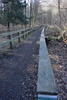

The above images may not be of the site on this page, but were taken nearby. They are loaded from Flickr so please click on them for image credits.
Click here to see more info for this site
Nearby sites
Click here to view sites on an interactive map of the areaKey: Red: member's photo, Blue: 3rd party photo, Yellow: other image, Green: no photo - please go there and take one, Grey: site destroyed
Download sites to:
KML (Google Earth)
GPX (GPS waypoints)
CSV (Garmin/Navman)
CSV (Excel)
To unlock full downloads you need to sign up as a Contributory Member. Otherwise downloads are limited to 50 sites.
Turn off the page maps and other distractions
Nearby sites listing. In the following links * = Image available
11.8km ENE 61° Grodzisko Nowy Jaworów* Hillfort
27.2km N 10° Grodzisko Mierczyce* Hillfort
32.6km E 86° Niedźwiedź i Panna z Rybą* Sculptured Stone
33.9km E 82° Sobótka Mnich II* Sculptured Stone
34.6km E 81° Sobótka sculptered stone I* Sculptured Stone
40.3km ESE 104° Grodzisko Przystronie Promontory Fort / Cliff Castle
49.3km ENE 78° Kurhan Kuklice Round Barrow(s)
51.7km ENE 72° Grodzisko Magnice Hillfort
52.4km ESE 117° Kurhany Muszkowice (1)* Barrow Cemetery
52.8km ESE 115° Kurhany Muszkowice (2)* Barrow Cemetery
52.9km ESE 115° Grobowce Megalityczne Muszkowice* Long Barrow
53.6km ESE 115° Kurhany Muszkowice (3)* Barrow Cemetery
61.1km NE 55° Grodzisko Szwedzki Szaniec - Osobowice* Hillfort
61.6km ENE 56° Grodzisko Góra Kapliczna - Osobowice* Hillfort
66.5km SSW 205° Rondel Na Výsluní* Causewayed Enclosure
66.6km NE 34° Grodzisko Bagno* Hillfort
67.2km NW 309° Grodzisko Otok Hillfort
67.2km SSW 205° Smiřice Paleolithic Settlement* Ancient Village or Settlement
67.5km SE 144° Jaskinia Radochowska Cave or Rock Shelter
67.6km SSW 202° Hubiles Propitiatory Cross* Ancient Cross
67.8km SSW 202° Long Stone of Číbuz* Standing Stone (Menhir)
67.9km NE 40° Kurhany Oborniki Slaskie (2)* Round Barrow(s)
68.2km NE 45° Kurhany Oborniki Slaskie (1)* Round Barrow(s)
69.2km NNE 19° Kurhan Słup Round Barrow(s)
69.3km NE 44° Grodzisko Oborniki Śląskie* Hillfort
View more nearby sites and additional images


 We would like to know more about this location. Please feel free to add a brief description and any relevant information in your own language.
 Wir möchten mehr über diese Stätte erfahren. Bitte zögern Sie nicht, eine kurze Beschreibung und relevante Informationen in Deutsch hinzuzufügen.
 Nous aimerions en savoir encore un peu sur les lieux. S'il vous plaît n'hesitez pas à ajouter une courte description et tous les renseignements pertinents dans votre propre langue.
 Quisieramos informarnos un poco más de las lugares. No dude en añadir una breve descripción y otros datos relevantes en su propio idioma.