<< Text Pages >> Grotta del Romito - Cave or Rock Shelter in Italy in Calabria
Submitted by coldrum on Sunday, 12 July 2009 Page Views: 4795
Natural PlacesSite Name: Grotta del Romito Alternative Name: Romito CaveCountry: Italy Region: Calabria Type: Cave or Rock Shelter
Nearest Town: Papasidero Nearest Village: Papasidero
Latitude: 39.910950N Longitude: 15.929100E
Condition:
| 5 | Perfect |
| 4 | Almost Perfect |
| 3 | Reasonable but with some damage |
| 2 | Ruined but still recognisable as an ancient site |
| 1 | Pretty much destroyed, possibly visible as crop marks |
| 0 | No data. |
| -1 | Completely destroyed |
| 5 | Superb |
| 4 | Good |
| 3 | Ordinary |
| 2 | Not Good |
| 1 | Awful |
| 0 | No data. |
| 5 | Can be driven to, probably with disabled access |
| 4 | Short walk on a footpath |
| 3 | Requiring a bit more of a walk |
| 2 | A long walk |
| 1 | In the middle of nowhere, a nightmare to find |
| 0 | No data. |
| 5 | co-ordinates taken by GPS or official recorded co-ordinates |
| 4 | co-ordinates scaled from a detailed map |
| 3 | co-ordinates scaled from a bad map |
| 2 | co-ordinates of the nearest village |
| 1 | co-ordinates of the nearest town |
| 0 | no data |
Be the first person to rate this site - see the 'Contribute!' box in the right hand menu.
Internal Links:
External Links:
Cave or Rock Shelter in Calabria
Cave with rock art.
More information at showcaves.com
You may be viewing yesterday's version of this page. To see the most up to date information please register for a free account.
Do not use the above information on other web sites or publications without permission of the contributor.
Nearby Images from Flickr
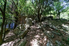
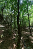
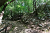
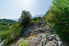
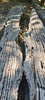
The above images may not be of the site on this page, but were taken nearby. They are loaded from Flickr so please click on them for image credits.
Click here to see more info for this site
Nearby sites
Click here to view sites on an interactive map of the areaKey: Red: member's photo, Blue: 3rd party photo, Yellow: other image, Green: no photo - please go there and take one, Grey: site destroyed
Download sites to:
KML (Google Earth)
GPX (GPS waypoints)
CSV (Garmin/Navman)
CSV (Excel)
To unlock full downloads you need to sign up as a Contributory Member. Otherwise downloads are limited to 50 sites.
Turn off the page maps and other distractions
Nearby sites listing. In the following links * = Image available
52.9km ESE 114° Sybaris* Ancient Village or Settlement
65.0km ENE 66° Cugno dei Vagni* Ancient Village or Settlement
71.5km WNW 293° Eleia Temple Ancient Temple
71.6km ENE 61° Siritide* Ancient Village or Settlement
92.5km NE 55° Metapontion* Ancient Village or Settlement
94.0km NE 53° Tavole Palatine Temple of Hera* Ancient Temple
96.7km NW 306° Poseidonia Temple of Hera* Ancient Temple
96.8km NW 306° Poseidonia Temple of Poseidon* Ancient Temple
97.1km NW 306° Poseidonia Temple of Athena* Ancient Temple
101.9km NE 34° Matera* Cave or Rock Shelter
103.8km NW 309° Foce del Sele Temple of Hera* Ancient Temple
115.6km NNE 27° Altamura Mura Megalitiche* Stone Fort or Dun
118.9km ESE 118° Krimissa Temple of Apollo Ancient Temple
121.5km NNE 26° La grotta di Lamalunga Cave or Rock Shelter
127.1km NE 55° Leucaspide Dolmen* Burial Chamber or Dolmen
127.2km ENE 60° Taras Temple* Ancient Temple
127.6km ENE 60° Taranto Museo Nazionale Archeologico* Museum
129.3km NE 55° Accettula Dolmen* Burial Chamber or Dolmen
129.3km NNE 32° Mercadante Menhir* Standing Stone (Menhir)
135.3km SSE 155° Scolacium* Ancient Temple
135.5km NNE 21° Pietrefitte 10 Standing Stone (Menhir)
136.7km NNE 22° Pietrefitte 9 Standing Stone (Menhir)
136.7km NNE 22° Pietrefitte 8 Standing Stone (Menhir)
137.2km S 173° Hipponion Temples Ancient Temple
137.6km NNE 22° Pietrefitte 7 Standing Stone (Menhir)
View more nearby sites and additional images


 We would like to know more about this location. Please feel free to add a brief description and any relevant information in your own language.
 Wir möchten mehr über diese Stätte erfahren. Bitte zögern Sie nicht, eine kurze Beschreibung und relevante Informationen in Deutsch hinzuzufügen.
 Nous aimerions en savoir encore un peu sur les lieux. S'il vous plaît n'hesitez pas à ajouter une courte description et tous les renseignements pertinents dans votre propre langue.
 Quisieramos informarnos un poco más de las lugares. No dude en añadir una breve descripción y otros datos relevantes en su propio idioma.