<< Text Pages >> Hipponion Temples - Ancient Temple in Italy in Calabria
Submitted by AlexHunger on Sunday, 09 September 2007 Page Views: 5164
Roman, Greek and ClassicalSite Name: Hipponion TemplesCountry: Italy
NOTE: This site is 50.081 km away from the location you searched for.
Region: Calabria Type: Ancient Temple
Nearest Town: Vibo Valentia
Latitude: 38.685500N Longitude: 16.109800E
Condition:
| 5 | Perfect |
| 4 | Almost Perfect |
| 3 | Reasonable but with some damage |
| 2 | Ruined but still recognisable as an ancient site |
| 1 | Pretty much destroyed, possibly visible as crop marks |
| 0 | No data. |
| -1 | Completely destroyed |
| 5 | Superb |
| 4 | Good |
| 3 | Ordinary |
| 2 | Not Good |
| 1 | Awful |
| 0 | No data. |
| 5 | Can be driven to, probably with disabled access |
| 4 | Short walk on a footpath |
| 3 | Requiring a bit more of a walk |
| 2 | A long walk |
| 1 | In the middle of nowhere, a nightmare to find |
| 0 | No data. |
| 5 | co-ordinates taken by GPS or official recorded co-ordinates |
| 4 | co-ordinates scaled from a detailed map |
| 3 | co-ordinates scaled from a bad map |
| 2 | co-ordinates of the nearest village |
| 1 | co-ordinates of the nearest town |
| 0 | no data |
Internal Links:
External Links:
Ancient Temple in Calabria
Substantial remains of 2 ancient 5th and 6th century BCE Greek Doric Temples.
The first is at the height of the Belvedere (or Telegrafo), but only its foundations measuring 37.45 metres by x 20.5 metres survive.
The second temple, measuring 27.5 metres by 18.1 metres was found at the Cofino heights (at 38.6766, 16.116).
Roman colonists appear to have quarried the temples.
You may be viewing yesterday's version of this page. To see the most up to date information please register for a free account.
Do not use the above information on other web sites or publications without permission of the contributor.
Nearby Images from Flickr

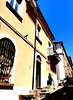
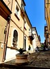
The above images may not be of the site on this page, but were taken nearby. They are loaded from Flickr so please click on them for image credits.
Click here to see more info for this site
Nearby sites
Click here to view sites on an interactive map of the areaKey: Red: member's photo, Blue: 3rd party photo, Yellow: other image, Green: no photo - please go there and take one, Grey: site destroyed
Download sites to:
KML (Google Earth)
GPX (GPS waypoints)
CSV (Garmin/Navman)
CSV (Excel)
To unlock full downloads you need to sign up as a Contributory Member. Otherwise downloads are limited to 50 sites.
Turn off the page maps and other distractions
Nearby sites listing. In the following links * = Image available
44.2km ENE 72° Scolacium* Ancient Temple
46.9km SSE 155° Marina di Gioiosa Jonica* Ancient Village or Settlement
48.4km ESE 123° Museo Archeologico di Monasterace Museum
48.7km ESE 123° Kaulonia Ancient Village or Settlement
48.7km ESE 123° Caulonia* Ancient Village or Settlement
53.2km SSE 169° Locri Epizephyrii Ancient Village or Settlement
54.3km SSE 168° Locri Epizefiri* Ancient Village or Settlement
91.6km W 266° Panarea Capo Graciano* Ancient Village or Settlement
100.9km SW 227° Rocca Timogna* Rock Outcrop
102.1km ENE 68° Lakinion Temple of Hera* Ancient Temple
110.8km WSW 237° Tindari* Ancient Village or Settlement
111.5km SW 229° Rocca Nkravaccada* Natural Stone / Erratic / Other Natural Feature
112.8km SW 227° Pizzo Vento* Natural Stone / Erratic / Other Natural Feature
113.0km SW 227° Grotta Grottona* Cave or Rock Shelter
113.7km SW 232° The rocky millstones of Tripi Ancient Mine, Quarry or other Industry
113.8km SW 228° La Valle di Levante* Natural Stone / Erratic / Other Natural Feature
113.8km SW 228° Rocca Salvatesta* Rock Outcrop
116.9km SW 218° Taormina* Ancient Village or Settlement
119.3km NNE 16° Sybaris* Ancient Village or Settlement
119.5km NE 48° Krimissa Temple of Apollo Ancient Temple
121.2km SW 231° Megaliti dell'Argimusco* Natural Stone / Erratic / Other Natural Feature
132.8km W 264° Filicudi Island Settlement* Ancient Village or Settlement
137.2km N 354° Grotta del Romito Cave or Rock Shelter
168.0km NNE 15° Cugno dei Vagni* Ancient Village or Settlement
177.0km NNE 16° Siritide* Ancient Village or Settlement
View more nearby sites and additional images


 We would like to know more about this location. Please feel free to add a brief description and any relevant information in your own language.
 Wir möchten mehr über diese Stätte erfahren. Bitte zögern Sie nicht, eine kurze Beschreibung und relevante Informationen in Deutsch hinzuzufügen.
 Nous aimerions en savoir encore un peu sur les lieux. S'il vous plaît n'hesitez pas à ajouter une courte description et tous les renseignements pertinents dans votre propre langue.
 Quisieramos informarnos un poco más de las lugares. No dude en añadir una breve descripción y otros datos relevantes en su propio idioma.