<< Our Photo Pages >> Archeological site 53 - Ancient Village or Settlement in Poland in Zachodniopomorskie
Submitted by macze84 on Tuesday, 14 April 2020 Page Views: 578
Mesolithic, Palaeolithic and EarlierSite Name: Archeological site 53Country: Poland
NOTE: This site is 17.164 km away from the location you searched for.
Voivodeship: Zachodniopomorskie Type: Ancient Village or Settlement
Nearest Village: Dobra
Latitude: 53.480290N Longitude: 14.417460E
Condition:
| 5 | Perfect |
| 4 | Almost Perfect |
| 3 | Reasonable but with some damage |
| 2 | Ruined but still recognisable as an ancient site |
| 1 | Pretty much destroyed, possibly visible as crop marks |
| 0 | No data. |
| -1 | Completely destroyed |
| 5 | Superb |
| 4 | Good |
| 3 | Ordinary |
| 2 | Not Good |
| 1 | Awful |
| 0 | No data. |
| 5 | Can be driven to, probably with disabled access |
| 4 | Short walk on a footpath |
| 3 | Requiring a bit more of a walk |
| 2 | A long walk |
| 1 | In the middle of nowhere, a nightmare to find |
| 0 | No data. |
| 5 | co-ordinates taken by GPS or official recorded co-ordinates |
| 4 | co-ordinates scaled from a detailed map |
| 3 | co-ordinates scaled from a bad map |
| 2 | co-ordinates of the nearest village |
| 1 | co-ordinates of the nearest town |
| 0 | no data |
Internal Links:
External Links:
")
Figures taken from "Badania stanowisk mezolitycznych w Dobrej i Grzepnicy, woj. szczecińskie w latach 1982–1984, Materiały zachodniopomorskie, t. 30, s. 7–21"
You may be viewing yesterday's version of this page. To see the most up to date information please register for a free account.
")
")
Do not use the above information on other web sites or publications without permission of the contributor.
Nearby Images from Flickr
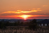
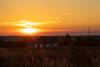
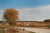


The above images may not be of the site on this page, but were taken nearby. They are loaded from Flickr so please click on them for image credits.
Click here to see more info for this site
Nearby sites
Click here to view sites on an interactive map of the areaKey: Red: member's photo, Blue: 3rd party photo, Yellow: other image, Green: no photo - please go there and take one, Grey: site destroyed
Download sites to:
KML (Google Earth)
GPX (GPS waypoints)
CSV (Garmin/Navman)
CSV (Excel)
To unlock full downloads you need to sign up as a Contributory Member. Otherwise downloads are limited to 50 sites.
Turn off the page maps and other distractions
Nearby sites listing. In the following links * = Image available
1.9km W 273° Kurhan Dobra* Round Barrow(s)
4.1km W 270° Kurhany Dobra* Barrow Cemetery
10.6km W 268° Rillenstein Plöwen 44* Carving
10.8km W 267° Burgwall Hühnerwinkel* Hillfort
11.1km WSW 245° Retziner Schalenstein* Rock Art
11.2km ESE 122° Grodzisko Szczecin* Hillfort
11.6km WSW 237° Hügelgrab Ramin* Round Barrow(s)
12.4km SSW 211° Hügelgrab Sonnenberger See* Round Barrow(s)
12.5km SSW 192° Hünenhacke Kirche Ladenthin* Ancient Mine, Quarry or other Industry
13.0km SSW 210° Hügelgrab Lebehn 1* Round Barrow(s)
13.1km WSW 248° Schälchenstein Retzin Ausbau* Rock Art
13.3km SSW 203° Hügelgräber am Lebehnscher See* Round Barrow(s)
13.3km WSW 249° Retziner Burgwall* Ancient Village or Settlement
13.3km W 268° Slawisches Hügelgräberfeld Löcknitz* Barrow Cemetery
13.4km SSW 193° Schälchenstein Ladenthin* Rock Art
13.4km WSW 252° Schalenstein Loecknitz* Rock Art
13.6km SW 226° Schwarzer Berg* Round Barrow(s)
14.6km WSW 244° Schälchenstein Menkin* Rock Art
14.8km SSW 204° Hügelgrab Lebehn 2* Round Barrow(s)
15.0km WNW 286° Schälchenstein Rothenklempenow* Rock Art
15.1km SSW 212° Hügelgrab Lebehn 3* Round Barrow(s)
15.2km NW 313° Hügelgrab Glashütte Vorpommern* Round Barrow(s)
15.4km WSW 241° Rillenstein Menkin* Carving
15.5km SW 234° Wollschow Ringwall* Ancient Village or Settlement
15.8km WSW 237° Wollschow Grab (30)* Burial Chamber or Dolmen
View more nearby sites and additional images


 We would like to know more about this location. Please feel free to add a brief description and any relevant information in your own language.
 Wir möchten mehr über diese Stätte erfahren. Bitte zögern Sie nicht, eine kurze Beschreibung und relevante Informationen in Deutsch hinzuzufügen.
 Nous aimerions en savoir encore un peu sur les lieux. S'il vous plaît n'hesitez pas à ajouter une courte description et tous les renseignements pertinents dans votre propre langue.
 Quisieramos informarnos un poco más de las lugares. No dude en añadir una breve descripción y otros datos relevantes en su propio idioma.