<< Text Pages >> In der Höll petroglyphs - Rock Art in Austria
Submitted by KaiHofmann on Monday, 08 September 2014 Page Views: 1675
Rock ArtSite Name: In der Höll petroglyphsCountry: Austria
NOTE: This site is 61.7 km away from the location you searched for.
Type: Rock Art
Nearest Town: Liezen Nearest Village: Spital am Pyhrn
Latitude: 47.646005N Longitude: 14.304165E
Condition:
| 5 | Perfect |
| 4 | Almost Perfect |
| 3 | Reasonable but with some damage |
| 2 | Ruined but still recognisable as an ancient site |
| 1 | Pretty much destroyed, possibly visible as crop marks |
| 0 | No data. |
| -1 | Completely destroyed |
| 5 | Superb |
| 4 | Good |
| 3 | Ordinary |
| 2 | Not Good |
| 1 | Awful |
| 0 | No data. |
| 5 | Can be driven to, probably with disabled access |
| 4 | Short walk on a footpath |
| 3 | Requiring a bit more of a walk |
| 2 | A long walk |
| 1 | In the middle of nowhere, a nightmare to find |
| 0 | No data. |
| 5 | co-ordinates taken by GPS or official recorded co-ordinates |
| 4 | co-ordinates scaled from a detailed map |
| 3 | co-ordinates scaled from a bad map |
| 2 | co-ordinates of the nearest village |
| 1 | co-ordinates of the nearest town |
| 0 | no data |
Internal Links:
External Links:
Rock Art in Austria
Abstract anthropomorphic and zoomorphic Palaeolithic petroglyphs can be found on 13 boulders.
You may be viewing yesterday's version of this page. To see the most up to date information please register for a free account.
Do not use the above information on other web sites or publications without permission of the contributor.
Nearby Images from Flickr
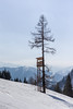
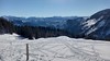


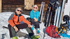
The above images may not be of the site on this page, but were taken nearby. They are loaded from Flickr so please click on them for image credits.
Click here to see more info for this site
Nearby sites
Click here to view sites on an interactive map of the areaKey: Red: member's photo, Blue: 3rd party photo, Yellow: other image, Green: no photo - please go there and take one, Grey: site destroyed
Download sites to:
KML (Google Earth)
GPX (GPS waypoints)
CSV (Garmin/Navman)
CSV (Excel)
To unlock full downloads you need to sign up as a Contributory Member. Otherwise downloads are limited to 50 sites.
Turn off the page maps and other distractions
Nearby sites listing. In the following links * = Image available
42.3km WSW 244° Notgasse Petroglyphen Rock Art
50.0km W 259° Museum Hallstatt* Museum
50.2km W 259° Hallstatt-Dachstein* Barrow Cemetery
50.6km W 260° Hallstatt Salt Mines* Ancient Mine, Quarry or other Industry
58.8km W 280° Kienbachklamm Rock Art
61.3km W 281° Lugberg Rock Art
68.1km N 10° Berglitzl Rock Art
71.4km WNW 286° Lake Mondsee Prehistoric Village Ancient Village or Settlement
74.2km N 355° Kuernbergwald Huegelgraeberfeld Barrow Cemetery
85.4km WSW 255° Sinnhubschlössl Ancient Village or Settlement
87.8km WSW 251° Arthurstollen Ancient Mine, Quarry or other Industry
91.2km ESE 120° Repolusthöhle Cave or Rock Shelter
91.2km ESE 121° Römerweg Badl Ancient Trackway
99.3km WSW 248° Goldegger Passstelle Ancient Village or Settlement
107.2km WNW 288° Summstein Laufen Modern Stone Circle etc
109.8km W 275° Karlstein Celtic Settlement Ancient Village or Settlement
111.2km NE 47° Venus of Willendorf* Ancient Village or Settlement
111.3km NNE 24° Wackelstein bei Harruck* Natural Stone / Erratic / Other Natural Feature
112.4km NE 45° Gars-Thunau Hillfort* Hillfort
113.0km N 7° U svatého Kamene* Sculptured Stone
114.0km ESE 102° Lochstein (Wenigzell) Holed Stone
114.2km SW 223° Schalenstein Danielsberg Rock Art
114.4km WSW 237° Schalenstein Oberer Bockhartsee Rock Art
114.5km NNE 25° Summstein Thail* Modern Stone Circle etc
114.5km NNE 25° Thail Opferstein* Natural Stone / Erratic / Other Natural Feature
View more nearby sites and additional images


 We would like to know more about this location. Please feel free to add a brief description and any relevant information in your own language.
 Wir möchten mehr über diese Stätte erfahren. Bitte zögern Sie nicht, eine kurze Beschreibung und relevante Informationen in Deutsch hinzuzufügen.
 Nous aimerions en savoir encore un peu sur les lieux. S'il vous plaît n'hesitez pas à ajouter une courte description et tous les renseignements pertinents dans votre propre langue.
 Quisieramos informarnos un poco más de las lugares. No dude en añadir una breve descripción y otros datos relevantes en su propio idioma.