

<< Our Photo Pages >> Černívsko Stone Circle - Modern Stone Circle etc in Czech Republic in Bohemia
Submitted by ladrin on Monday, 24 April 2023 Page Views: 499
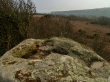
Modern SitesSite Name: Černívsko Stone CircleCountry: Czech Republic
NOTE: This site is 8.402 km away from the location you searched for.
Region: Bohemia Type: Modern Stone Circle etc
Nearest Town: Blatná Nearest Village: Černívsko
Latitude: 49.475052N Longitude: 13.937609E
Condition:
| 5 | Perfect |
| 4 | Almost Perfect |
| 3 | Reasonable but with some damage |
| 2 | Ruined but still recognisable as an ancient site |
| 1 | Pretty much destroyed, possibly visible as crop marks |
| 0 | No data. |
| -1 | Completely destroyed |
| 5 | Superb |
| 4 | Good |
| 3 | Ordinary |
| 2 | Not Good |
| 1 | Awful |
| 0 | No data. |
| 5 | Can be driven to, probably with disabled access |
| 4 | Short walk on a footpath |
| 3 | Requiring a bit more of a walk |
| 2 | A long walk |
| 1 | In the middle of nowhere, a nightmare to find |
| 0 | No data. |
| 5 | co-ordinates taken by GPS or official recorded co-ordinates |
| 4 | co-ordinates scaled from a detailed map |
| 3 | co-ordinates scaled from a bad map |
| 2 | co-ordinates of the nearest village |
| 1 | co-ordinates of the nearest town |
| 0 | no data |
Internal Links:
External Links:
")
According to available information they are providing services as tantric center and the stone circle is presented as a shamanic site. No further information.
You may be viewing yesterday's version of this page. To see the most up to date information please register for a free account.
")
")
")
")
Do not use the above information on other web sites or publications without permission of the contributor.
Click here to see more info for this site
Nearby sites
Click here to view sites on an interactive map of the areaKey: Red: member's photo, Blue: 3rd party photo, Yellow: other image, Green: no photo - please go there and take one, Grey: site destroyed
Download sites to:
KML (Google Earth)
GPX (GPS waypoints)
CSV (Garmin/Navman)
CSV (Excel)
To unlock full downloads you need to sign up as a Contributory Member. Otherwise downloads are limited to 50 sites.
Turn off the page maps and other distractions
Nearby sites listing. In the following links * = Image available
1.1km WNW 286° Hostišovice Menhir* Standing Stone (Menhir)
4.1km W 260° Dwarf of Dobšice* Standing Stone (Menhir)
4.3km WSW 254° Menhir of Hliniční Hill* Standing Stone (Menhir)
6.8km WNW 295° Bělčice propitiatory cross* Ancient Cross
6.9km WNW 297° Celtic Sanctum Bělčice* Hillfort
7.6km WSW 248° Hajany Stone Row* Modern Stone Circle etc
9.6km WSW 240° Tchořovice Propitiatory Cross* Ancient Cross
13.5km SSW 202° Milčice Stone* Rock Art
14.2km S 191° Sedlice Stone Rows* Stone Row / Alignment
14.3km SW 236° Kadovsky viklan* Natural Stone / Erratic / Other Natural Feature
14.9km WSW 243° The Stone Crone* Sculptured Stone
15.2km SW 236° Maly certuv naramek* Natural Stone / Erratic / Other Natural Feature
15.5km WSW 237° Obetni kamen* Natural Stone / Erratic / Other Natural Feature
16.2km SW 236° Velky certuv naramek* Natural Stone / Erratic / Other Natural Feature
18.1km S 181° Radomyšl Stone Cross I.* Ancient Cross
18.9km ESE 102° Hlízová Tower Zvíkov* Carving
22.2km WNW 282° St. Vojtech stone Vrčeň* Sculptured Stone
22.6km ENE 77° Vesec Sphinx* Natural Stone / Erratic / Other Natural Feature
22.6km E 97° Obrovy Hroby (Giants graves)* Misc. Earthwork
23.5km E 88° Koška Menhir* Standing Stone (Menhir)
23.6km E 80° Vesec Stone Gate* Natural Stone / Erratic / Other Natural Feature
24.2km SE 141° Prehistoric Tumuli Písek* Chambered Cairn
24.3km E 79° Angel Stone Vesec* Natural Stone / Erratic / Other Natural Feature
25.5km W 275° John of Nepomuk well* Holy Well or Sacred Spring
25.9km W 274° Stone of the Footstep* Sculptured Stone
View more nearby sites and additional images


 We would like to know more about this location. Please feel free to add a brief description and any relevant information in your own language.
 Wir möchten mehr über diese Stätte erfahren. Bitte zögern Sie nicht, eine kurze Beschreibung und relevante Informationen in Deutsch hinzuzufügen.
 Nous aimerions en savoir encore un peu sur les lieux. S'il vous plaît n'hesitez pas à ajouter une courte description et tous les renseignements pertinents dans votre propre langue.
 Quisieramos informarnos un poco más de las lugares. No dude en añadir una breve descripción y otros datos relevantes en su propio idioma.