<< Our Photo Pages >> Sannōzuka Kofun - Passage Grave in Japan in Honshū
Submitted by Aska on Saturday, 18 October 2014 Page Views: 2133
Iron Age and Later PrehistorySite Name: Sannōzuka Kofun Alternative Name: 山王塚古墳Country: Japan
NOTE: This site is 5.686 km away from the location you searched for.
Region: Honshū Type: Passage Grave
Nearest Town: Kawagoe (Saitama pref.) Nearest Village: Ōtsuka 大塚
Latitude: 35.899910N Longitude: 139.461880E
Condition:
| 5 | Perfect |
| 4 | Almost Perfect |
| 3 | Reasonable but with some damage |
| 2 | Ruined but still recognisable as an ancient site |
| 1 | Pretty much destroyed, possibly visible as crop marks |
| 0 | No data. |
| -1 | Completely destroyed |
| 5 | Superb |
| 4 | Good |
| 3 | Ordinary |
| 2 | Not Good |
| 1 | Awful |
| 0 | No data. |
| 5 | Can be driven to, probably with disabled access |
| 4 | Short walk on a footpath |
| 3 | Requiring a bit more of a walk |
| 2 | A long walk |
| 1 | In the middle of nowhere, a nightmare to find |
| 0 | No data. |
| 5 | co-ordinates taken by GPS or official recorded co-ordinates |
| 4 | co-ordinates scaled from a detailed map |
| 3 | co-ordinates scaled from a bad map |
| 2 | co-ordinates of the nearest village |
| 1 | co-ordinates of the nearest town |
| 0 | no data |
Internal Links:
External Links:
")
The greatest (63m) push-button (hemisphere on a rectangular basement) shaped tumulus in a residential area. A small shinto shine was placed on it, the mound has been preserved as a sacred area and numerous trees have grown there. Now it looks like a isolated wood in a town, the trees hinders from observing the shape of the mound.
You may be viewing yesterday's version of this page. To see the most up to date information please register for a free account.
Do not use the above information on other web sites or publications without permission of the contributor.
Nearby Images from Flickr


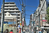
The above images may not be of the site on this page, but were taken nearby. They are loaded from Flickr so please click on them for image credits.
Click here to see more info for this site
Nearby sites
Click here to view sites on an interactive map of the areaKey: Red: member's photo, Blue: 3rd party photo, Yellow: other image, Green: no photo - please go there and take one, Grey: site destroyed
Download sites to:
KML (Google Earth)
GPX (GPS waypoints)
CSV (Garmin/Navman)
CSV (Excel)
To unlock full downloads you need to sign up as a Contributory Member. Otherwise downloads are limited to 50 sites.
Turn off the page maps and other distractions
Nearby sites listing. In the following links * = Image available
12.4km WNW 303° Ōrui Kofungun* Chambered Cairn
12.7km W 268° Shōden-in temple* Modern Stone Circle etc
14.4km WSW 252° Nōnin-ji temple* Modern Stone Circle etc
16.0km NNW 347° Yoshimi Hyakuana* Rock Cut Tomb
23.7km SW 222° Sedo-oka Kofungun* Chambered Cairn
25.0km S 181° Musashi-Fuchū Kumano-Jinja Kofun* Passage Grave
25.6km N 3° Sakitama Kofungun* Passage Grave
26.1km SSE 165° Tenmondai-Kōnai Kofun* Passage Grave
27.1km N 5° Hachiman-yama Kofun* Passage Grave
27.4km WSW 246° Gyokudō Bijutsukan art museum* Modern Stone Circle etc
29.2km S 185° Inarizuka Kofun* Passage Grave
29.9km NNW 339° Miyazuka Kofun* Passage Grave
32.6km SSE 149° Gōtoku-ji temple* Modern Stone Circle etc
34.0km SE 127° Yayoi* Ancient Mine, Quarry or other Industry
34.4km SSW 195° Tabata* Stone Circle
36.6km SSE 153° Noge Ōtsuka Kofun* Long Barrow
36.7km S 172° Hayano Yokoana* Rock Cut Tomb
36.8km SE 132° Hemisphere* Modern Stone Circle etc
37.4km SSE 160° Maginu Kofun* Passage Grave
38.7km S 169° Ichigao Yokoana* Rock Cut Tomb
39.0km SE 129° Kiyosumi Teien garden* Modern Stone Circle etc
39.5km SSE 152° Sengen Jinja Kofun* NOT SET
41.8km SE 145° Ōmori Kaizuka* Ancient Village or Settlement
43.0km N 355° Tsukamawari Kofun* Long Barrow
44.0km SW 228° Uenoyama Kofun (in Yamanashi)* Chambered Cairn
View more nearby sites and additional images


 We would like to know more about this location. Please feel free to add a brief description and any relevant information in your own language.
 Wir möchten mehr über diese Stätte erfahren. Bitte zögern Sie nicht, eine kurze Beschreibung und relevante Informationen in Deutsch hinzuzufügen.
 Nous aimerions en savoir encore un peu sur les lieux. S'il vous plaît n'hesitez pas à ajouter une courte description et tous les renseignements pertinents dans votre propre langue.
 Quisieramos informarnos un poco más de las lugares. No dude en añadir una breve descripción y otros datos relevantes en su propio idioma.