


<< Our Photo Pages >> Chikamori - Timber Circle in Japan in Honshū
Submitted by Aska on Friday, 14 October 2011 Page Views: 3500
Neolithic and Bronze AgeSite Name: Chikamori Alternative Name: チカモリ遺跡Country: Japan
NOTE: This site is 2.172 km away from the location you searched for.
Region: Honshū Type: Timber Circle
Nearest Town: Kanazawa (Ishikawa pref.) Nearest Village: Shinbohon 新保本
Latitude: 36.556270N Longitude: 136.605000E
Condition:
| 5 | Perfect |
| 4 | Almost Perfect |
| 3 | Reasonable but with some damage |
| 2 | Ruined but still recognisable as an ancient site |
| 1 | Pretty much destroyed, possibly visible as crop marks |
| 0 | No data. |
| -1 | Completely destroyed |
| 5 | Superb |
| 4 | Good |
| 3 | Ordinary |
| 2 | Not Good |
| 1 | Awful |
| 0 | No data. |
| 5 | Can be driven to, probably with disabled access |
| 4 | Short walk on a footpath |
| 3 | Requiring a bit more of a walk |
| 2 | A long walk |
| 1 | In the middle of nowhere, a nightmare to find |
| 0 | No data. |
| 5 | co-ordinates taken by GPS or official recorded co-ordinates |
| 4 | co-ordinates scaled from a detailed map |
| 3 | co-ordinates scaled from a bad map |
| 2 | co-ordinates of the nearest village |
| 1 | co-ordinates of the nearest town |
| 0 | no data |
Internal Links:
External Links:
")
The timber circle was reconstructed with concrete.
You may be viewing yesterday's version of this page. To see the most up to date information please register for a free account.
")
Do not use the above information on other web sites or publications without permission of the contributor.
Nearby Images from Flickr
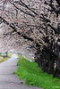
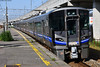
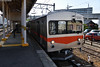
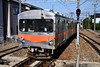
The above images may not be of the site on this page, but were taken nearby. They are loaded from Flickr so please click on them for image credits.
Click here to see more info for this site
Nearby sites
Click here to view sites on an interactive map of the areaKey: Red: member's photo, Blue: 3rd party photo, Yellow: other image, Green: no photo - please go there and take one, Grey: site destroyed
Download sites to:
KML (Google Earth)
GPX (GPS waypoints)
CSV (Garmin/Navman)
CSV (Excel)
To unlock full downloads you need to sign up as a Contributory Member. Otherwise downloads are limited to 50 sites.
Turn off the page maps and other distractions
Nearby sites listing. In the following links * = Image available
901m SSW 214° Okyōzuka* Ancient Village or Settlement
6.5km E 95° Tentoku-in temple (in Kanazawa)* Modern Stone Circle etc
10.0km WSW 241° IshinokiZuka* Stone Circle
28.0km ENE 59° Sakura-machi* Timber Circle
31.6km SSW 212° Nata-dera temple* Modern Stone Circle etc
38.8km SW 223° Soryō-kan* Modern Stone Circle etc
45.9km NE 52° Kokutai-ji temple* Modern Stone Circle etc
55.9km NE 36° Sekidōsan temple complex ruin* Modern Stone Circle etc
57.3km S 186° ex-Genshō-in temple* Modern Stone Circle etc
67.2km ESE 123° Hieda Jinja shrine* Standing Stones
67.9km SSW 204° Ichijōdani Asakura Family gardens* Modern Stone Circle etc
68.0km ESE 112° Ema Family House Garden* Modern Stone Circle etc
68.8km ESE 114° Tateishi Iseki Kuromurehi* Standing Stone (Menhir)
73.6km SE 126° Kaitō* Stone Circle
81.1km SSW 205° Jōfuku-ji temple* Modern Stone Circle etc
87.7km SSE 161° Tō Clan Residence Garden* Modern Stone Circle etc
89.2km NNE 27° Ishibotokeyama* Standing Stones
99.0km NNE 33° Mawaki* Timber Circle
107.5km E 92° Wappara* Stone Circle
109.5km E 91° Shingō Kofungun* Chambered Cairn
111.7km SSW 200° TsubakiZaka Honjin ato* Modern Stone Circle etc
118.9km S 169° Shinchō-ji temple* Modern Stone Circle etc
119.3km ENE 64° Teraji* Timber Circle
119.6km ESE 104° Honmura-no-Jindaimoji-hi* Carving
122.4km SSE 163° Shōgen-ji Temple* Modern Stone Circle etc
View more nearby sites and additional images


 We would like to know more about this location. Please feel free to add a brief description and any relevant information in your own language.
 Wir möchten mehr über diese Stätte erfahren. Bitte zögern Sie nicht, eine kurze Beschreibung und relevante Informationen in Deutsch hinzuzufügen.
 Nous aimerions en savoir encore un peu sur les lieux. S'il vous plaît n'hesitez pas à ajouter une courte description et tous les renseignements pertinents dans votre propre langue.
 Quisieramos informarnos un poco más de las lugares. No dude en añadir una breve descripción y otros datos relevantes en su propio idioma.