


<< Our Photo Pages >> Nakayama Sōen Kofun - Passage Grave in Japan in Honshū
Submitted by Aska on Sunday, 27 February 2011 Page Views: 4858
Iron Age and Later PrehistorySite Name: Nakayama Sōen Kofun Alternative Name: 中山荘園古墳 Nakayama Soen KofunCountry: Japan Region: Honshū Type: Passage Grave
Nearest Town: Takarazuka (Hyōgo pref.) Nearest Village: NakayamaSōen 中山
Latitude: 34.820070N Longitude: 135.363190E
Condition:
| 5 | Perfect |
| 4 | Almost Perfect |
| 3 | Reasonable but with some damage |
| 2 | Ruined but still recognisable as an ancient site |
| 1 | Pretty much destroyed, possibly visible as crop marks |
| 0 | No data. |
| -1 | Completely destroyed |
| 5 | Superb |
| 4 | Good |
| 3 | Ordinary |
| 2 | Not Good |
| 1 | Awful |
| 0 | No data. |
| 5 | Can be driven to, probably with disabled access |
| 4 | Short walk on a footpath |
| 3 | Requiring a bit more of a walk |
| 2 | A long walk |
| 1 | In the middle of nowhere, a nightmare to find |
| 0 | No data. |
| 5 | co-ordinates taken by GPS or official recorded co-ordinates |
| 4 | co-ordinates scaled from a detailed map |
| 3 | co-ordinates scaled from a bad map |
| 2 | co-ordinates of the nearest village |
| 1 | co-ordinates of the nearest town |
| 0 | no data |
Internal Links:
External Links:
")
Note: Aska's latest dispatches from Japan, including some rare barrows
You may be viewing yesterday's version of this page. To see the most up to date information please register for a free account.
Do not use the above information on other web sites or publications without permission of the contributor.
Nearby Images from Flickr
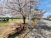

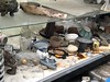
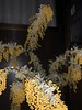
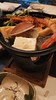
The above images may not be of the site on this page, but were taken nearby. They are loaded from Flickr so please click on them for image credits.
Click here to see more info for this site
Nearby sites
Click here to view sites on an interactive map of the areaKey: Red: member's photo, Blue: 3rd party photo, Yellow: other image, Green: no photo - please go there and take one, Grey: site destroyed
Download sites to:
KML (Google Earth)
GPX (GPS waypoints)
CSV (Garmin/Navman)
CSV (Excel)
To unlock full downloads you need to sign up as a Contributory Member. Otherwise downloads are limited to 50 sites.
Turn off the page maps and other distractions
Nearby sites listing. In the following links * = Image available
6.0km E 83° Ikada Castle* Modern Stone Circle etc
12.3km SSE 158° Honkō-ji temple* Modern Stone Circle etc
13.4km ENE 68° Hatten Ishigura* Pyramid / Mastaba
20.3km E 79° Shin-ike Haniwa Kōba Kōen* Ancient Mine, Quarry or other Industry
21.0km E 87° Fumon-ji temple* Modern Stone Circle etc
21.3km SE 135° Hōkoku-jinja shrine* Modern Stone Circle etc
21.4km E 81° Imashirozuka Kofun* Long Barrow
21.9km SSE 146° Gansen-ji temple* Modern Stone Circle etc
23.1km SE 142° Shitennō-ji temple* Ancient Temple
24.2km N 359° Chōsan-ji temple* Modern Stone Circle etc
25.5km ESE 122° Kōnoike Shinden hall* Modern Stone Circle etc
26.2km E 96° Iraku Park* Modern Stone Circle etc
28.0km ESE 106° Ishi-no-Hōden Kofun* Passage Grave
28.1km N 358° Sumiyoshi Jinja shrine (in Sasayama city)* Modern Stone Circle etc
28.8km N 357° Honkyū-ji temple* Modern Stone Circle etc
29.5km SE 125° Hanazono Rugby Stadium* Modern Stone Circle etc
29.5km SSE 161° Nanshū-ji temple* Modern Stone Circle etc
29.8km NNW 342° Shōkaku-ji temple* Modern Stone Circle etc
30.2km ENE 63° Jūrin-ji temple* Modern Stone Circle etc
30.4km WSW 243° An'yō-in temple* Modern Stone Circle etc
30.7km SSE 158° Daisen Kofun* Long Barrow
30.7km ENE 60° Shōhō-ji temple* Modern Stone Circle etc
31.3km NNW 335° Sasayama Kankō Hotel* Modern Stone Circle etc
31.3km ENE 65° Kōmyō-ji temple (in Kyōto)* Modern Stone Circle etc
31.4km ENE 78° Iwashimizu Hachimangū shrine* Modern Stone Circle etc
View more nearby sites and additional images


 We would like to know more about this location. Please feel free to add a brief description and any relevant information in your own language.
 Wir möchten mehr über diese Stätte erfahren. Bitte zögern Sie nicht, eine kurze Beschreibung und relevante Informationen in Deutsch hinzuzufügen.
 Nous aimerions en savoir encore un peu sur les lieux. S'il vous plaît n'hesitez pas à ajouter une courte description et tous les renseignements pertinents dans votre propre langue.
 Quisieramos informarnos un poco más de las lugares. No dude en añadir una breve descripción y otros datos relevantes en su propio idioma.