<< Our Photo Pages >> Uma Mukaiyama Kofun - Long Barrow in Japan in Shikoku
Submitted by Aska on Friday, 13 July 2012 Page Views: 3051
Iron Age and Later PrehistorySite Name: Uma Mukaiyama Kofun Alternative Name: 宇摩向山古墳Country: Japan
NOTE: This site is 50.446 km away from the location you searched for.
Region: Shikoku Type: Long Barrow
Nearest Town: Shikoku-Chūō (Ehime pref.) Nearest Village: Kinseichō-Shimobun 金生
Latitude: 34.006530N Longitude: 133.584490E
Condition:
| 5 | Perfect |
| 4 | Almost Perfect |
| 3 | Reasonable but with some damage |
| 2 | Ruined but still recognisable as an ancient site |
| 1 | Pretty much destroyed, possibly visible as crop marks |
| 0 | No data. |
| -1 | Completely destroyed |
| 5 | Superb |
| 4 | Good |
| 3 | Ordinary |
| 2 | Not Good |
| 1 | Awful |
| 0 | No data. |
| 5 | Can be driven to, probably with disabled access |
| 4 | Short walk on a footpath |
| 3 | Requiring a bit more of a walk |
| 2 | A long walk |
| 1 | In the middle of nowhere, a nightmare to find |
| 0 | No data. |
| 5 | co-ordinates taken by GPS or official recorded co-ordinates |
| 4 | co-ordinates scaled from a detailed map |
| 3 | co-ordinates scaled from a bad map |
| 2 | co-ordinates of the nearest village |
| 1 | co-ordinates of the nearest town |
| 0 | no data |
Internal Links:
External Links:
I have visited· I would like to visit
rrmoser would like to visit
")
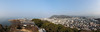
Great rectangular-shaped tumulus (70m × 46m), with 2 chambers in a residential area near a river.
Under re-excavation in 2012.
You may be viewing yesterday's version of this page. To see the most up to date information please register for a free account.
Do not use the above information on other web sites or publications without permission of the contributor.
Nearby Images from Flickr


The above images may not be of the site on this page, but were taken nearby. They are loaded from Flickr so please click on them for image credits.
Click here to see more info for this site
Nearby sites
Click here to view sites on an interactive map of the areaKey: Red: member's photo, Blue: 3rd party photo, Yellow: other image, Green: no photo - please go there and take one, Grey: site destroyed
Download sites to:
KML (Google Earth)
GPX (GPS waypoints)
CSV (Garmin/Navman)
CSV (Excel)
To unlock full downloads you need to sign up as a Contributory Member. Otherwise downloads are limited to 50 sites.
Turn off the page maps and other distractions
Nearby sites listing. In the following links * = Image available
15.8km NNE 22° Kōshōjiyama Kofungun* Passage Grave
22.3km NNE 33° Yaobikuni-tō* Ancient Temple
25.5km E 94° Myōken Jinja shrine (in Nozumi, Miyoshi city)* Stone Row / Alignment
27.6km NNE 32° Ōkubo Kyōzuka Kofun* Chambered Cairn
27.8km NE 40° Notanoin Kofun* Chambered Cairn
28.0km NE 37° Miyagao Kofun* Passage Grave
28.5km NE 38° Kawaratani Kofungun* Passage Grave
29.1km NE 42° Ōsayama Wankashizuka Kofun* Chambered Cairn
29.2km NE 42° Ōsayama Kyōzuka Kofun* Chambered Cairn
29.5km NE 40° Oka Kofungun* Passage Grave
29.9km E 82° Ashiro Higashihara Iseki* Chambered Cairn
30.7km NE 37° Suriusuyama Kofun* Passage Grave
32.5km E 86° Tanda Kofun* Chambered Cairn
32.7km E 87° Namiuchi* Standing Stones
33.7km E 84° Yahata Jinja shrine (in HigashiMiyoshi-chō, Tokushima pref.)* Stone Row / Alignment
39.0km WSW 251° Hōkoku-ji temple* Modern Stone Circle etc
39.9km NE 46° Jinnomaru Kofungun* Long Barrow
40.7km NE 46° Yokoyama Kofungun* Chambered Cairn
41.6km NNE 33° Shōtsūjiyama Kofun* Chambered Cairn
42.0km E 88° Dōmekidō* Standing Stones
42.7km NE 39° Hakarigōro Kofun* Chambered Cairn
42.8km NE 39° Jiigamatsu Kofun* Chambered Cairn
42.8km NE 41° Kiyama* Hillfort
43.5km E 85° Nishiyama Kofun (in Tokushima)* Standing Stone (Menhir)
44.0km NE 41° Daigo Kofungun* Passage Grave
View more nearby sites and additional images


 We would like to know more about this location. Please feel free to add a brief description and any relevant information in your own language.
 Wir möchten mehr über diese Stätte erfahren. Bitte zögern Sie nicht, eine kurze Beschreibung und relevante Informationen in Deutsch hinzuzufügen.
 Nous aimerions en savoir encore un peu sur les lieux. S'il vous plaît n'hesitez pas à ajouter une courte description et tous les renseignements pertinents dans votre propre langue.
 Quisieramos informarnos un poco más de las lugares. No dude en añadir una breve descripción y otros datos relevantes en su propio idioma.