<< Text Pages >> Heidenschanze Coschütz - Hillfort in Germany in Saxony
Submitted by KaiHofmann on Wednesday, 31 October 2012 Page Views: 1874
Iron Age and Later PrehistorySite Name: Heidenschanze CoschützCountry: Germany
NOTE: This site is 8.537 km away from the location you searched for.
Land: Saxony Type: Hillfort
Nearest Town: Dresden Nearest Village: Coschuetz
Latitude: 51.020391N Longitude: 13.687682E
Condition:
| 5 | Perfect |
| 4 | Almost Perfect |
| 3 | Reasonable but with some damage |
| 2 | Ruined but still recognisable as an ancient site |
| 1 | Pretty much destroyed, possibly visible as crop marks |
| 0 | No data. |
| -1 | Completely destroyed |
| 5 | Superb |
| 4 | Good |
| 3 | Ordinary |
| 2 | Not Good |
| 1 | Awful |
| 0 | No data. |
| 5 | Can be driven to, probably with disabled access |
| 4 | Short walk on a footpath |
| 3 | Requiring a bit more of a walk |
| 2 | A long walk |
| 1 | In the middle of nowhere, a nightmare to find |
| 0 | No data. |
| 5 | co-ordinates taken by GPS or official recorded co-ordinates |
| 4 | co-ordinates scaled from a detailed map |
| 3 | co-ordinates scaled from a bad map |
| 2 | co-ordinates of the nearest village |
| 1 | co-ordinates of the nearest town |
| 0 | no data |
Internal Links:
External Links:
Hillfort in Saxony
Large and important bronze age hillfort close to Dresden.
You may be viewing yesterday's version of this page. To see the most up to date information please register for a free account.
Do not use the above information on other web sites or publications without permission of the contributor.
Nearby Images from Flickr

The above images may not be of the site on this page, but were taken nearby. They are loaded from Flickr so please click on them for image credits.
Click here to see more info for this site
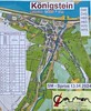
Nearby sites
Click here to view sites on an interactive map of the areaKey: Red: member's photo, Blue: 3rd party photo, Yellow: other image, Green: no photo - please go there and take one, Grey: site destroyed
Download sites to:
KML (Google Earth)
GPX (GPS waypoints)
CSV (Garmin/Navman)
CSV (Excel)
To unlock full downloads you need to sign up as a Contributory Member. Otherwise downloads are limited to 50 sites.
Turn off the page maps and other distractions
Nearby sites listing. In the following links * = Image available
5.2km ESE 105° Heiliger Born Neuostra Holy Well or Sacred Spring
5.7km NE 38° Dresden Museum für Völkerkunde Museum
7.2km ESE 113° Kreisgrabenanlage Nickern DD-09 Henge
7.4km ESE 111° Kreisgrabenanlage Nickern DD-98 Henge
7.7km ESE 110° Kreisgrabenanlage Nickern DD-02 Henge
8.6km ESE 116° Wallburg Lockwitz Hillfort
28.2km WSW 243° Summstein Freiberg Modern Stone Circle etc
28.3km NW 316° Burgberg Zeren* Hillfort
29.3km NW 322° Burgberg Löbsal* Hillfort
29.4km ESE 110° Lilienstein Rock Art
29.7km NW 321° Wallburg Göhrisch* Hillfort
30.3km NW 323° Goldkuppe* Hillfort
39.2km WNW 302° Steudten* Standing Stone (Menhir)
40.6km N 358° Grossthiemig Kreuz Ancient Cross
41.2km ESE 105° Kuhstallhoehle Cave or Rock Shelter
41.3km ENE 72° Dreistuehle Rock Art
47.2km ESE 107° Altarstein Sächsische Schweiz Natural Stone / Erratic / Other Natural Feature
47.5km ENE 63° Sollschwitz Schalenstein Rock Art
48.4km NNW 346° Gotenkreuz Elsterwerda Holed Stone
49.1km ENE 63° Dreikretscham Steinkreuz Ancient Cross
49.3km E 89° Sohland Huehnengrab Chambered Tomb
49.3km E 88° Sohland Opferbecken Natural Stone / Erratic / Other Natural Feature
49.6km ENE 68° Bloaschuetz Grabhuegel Round Barrow(s)
49.6km ENE 68° Bloaschuetz Schalenstein Rock Art
51.2km ENE 74° Doberschauer Schanze Hillfort
View more nearby sites and additional images


 We would like to know more about this location. Please feel free to add a brief description and any relevant information in your own language.
 Wir möchten mehr über diese Stätte erfahren. Bitte zögern Sie nicht, eine kurze Beschreibung und relevante Informationen in Deutsch hinzuzufügen.
 Nous aimerions en savoir encore un peu sur les lieux. S'il vous plaît n'hesitez pas à ajouter une courte description et tous les renseignements pertinents dans votre propre langue.
 Quisieramos informarnos un poco más de las lugares. No dude en añadir una breve descripción y otros datos relevantes en su propio idioma.