

<< Text Pages >> Goldegger Passstelle - Ancient Village or Settlement in Austria
Submitted by KaiHofmann on Thursday, 04 January 2018 Page Views: 758
Multi-periodSite Name: Goldegger PassstelleCountry: Austria
NOTE: This site is 18.571 km away from the location you searched for.
Type: Ancient Village or Settlement
Nearest Town: Schwarzach im Pongau Nearest Village: Goldegg
Latitude: 47.302143N Longitude: 13.085381E
Condition:
| 5 | Perfect |
| 4 | Almost Perfect |
| 3 | Reasonable but with some damage |
| 2 | Ruined but still recognisable as an ancient site |
| 1 | Pretty much destroyed, possibly visible as crop marks |
| 0 | No data. |
| -1 | Completely destroyed |
| 5 | Superb |
| 4 | Good |
| 3 | Ordinary |
| 2 | Not Good |
| 1 | Awful |
| 0 | No data. |
| 5 | Can be driven to, probably with disabled access |
| 4 | Short walk on a footpath |
| 3 | Requiring a bit more of a walk |
| 2 | A long walk |
| 1 | In the middle of nowhere, a nightmare to find |
| 0 | No data. |
| 5 | co-ordinates taken by GPS or official recorded co-ordinates |
| 4 | co-ordinates scaled from a detailed map |
| 3 | co-ordinates scaled from a bad map |
| 2 | co-ordinates of the nearest village |
| 1 | co-ordinates of the nearest town |
| 0 | no data |
Be the first person to rate this site - see the 'Contribute!' box in the right hand menu.
Internal Links:
External Links:
Ancient Village or Settlement in Austria
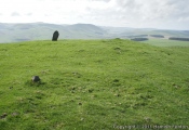
Iron age hillfort of the Latène culture. The settlement was situated above the Salzach river. It was probably built for guarding the ancient way from the Salzach valley to the Gastein valley.
You may be viewing yesterday's version of this page. To see the most up to date information please register for a free account.
Do not use the above information on other web sites or publications without permission of the contributor.
Nearby Images from Flickr


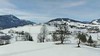
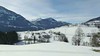
The above images may not be of the site on this page, but were taken nearby. They are loaded from Flickr so please click on them for image credits.
Click here to see more info for this site
Nearby sites
Click here to view sites on an interactive map of the areaKey: Red: member's photo, Blue: 3rd party photo, Yellow: other image, Green: no photo - please go there and take one, Grey: site destroyed
Download sites to:
KML (Google Earth)
GPX (GPS waypoints)
CSV (Garmin/Navman)
CSV (Excel)
To unlock full downloads you need to sign up as a Contributory Member. Otherwise downloads are limited to 50 sites.
Turn off the page maps and other distractions
Nearby sites listing. In the following links * = Image available
12.3km NE 47° Arthurstollen Ancient Mine, Quarry or other Industry
17.7km NNE 32° Sinnhubschlössl Ancient Village or Settlement
24.8km S 189° Schalenstein Oberer Bockhartsee Rock Art
30.6km SW 217° Hochtor Ancient Road* Ancient Trackway
44.8km W 267° Hexenstein Felberturm Standing Stone (Menhir)
48.4km SSE 162° Schalenstein Danielsberg Rock Art
49.9km NNW 339° Karlstein Celtic Settlement Ancient Village or Settlement
50.8km NE 55° Hallstatt Salt Mines* Ancient Mine, Quarry or other Industry
51.0km NE 56° Hallstatt-Dachstein* Barrow Cemetery
51.3km NE 56° Museum Hallstatt* Museum
57.1km ENE 70° Notgasse Petroglyphen Rock Art
58.1km NNE 32° Lugberg Rock Art
59.0km NE 34° Kienbachklamm Rock Art
61.4km NNE 21° Lake Mondsee Prehistoric Village Ancient Village or Settlement
66.8km NNW 330° Summstein Siegsdorf Modern Stone Circle etc
71.5km N 351° Summstein Laufen Modern Stone Circle etc
74.2km WNW 296° Tischoferhoehle* Cave or Rock Shelter
80.5km NW 320° Herrenchimsee Ringwall Ancient Village or Settlement
85.6km NNW 332° Grabhügelfeld Stein an der Traun Barrow Cemetery
86.0km NNW 329° Viereckschanze Truchtlaching* Misc. Earthwork
94.2km W 261° Stoanerhof stones* Standing Stones
99.1km NNW 342° Margarethenberg Hillfort
99.3km ENE 67° In der Höll petroglyphs Rock Art
100.6km W 272° Pleiades Stone of Tarzens* Rock Art
101.5km NW 326° Bräundlstein* Natural Stone / Erratic / Other Natural Feature
View more nearby sites and additional images


 We would like to know more about this location. Please feel free to add a brief description and any relevant information in your own language.
 Wir möchten mehr über diese Stätte erfahren. Bitte zögern Sie nicht, eine kurze Beschreibung und relevante Informationen in Deutsch hinzuzufügen.
 Nous aimerions en savoir encore un peu sur les lieux. S'il vous plaît n'hesitez pas à ajouter une courte description et tous les renseignements pertinents dans votre propre langue.
 Quisieramos informarnos un poco más de las lugares. No dude en añadir una breve descripción y otros datos relevantes en su propio idioma.