<< Our Photo Pages >> Stoanerhof stones - Standing Stones in Austria
Submitted by theCaptain on Friday, 20 February 2015 Page Views: 2140
Neolithic and Bronze AgeSite Name: Stoanerhof stonesCountry: Austria Type: Standing Stones
Nearest Town: Mayrhofen Nearest Village: Stoanerhof
Latitude: 47.158900N Longitude: 11.855800E
Condition:
| 5 | Perfect |
| 4 | Almost Perfect |
| 3 | Reasonable but with some damage |
| 2 | Ruined but still recognisable as an ancient site |
| 1 | Pretty much destroyed, possibly visible as crop marks |
| 0 | No data. |
| -1 | Completely destroyed |
| 5 | Superb |
| 4 | Good |
| 3 | Ordinary |
| 2 | Not Good |
| 1 | Awful |
| 0 | No data. |
| 5 | Can be driven to, probably with disabled access |
| 4 | Short walk on a footpath |
| 3 | Requiring a bit more of a walk |
| 2 | A long walk |
| 1 | In the middle of nowhere, a nightmare to find |
| 0 | No data. |
| 5 | co-ordinates taken by GPS or official recorded co-ordinates |
| 4 | co-ordinates scaled from a detailed map |
| 3 | co-ordinates scaled from a bad map |
| 2 | co-ordinates of the nearest village |
| 1 | co-ordinates of the nearest town |
| 0 | no data |
Internal Links:
External Links:
I have visited· I would like to visit
TheCaptain has visited here
")
I have no idea whether they are ancient menhirs, but they don't look natural to me, and look to have been stood in their positions deliberately.
You may be viewing yesterday's version of this page. To see the most up to date information please register for a free account.
")
Do not use the above information on other web sites or publications without permission of the contributor.
Nearby Images from Flickr


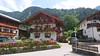
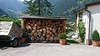

The above images may not be of the site on this page, but were taken nearby. They are loaded from Flickr so please click on them for image credits.
Click here to see more info for this site
Nearby sites
Click here to view sites on an interactive map of the areaKey: Red: member's photo, Blue: 3rd party photo, Yellow: other image, Green: no photo - please go there and take one, Grey: site destroyed
Download sites to:
KML (Google Earth)
GPX (GPS waypoints)
CSV (Garmin/Navman)
CSV (Excel)
To unlock full downloads you need to sign up as a Contributory Member. Otherwise downloads are limited to 50 sites.
Turn off the page maps and other distractions
Nearby sites listing. In the following links * = Image available
19.4km NNW 336° Pleiades Stone of Tarzens* Rock Art
31.1km W 276° Cupstone Slabs-Graveyard Tarzens* Rock Art
33.6km W 281° Goldbichl Natural Stone / Erratic / Other Natural Feature
33.6km WNW 283° Igls Hinkelstein Standing Stone (Menhir)
41.9km S 177° Cupmarked boulder near Pflaurenz Rock Art
42.1km W 265° Cupstone Menhir Viggar Valley Tyrol* Rock Art
44.2km W 264° Cupstone Lithagrub-Profegl Alm* Rock Art
45.9km N 354° Schneidjoch Heilige Quelle Holy Well or Sacred Spring
46.0km N 354° Schneidjoch Felsinschrift* Rock Art
49.8km ENE 74° Hexenstein Felberturm Standing Stone (Menhir)
50.1km SSW 197° Bildstein (Elvas)* Rock Art
54.6km NNE 28° Tischoferhoehle* Cave or Rock Shelter
60.1km WSW 247° Windachtal Schalenstein II Rock Art
63.1km NW 306° Kaltenbrunn* Modern Stone Circle etc
65.3km WSW 251° Windachtal Schalenstein I Rock Art
65.5km NW 324° Birg Kochelsee* Hillfort
67.4km WSW 252° Sölden menhir* Standing Stone (Menhir)
67.4km WSW 252° Schlangenfelsen (Snake's rock) Rock Art
67.7km WSW 247° Lenzenalm Schalenstein Rock Art
67.8km W 261° Burgstein Schalenstein Rock Art
69.7km W 268° Ötzi Village* Museum
71.0km W 263° Innerbergalm Schalenstein Rock Art
72.3km WSW 248° Heiligkreuz Teufelsfelsen Rock Art
73.3km N 4° Ruhestein Alb* Rock Art
73.3km N 4° Anianus Quelle* Holy Well or Sacred Spring
View more nearby sites and additional images


 We would like to know more about this location. Please feel free to add a brief description and any relevant information in your own language.
 Wir möchten mehr über diese Stätte erfahren. Bitte zögern Sie nicht, eine kurze Beschreibung und relevante Informationen in Deutsch hinzuzufügen.
 Nous aimerions en savoir encore un peu sur les lieux. S'il vous plaît n'hesitez pas à ajouter une courte description et tous les renseignements pertinents dans votre propre langue.
 Quisieramos informarnos un poco más de las lugares. No dude en añadir una breve descripción y otros datos relevantes en su propio idioma.