<< Our Photo Pages >> Cupstone Menhir Viggar Valley Tyrol - Rock Art in Austria
Submitted by Stonegps on Monday, 05 July 2021 Page Views: 1297
Date UncertainSite Name: Cupstone Menhir Viggar Valley Tyrol Alternative Name: Cupstone Viggar OberlegerCountry: Austria Type: Rock Art
Nearest Town: Innsbruck Nearest Village: Ellbögen
Latitude: 47.122100N Longitude: 11.302300E
Condition:
| 5 | Perfect |
| 4 | Almost Perfect |
| 3 | Reasonable but with some damage |
| 2 | Ruined but still recognisable as an ancient site |
| 1 | Pretty much destroyed, possibly visible as crop marks |
| 0 | No data. |
| -1 | Completely destroyed |
| 5 | Superb |
| 4 | Good |
| 3 | Ordinary |
| 2 | Not Good |
| 1 | Awful |
| 0 | No data. |
| 5 | Can be driven to, probably with disabled access |
| 4 | Short walk on a footpath |
| 3 | Requiring a bit more of a walk |
| 2 | A long walk |
| 1 | In the middle of nowhere, a nightmare to find |
| 0 | No data. |
| 5 | co-ordinates taken by GPS or official recorded co-ordinates |
| 4 | co-ordinates scaled from a detailed map |
| 3 | co-ordinates scaled from a bad map |
| 2 | co-ordinates of the nearest village |
| 1 | co-ordinates of the nearest town |
| 0 | no data |
Internal Links:
External Links:
")
Dating is difficult, but the oldest archaeological site nearby in the Fotschervalley was dated 12.500 BC. It is a classic alpine signpost translation you can read on the posted painting.
Foto was done by our partner Ing.Josef Höfer and translation by Herbert Kirnbauer.
Thomas Walli-Knofler
Innsbruck
See below for more details
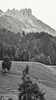
Note: Prehistoric Cupstones in Tyrol-Austria. More details on this page, and see the nearby sites list for some more examples of the discoveries
You may be viewing yesterday's version of this page. To see the most up to date information please register for a free account.
")
")
Do not use the above information on other web sites or publications without permission of the contributor.
Nearby Images from Flickr


The above images may not be of the site on this page, but were taken nearby. They are loaded from Flickr so please click on them for image credits.
Click here to see more info for this site
Nearby sites
Click here to view sites on an interactive map of the areaKey: Red: member's photo, Blue: 3rd party photo, Yellow: other image, Green: no photo - please go there and take one, Grey: site destroyed
Download sites to:
KML (Google Earth)
GPX (GPS waypoints)
CSV (Garmin/Navman)
CSV (Excel)
To unlock full downloads you need to sign up as a Contributory Member. Otherwise downloads are limited to 50 sites.
Turn off the page maps and other distractions
Nearby sites listing. In the following links * = Image available
2.2km WSW 255° Cupstone Lithagrub-Profegl Alm* Rock Art
13.1km ENE 57° Cupstone Slabs-Graveyard Tarzens* Rock Art
13.7km NE 40° Goldbichl Natural Stone / Erratic / Other Natural Feature
14.5km NE 38° Igls Hinkelstein Standing Stone (Menhir)
23.8km SW 214° Windachtal Schalenstein II Rock Art
26.0km WSW 255° Burgstein Schalenstein Rock Art
26.3km SW 229° Windachtal Schalenstein I Rock Art
27.8km W 272° Ötzi Village* Museum
27.9km SW 233° Sölden menhir* Standing Stone (Menhir)
28.0km SW 232° Schlangenfelsen (Snake's rock) Rock Art
29.0km W 260° Innerbergalm Schalenstein Rock Art
30.4km SW 222° Lenzenalm Schalenstein Rock Art
34.2km WNW 284° Sautens Opferstein Natural Stone / Erratic / Other Natural Feature
34.3km SW 226° Heiligkreuz Teufelsfelsen Rock Art
40.3km ENE 57° Pleiades Stone of Tarzens* Rock Art
40.5km SW 225° Mutsbichl Schalensteine Rock Art
42.0km NNW 347° Kaltenbrunn* Modern Stone Circle etc
42.1km E 84° Stoanerhof stones* Standing Stones
42.1km SW 225° Hohler Stein Kaser Natural Stone / Erratic / Other Natural Feature
44.0km SW 223° Kaser Menhir Standing Stone (Menhir)
46.4km SSW 199° Spronser Seen (Sprons Lakes)* Rock Art
48.6km W 264° Schalenstein Prutz Rock Art
51.2km SSW 195° Stone Age 2001* Modern Stone Circle etc
51.9km SW 223° Ötzi Memorial* Marker Stone
51.9km SSE 148° Bildstein (Elvas)* Rock Art
View more nearby sites and additional images


 We would like to know more about this location. Please feel free to add a brief description and any relevant information in your own language.
 Wir möchten mehr über diese Stätte erfahren. Bitte zögern Sie nicht, eine kurze Beschreibung und relevante Informationen in Deutsch hinzuzufügen.
 Nous aimerions en savoir encore un peu sur les lieux. S'il vous plaît n'hesitez pas à ajouter une courte description et tous les renseignements pertinents dans votre propre langue.
 Quisieramos informarnos un poco más de las lugares. No dude en añadir una breve descripción y otros datos relevantes en su propio idioma.