


<< Text Pages >> Grabhuegelfeld Bebertal - Barrow Cemetery in Germany in Saxony-Anhalt
Submitted by KaiHofmann on Sunday, 04 September 2022 Page Views: 648
Neolithic and Bronze AgeSite Name: Grabhuegelfeld BebertalCountry: Germany
NOTE: This site is 3.209 km away from the location you searched for.
Land: Saxony-Anhalt Type: Barrow Cemetery
Nearest Town: Bebertal Nearest Village: Haldensleben
Latitude: 52.245112N Longitude: 11.341042E
Condition:
| 5 | Perfect |
| 4 | Almost Perfect |
| 3 | Reasonable but with some damage |
| 2 | Ruined but still recognisable as an ancient site |
| 1 | Pretty much destroyed, possibly visible as crop marks |
| 0 | No data. |
| -1 | Completely destroyed |
| 5 | Superb |
| 4 | Good |
| 3 | Ordinary |
| 2 | Not Good |
| 1 | Awful |
| 0 | No data. |
| 5 | Can be driven to, probably with disabled access |
| 4 | Short walk on a footpath |
| 3 | Requiring a bit more of a walk |
| 2 | A long walk |
| 1 | In the middle of nowhere, a nightmare to find |
| 0 | No data. |
| 5 | co-ordinates taken by GPS or official recorded co-ordinates |
| 4 | co-ordinates scaled from a detailed map |
| 3 | co-ordinates scaled from a bad map |
| 2 | co-ordinates of the nearest village |
| 1 | co-ordinates of the nearest town |
| 0 | no data |
Be the first person to rate this site - see the 'Contribute!' box in the right hand menu.
Internal Links:
External Links:
Barrow Cemetery in Saxony-Anhalt
barrow cementary of about 40 bronze age burial mounds.
You may be viewing yesterday's version of this page. To see the most up to date information please register for a free account.
Do not use the above information on other web sites or publications without permission of the contributor.
Nearby Images from Flickr
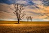
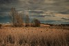
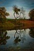
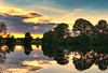
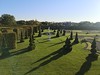
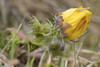
The above images may not be of the site on this page, but were taken nearby. They are loaded from Flickr so please click on them for image credits.
Click here to see more info for this site
Nearby sites
Click here to view sites on an interactive map of the areaKey: Red: member's photo, Blue: 3rd party photo, Yellow: other image, Green: no photo - please go there and take one, Grey: site destroyed
Download sites to:
KML (Google Earth)
GPX (GPS waypoints)
CSV (Garmin/Navman)
CSV (Excel)
To unlock full downloads you need to sign up as a Contributory Member. Otherwise downloads are limited to 50 sites.
Turn off the page maps and other distractions
Nearby sites listing. In the following links * = Image available
730m NW 325° Dönstedt 11 Burial Chamber or Dolmen
841m W 279° Dönstedt 14 Chambered Tomb
872m ENE 77° Dönstedt 15 Chambered Tomb
892m NE 42° Alvensleben 32* Burial Chamber or Dolmen
971m NNW 334° Dönstedt 5 Chambered Tomb
1.0km N 9° Dönstedt 10* Passage Grave
1.1km N 359° Dönstedt 19 Chambered Tomb
1.1km NNW 331° Dönstedt 9 Chambered Tomb
1.1km NNW 329° Dönstedt 8 Burial Chamber or Dolmen
1.1km NNW 334° Dönstedt 13 Burial Chamber or Dolmen
1.1km NW 322° Alvensleben 24 Long Barrow
1.2km N 4° Dönstedt 20 Chambered Tomb
1.2km NNW 332° Dönstedt 12 Chambered Tomb
1.2km NNW 335° Dönstedt 21 Chambered Tomb
1.4km NNE 19° Alvensleben 30* Burial Chamber or Dolmen
1.5km NNW 336° Alvensleben 42 Long Barrow
1.5km N 10° Alvensleben 27* Burial Chamber or Dolmen
1.5km NNE 12° Alvensleben 28* Burial Chamber or Dolmen
1.5km N 7° Alvensleben 26 Burial Chamber or Dolmen
1.6km NNW 336° Alvensleben 43 Long Barrow
1.7km NNE 27° Alvensleben 29 Burial Chamber or Dolmen
1.7km NE 35° Alvensleben 31 Long Barrow
1.8km NNW 327° Alvensleben 41 Long Barrow
1.8km N 352° Dönstedt 4* Passage Grave
1.9km N 10° Alvensleben 25 Burial Chamber or Dolmen
View more nearby sites and additional images


 We would like to know more about this location. Please feel free to add a brief description and any relevant information in your own language.
 Wir möchten mehr über diese Stätte erfahren. Bitte zögern Sie nicht, eine kurze Beschreibung und relevante Informationen in Deutsch hinzuzufügen.
 Nous aimerions en savoir encore un peu sur les lieux. S'il vous plaît n'hesitez pas à ajouter une courte description et tous les renseignements pertinents dans votre propre langue.
 Quisieramos informarnos un poco más de las lugares. No dude en añadir una breve descripción y otros datos relevantes en su propio idioma.