 with our Megalithic Portal iPhone app")

<< Our Photo Pages >> Opfersteine Schoengeising - Rock Art in Germany in Bavaria
Submitted by KaiHofmann on Tuesday, 14 February 2012 Page Views: 2861
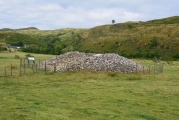
Rock ArtSite Name: Opfersteine SchoengeisingCountry: Germany
NOTE: This site is 1.965 km away from the location you searched for.
Land: Bavaria Type: Rock Art
Nearest Town: Grafrath Nearest Village: Unteralting
Latitude: 48.125182N Longitude: 11.189857E
Condition:
| 5 | Perfect |
| 4 | Almost Perfect |
| 3 | Reasonable but with some damage |
| 2 | Ruined but still recognisable as an ancient site |
| 1 | Pretty much destroyed, possibly visible as crop marks |
| 0 | No data. |
| -1 | Completely destroyed |
| 5 | Superb |
| 4 | Good |
| 3 | Ordinary |
| 2 | Not Good |
| 1 | Awful |
| 0 | No data. |
| 5 | Can be driven to, probably with disabled access |
| 4 | Short walk on a footpath |
| 3 | Requiring a bit more of a walk |
| 2 | A long walk |
| 1 | In the middle of nowhere, a nightmare to find |
| 0 | No data. |
| 5 | co-ordinates taken by GPS or official recorded co-ordinates |
| 4 | co-ordinates scaled from a detailed map |
| 3 | co-ordinates scaled from a bad map |
| 2 | co-ordinates of the nearest village |
| 1 | co-ordinates of the nearest town |
| 0 | no data |
Internal Links:
External Links:
I have visited· I would like to visit
tiger visited on 8th Jan 2023 - their rating: Cond: 4 Amb: 4 Access: 3 Very pretty, nice forest. It seems to be an active site for some local pagans/heathens etc. There were quite a lot of fresh offerings (stones shells) and burned incest, small burned spots around.
CAW visited - their rating: Cond: 3 Amb: 4 Access: 3
Average ratings for this site from all visit loggers: Condition: 3.5 Ambience: 4 Access: 3
")
You may be viewing yesterday's version of this page. To see the most up to date information please register for a free account.
Do not use the above information on other web sites or publications without permission of the contributor.
Nearby Images from Flickr
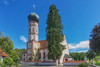
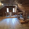
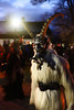
The above images may not be of the site on this page, but were taken nearby. They are loaded from Flickr so please click on them for image credits.
Click here to see more info for this site
Nearby sites
Click here to view sites on an interactive map of the areaKey: Red: member's photo, Blue: 3rd party photo, Yellow: other image, Green: no photo - please go there and take one, Grey: site destroyed
Download sites to:
KML (Google Earth)
GPX (GPS waypoints)
CSV (Garmin/Navman)
CSV (Excel)
To unlock full downloads you need to sign up as a Contributory Member. Otherwise downloads are limited to 50 sites.
Turn off the page maps and other distractions
Nearby sites listing. In the following links * = Image available
153m NE 37° Sunderburg Hillfort
12.9km E 86° Zeit+Raum Museum Germering Museum
13.8km S 184° Archaeological Park Herrsching* Museum
13.8km S 184° Baiuvarian Cemetery Herrsching* Barrow Cemetery
14.1km SW 222° Keltenschanze Utting* Misc. Earthwork
15.4km ENE 74° Viereckschanze Aubinger Lohe Misc. Earthwork
15.8km SE 130° Gut Rieden Grabhügel Barrow Cemetery
16.8km SE 131° Petersbrunn (Starnberg) Holy Well or Sacred Spring
17.8km ESE 114° Viereckschanze Buchendorf Misc. Earthwork
17.8km W 276° Unfriedshausen Ancient Village or Settlement
18.1km W 278° Pestenacker* Ancient Village or Settlement
22.1km WSW 241° Pürgel Grabhügelfeld Round Barrow(s)
22.3km SSE 157° Pfahlbausiedlung Roseninsel* Crannog
25.5km SE 124° Birg Hohenschäftlarn Ancient Village or Settlement
28.3km NNW 333° Rederzhausen Siedlung Ancient Village or Settlement
28.3km NNW 333° Rederzhausen Grabhügel Artificial Mound
29.8km E 86° Archäologische Staatssammlung Museum
31.0km ESE 114° Viereckschanze Deisenhofen (II)* Misc. Earthwork
31.8km SE 126° Holzhausen Viereckschanze (II)* Misc. Earthwork
31.8km ESE 116° Viereckschanze Deisenhofen (I)* Misc. Earthwork
31.9km SE 125° Holzhausen Viereckschanze (I)* Misc. Earthwork
32.2km ESE 113° Doppelviereckschanze Deisenhofen* Misc. Earthwork
32.5km ESE 119° Oberbiberg Viereckschanze* Misc. Earthwork
33.0km ESE 112° Oberhaching Siedlung Ancient Village or Settlement
33.0km ESE 112° Oberhaching Viereckschanze* Misc. Earthwork
View more nearby sites and additional images


 We would like to know more about this location. Please feel free to add a brief description and any relevant information in your own language.
 Wir möchten mehr über diese Stätte erfahren. Bitte zögern Sie nicht, eine kurze Beschreibung und relevante Informationen in Deutsch hinzuzufügen.
 Nous aimerions en savoir encore un peu sur les lieux. S'il vous plaît n'hesitez pas à ajouter une courte description et tous les renseignements pertinents dans votre propre langue.
 Quisieramos informarnos un poco más de las lugares. No dude en añadir una breve descripción y otros datos relevantes en su propio idioma.