

<< Our Photo Pages >> Romskollen - Hillfort in Norway in Akershus
Submitted by kenntha88 on Sunday, 25 September 2022 Page Views: 283
Iron Age and Later PrehistorySite Name: RomskollenCountry: Norway
NOTE: This site is 1.94 km away from the location you searched for.
Fylke: Akershus Type: Hillfort
Nearest Town: Askim
Latitude: 59.588622N Longitude: 11.109465E
Condition:
| 5 | Perfect |
| 4 | Almost Perfect |
| 3 | Reasonable but with some damage |
| 2 | Ruined but still recognisable as an ancient site |
| 1 | Pretty much destroyed, possibly visible as crop marks |
| 0 | No data. |
| -1 | Completely destroyed |
| 5 | Superb |
| 4 | Good |
| 3 | Ordinary |
| 2 | Not Good |
| 1 | Awful |
| 0 | No data. |
| 5 | Can be driven to, probably with disabled access |
| 4 | Short walk on a footpath |
| 3 | Requiring a bit more of a walk |
| 2 | A long walk |
| 1 | In the middle of nowhere, a nightmare to find |
| 0 | No data. |
| 5 | co-ordinates taken by GPS or official recorded co-ordinates |
| 4 | co-ordinates scaled from a detailed map |
| 3 | co-ordinates scaled from a bad map |
| 2 | co-ordinates of the nearest village |
| 1 | co-ordinates of the nearest town |
| 0 | no data |
Internal Links:
External Links:
")
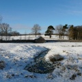
The Romskollen hillfort is located on a large natural oval shaped hill just east of the town Askim. Several hiking footpaths and trails leads from the bottom of the hill up to the fort. To the south the hill is damaged by several stone quarries from modern times and a water reservoir is located on the top of the hill at the highest point.
The hill has steep sides to the east, west and south. The hill is less steep to the north where the defensive works can be found. It seems to be only one single wall and some "arms" leading from the main wall. The wall starts on the North-West end of the hill around 100 metres NW of the water reservoir. It is shaped as a semi circle to the east where it follows a natural rock cliff. Here it is overgrown and parts of the wall have collapset and it can be hard to see at some points. It is around 1 to 3 metres wide and 0,2 to 0,5 metres in height.
The wall then turns SSE in a length of 20 metres. 10 metres away from the turn it becomes more visible. It also follows a natural small ravine that could have workes as a natural ditch or moat. On the inside the wall is around 1 metre in height. After 20 metres the wall then bends to the ESE. At one point in a natural depression the wall is very thick. It follows a ESE direction for 18 metres to what seems to have been the entrance to the fort.
From the entrance the wall runs in a SE direction in a length of 11m. Here the wall is heavily overgrown. It then turns NE in a length of 14m, where it goes over a shelf to continue at its base, where a new semicircular projection extends diametrically on the main wall 5m (NNWSE). The main wall then runs NNW in a length of 9m. The main wall, then turns towards the N and runs in l of 25m. In this section, it forms a kind of "S" and consists partly of very coarse stone. In the N part, the slope is easy to defend, so here the wall has been strengthened with an extension on the inside, it is quite overgrown and therefore difficult to describe in more detail.
The wall then goes ENE-over in a length of 14m, then bends SE in a length of 36m. Here the wall is partly less overgrown. But at the SE end is a smaller shelf with dense vegetation and moss and here there are probably stones hidden under the vegetation. Here the wall seems to end. 25-30m SE of the end of the wall, a gorge runs in a NE-SSW direction. The NNE end ends in a steep slope
The footpath leads trough the entrance and after 10 metres there is a large information poster.
You may be viewing yesterday's version of this page. To see the most up to date information please register for a free account.
")
")
")
")
")
")
")
")
Do not use the above information on other web sites or publications without permission of the contributor.
Click here to see more info for this site
Nearby sites
Click here to view sites on an interactive map of the areaKey: Red: member's photo, Blue: 3rd party photo, Yellow: other image, Green: no photo - please go there and take one, Grey: site destroyed
Download sites to:
KML (Google Earth)
GPX (GPS waypoints)
CSV (Garmin/Navman)
CSV (Excel)
To unlock full downloads you need to sign up as a Contributory Member. Otherwise downloads are limited to 50 sites.
Turn off the page maps and other distractions
Nearby sites listing. In the following links * = Image available
2.6km ENE 67° Offeret* Stone Circle
2.8km E 95° Askim Folkepark Cemetery* Barrow Cemetery
2.9km E 94° Askim Fylkessykehusets Park* Barrow Cemetery
3.5km ESE 108° Somerrogata-Løkentunet* Round Barrow(s)
3.7km E 84° Museumsveien* Round Barrow(s)
3.8km ENE 56° Haraldstad Mound* Round Barrow(s)
4.3km ESE 109° Neverstien-Løken Søndre* Round Barrow(s)
4.5km E 80° Grøttvet Nordre* Stone Circle
5.4km NNW 330° Hylligraven* Passage Grave
7.4km N 350° Olafsrud-Slottsåsen Hillfort* Hillfort
10.2km E 100° Monaryggen* Barrow Cemetery
11.1km WSW 237° Bjørnefestningen* Hillfort
11.9km E 101° Ospeveien* Round Barrow(s)
13.5km ESE 109° Bjerkelunden* Barrow Cemetery
13.9km SSE 165° Skiptvet Church cup Mark* Carving
15.7km ENE 73° Bæljeråsen* Hillfort
16.1km NW 307° Kråkstad* Barrow Cemetery
16.2km NW 304° Tomter* Stone Circle
16.2km SSE 168° Kransrud-Borgåsen* Hillfort
16.4km W 266° Garder* Barrow Cemetery
16.5km W 268° Nordre-Hovum/Hovtun* Barrow Cemetery
16.5km ESE 123° Trømborg* Barrow Cemetery
16.6km NW 307° Prestegårdshavna* Barrow Cemetery
16.7km NW 314° St Hanshaugen* Round Barrow(s)
16.8km W 267° Enerås-Hovum* Barrow Cemetery
View more nearby sites and additional images


 We would like to know more about this location. Please feel free to add a brief description and any relevant information in your own language.
 Wir möchten mehr über diese Stätte erfahren. Bitte zögern Sie nicht, eine kurze Beschreibung und relevante Informationen in Deutsch hinzuzufügen.
 Nous aimerions en savoir encore un peu sur les lieux. S'il vous plaît n'hesitez pas à ajouter une courte description et tous les renseignements pertinents dans votre propre langue.
 Quisieramos informarnos un poco más de las lugares. No dude en añadir una breve descripción y otros datos relevantes en su propio idioma.