<< Other Photo Pages >> Staffelberg - Hillfort in Germany in Bavaria
Submitted by AlexHunger on Saturday, 18 February 2006 Page Views: 3138
Iron Age and Later PrehistorySite Name: StaffelbergCountry: Germany
NOTE: This site is 5.878 km away from the location you searched for.
Land: Bavaria Type: Hillfort
Nearest Town: Bamberg Nearest Village: Bad Staffelstein
Latitude: 50.092163N Longitude: 11.025335E
Condition:
| 5 | Perfect |
| 4 | Almost Perfect |
| 3 | Reasonable but with some damage |
| 2 | Ruined but still recognisable as an ancient site |
| 1 | Pretty much destroyed, possibly visible as crop marks |
| 0 | No data. |
| -1 | Completely destroyed |
| 5 | Superb |
| 4 | Good |
| 3 | Ordinary |
| 2 | Not Good |
| 1 | Awful |
| 0 | No data. |
| 5 | Can be driven to, probably with disabled access |
| 4 | Short walk on a footpath |
| 3 | Requiring a bit more of a walk |
| 2 | A long walk |
| 1 | In the middle of nowhere, a nightmare to find |
| 0 | No data. |
| 5 | co-ordinates taken by GPS or official recorded co-ordinates |
| 4 | co-ordinates scaled from a detailed map |
| 3 | co-ordinates scaled from a bad map |
| 2 | co-ordinates of the nearest village |
| 1 | co-ordinates of the nearest town |
| 0 | no data |
Internal Links:
External Links:
I have visited· I would like to visit
Harald_Platta has visited here
")
Hillfort used from Neolithic to Middle Ages. Now only a church.
You may be viewing yesterday's version of this page. To see the most up to date information please register for a free account.
")
")
Do not use the above information on other web sites or publications without permission of the contributor.
Nearby Images from Flickr

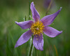
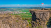
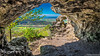
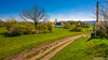

The above images may not be of the site on this page, but were taken nearby. They are loaded from Flickr so please click on them for image credits.
Click here to see more info for this site
Nearby sites
Click here to view sites on an interactive map of the areaKey: Red: member's photo, Blue: 3rd party photo, Yellow: other image, Green: no photo - please go there and take one, Grey: site destroyed
Download sites to:
KML (Google Earth)
GPX (GPS waypoints)
CSV (Garmin/Navman)
CSV (Excel)
To unlock full downloads you need to sign up as a Contributory Member. Otherwise downloads are limited to 50 sites.
Turn off the page maps and other distractions
Nearby sites listing. In the following links * = Image available
9.0km NW 316° Püchitz Neolithic Village Ancient Village or Settlement
19.7km SSE 167° Jungfernhoehle (Virgin's cave)* Cave or Rock Shelter
20.3km SW 224° Bamberg Cave Rock Art
21.7km S 183° Lietzendorf Grabhügel Barrow Cemetery
24.3km ESE 106° Turmberg Hillfort Hillfort
24.6km SSW 205° Historisches Museum Bamberg* Museum
25.3km ENE 71° Schamelstein Sculptured Stone
30.0km NW 323° Saarbach Hünengrab Not Known (by us)
31.4km NNE 21° Marterstein Sonneberg* Standing Stone (Menhir)
31.4km NNW 331° Poststein Rock Art
33.9km SSE 156° Langenstein Streitberg Natural Stone / Erratic / Other Natural Feature
35.0km SE 130° Neubürg* Ancient Village or Settlement
37.9km N 359° Herrenberg Wallanlage Causewayed Enclosure
38.1km WSW 247° Kleiner Knetzberg Hillfort
39.4km N 358° Bleß Wallanlage* Causewayed Enclosure
40.7km SSE 151° Esperhöhle Leutzdorf Cave or Rock Shelter
42.4km SSE 167° Walberla* Hillfort
45.0km SW 231° Hünerstein Ebrach Standing Stone (Menhir)
46.1km NW 318° Steinsburgmuseum* Museum
46.5km NW 315° Gräberfeld Merzelbachwald (1)* Round Barrow(s)
46.6km NW 318° Steinsburg Grabhügel (2) Round Barrow(s)
46.6km NW 315° Gräberfeld Merzelbachwald (2)* Round Barrow(s)
46.9km NW 319° Steinsburg* Hillfort
46.9km SW 235° Ebracher Bildstein* Sculptured Stone
47.1km NW 317° Steinsburg Grabhügel (1) Round Barrow(s)
View more nearby sites and additional images


 We would like to know more about this location. Please feel free to add a brief description and any relevant information in your own language.
 Wir möchten mehr über diese Stätte erfahren. Bitte zögern Sie nicht, eine kurze Beschreibung und relevante Informationen in Deutsch hinzuzufügen.
 Nous aimerions en savoir encore un peu sur les lieux. S'il vous plaît n'hesitez pas à ajouter une courte description et tous les renseignements pertinents dans votre propre langue.
 Quisieramos informarnos un poco más de las lugares. No dude en añadir una breve descripción y otros datos relevantes en su propio idioma.