

<< Our Photo Pages >> Feldhusen - Chambered Tomb in Germany in Mecklenburg-Western Pomerania
Submitted by Klingon on Thursday, 23 June 2005 Page Views: 2528
Neolithic and Bronze AgeSite Name: FeldhusenCountry: Germany
NOTE: This site is 4.645 km away from the location you searched for.
Land: Mecklenburg-Western Pomerania Type: Chambered Tomb
Nearest Village: Feldhusen
Latitude: 53.950325N Longitude: 10.954320E
Condition:
| 5 | Perfect |
| 4 | Almost Perfect |
| 3 | Reasonable but with some damage |
| 2 | Ruined but still recognisable as an ancient site |
| 1 | Pretty much destroyed, possibly visible as crop marks |
| 0 | No data. |
| -1 | Completely destroyed |
| 5 | Superb |
| 4 | Good |
| 3 | Ordinary |
| 2 | Not Good |
| 1 | Awful |
| 0 | No data. |
| 5 | Can be driven to, probably with disabled access |
| 4 | Short walk on a footpath |
| 3 | Requiring a bit more of a walk |
| 2 | A long walk |
| 1 | In the middle of nowhere, a nightmare to find |
| 0 | No data. |
| 5 | co-ordinates taken by GPS or official recorded co-ordinates |
| 4 | co-ordinates scaled from a detailed map |
| 3 | co-ordinates scaled from a bad map |
| 2 | co-ordinates of the nearest village |
| 1 | co-ordinates of the nearest town |
| 0 | no data |
Be the first person to rate this site - see the 'Contribute!' box in the right hand menu.
Internal Links:
External Links:
I have visited· I would like to visit
weldersdog- visited - their rating: Cond: 4 Amb: 4 Access: 3
")
You may be viewing yesterday's version of this page. To see the most up to date information please register for a free account.
")
")
")
")
Do not use the above information on other web sites or publications without permission of the contributor.
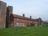
Nearby Images from Flickr
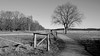

The above images may not be of the site on this page, but were taken nearby. They are loaded from Flickr so please click on them for image credits.
Click here to see more info for this site
Nearby sites
Click here to view sites on an interactive map of the areaKey: Red: member's photo, Blue: 3rd party photo, Yellow: other image, Green: no photo - please go there and take one, Grey: site destroyed
Download sites to:
KML (Google Earth)
GPX (GPS waypoints)
CSV (Garmin/Navman)
CSV (Excel)
To unlock full downloads you need to sign up as a Contributory Member. Otherwise downloads are limited to 50 sites.
Turn off the page maps and other distractions
Nearby sites listing. In the following links * = Image available
10.1km WSW 255° Poeppendorf Huenengrab* Passage Grave
12.1km W 260° Offendorf Langbett* Long Barrow
13.4km ESE 114° Kussow Steingrab* Modern Stone Circle etc
13.5km ESE 114° Kussow Steinzeitdorf* Museum
14.3km W 270° Ratekau Dolmen* Burial Chamber or Dolmen
14.6km W 263° Ratekau Ganggrab Passage Grave
15.8km WNW 287° Pansdorf Grellberg Round Barrow(s)
19.0km NW 305° Gronenberg Steingrab* Burial Chamber or Dolmen
19.3km ESE 119° Langer Stein Grevesmühlen* Standing Stone (Menhir)
19.9km NNW 333° Luschendorfer Steinkiste* Cist
19.9km NNW 333° Museum der Stadt Neustadt in Holstein Museum
20.2km ESE 116° Hamberge Schalenstein* Rock Art
21.5km ESE 112° Sühnestein von Everstorf* Early Christian Sculptured Stone
21.9km ESE 111° Everstorfer Forst Nord (10)* Chambered Tomb
21.9km NNW 328° Sierhagen Huegelgrab 1* Round Barrow(s)
21.9km ESE 111° Everstorfer Forst Nord (9)* Chambered Tomb
22.2km NW 325° Sierhagen Steingrab 2* Long Barrow
22.3km NNW 326° Sierhagen Huegelgrab 3* Round Barrow(s)
22.3km ESE 110° Everstorfer Forst Nord (7)* Burial Chamber or Dolmen
22.4km ESE 110° Everstorfer Forst Nord (6)* Long Barrow
22.4km ESE 110° Everstorfer Forst Nord (5)* Burial Chamber or Dolmen
22.4km ESE 110° Everstorfer Forst Nord (8)* Chambered Tomb
22.5km ESE 110° Everstorfer Forst Nord (2)* Burial Chamber or Dolmen
22.5km ESE 110° Everstorfer Forst Nord (3)* Long Barrow
22.5km ESE 110° Everstorfer Forst Nord (4)* Long Barrow
View more nearby sites and additional images


 We would like to know more about this location. Please feel free to add a brief description and any relevant information in your own language.
 Wir möchten mehr über diese Stätte erfahren. Bitte zögern Sie nicht, eine kurze Beschreibung und relevante Informationen in Deutsch hinzuzufügen.
 Nous aimerions en savoir encore un peu sur les lieux. S'il vous plaît n'hesitez pas à ajouter une courte description et tous les renseignements pertinents dans votre propre langue.
 Quisieramos informarnos un poco más de las lugares. No dude en añadir una breve descripción y otros datos relevantes en su propio idioma.