<< Text Pages >> Bamberg Cave - Rock Art in Germany in Bavaria
Submitted by KaiHofmann on Monday, 19 January 2015 Page Views: 1661
Rock ArtSite Name: Bamberg CaveCountry: Germany
NOTE: This site is 3.997 km away from the location you searched for.
Land: Bavaria Type: Rock Art
Nearest Town: Bamberg
Latitude: 49.960488N Longitude: 10.829360E
Condition:
| 5 | Perfect |
| 4 | Almost Perfect |
| 3 | Reasonable but with some damage |
| 2 | Ruined but still recognisable as an ancient site |
| 1 | Pretty much destroyed, possibly visible as crop marks |
| 0 | No data. |
| -1 | Completely destroyed |
| 5 | Superb |
| 4 | Good |
| 3 | Ordinary |
| 2 | Not Good |
| 1 | Awful |
| 0 | No data. |
| 5 | Can be driven to, probably with disabled access |
| 4 | Short walk on a footpath |
| 3 | Requiring a bit more of a walk |
| 2 | A long walk |
| 1 | In the middle of nowhere, a nightmare to find |
| 0 | No data. |
| 5 | co-ordinates taken by GPS or official recorded co-ordinates |
| 4 | co-ordinates scaled from a detailed map |
| 3 | co-ordinates scaled from a bad map |
| 2 | co-ordinates of the nearest village |
| 1 | co-ordinates of the nearest town |
| 0 | no data |
Be the first person to rate this site - see the 'Contribute!' box in the right hand menu.
Internal Links:
External Links:
Rock Art in Bavaria
A small 5m deep cave on private ground, which shows the probably only cave art in germany found yet (2011). The cave is covered with limescale which remembers on human genitals. On this limescale archaeologists found light engravings which where probably more than 10.000 years old. The cave chamber was possibly a fertility rite sanctuary. The exact location will be kept secret.
For more information and some photos:
Cave art in Germany
You may be viewing yesterday's version of this page. To see the most up to date information please register for a free account.
Do not use the above information on other web sites or publications without permission of the contributor.
Nearby Images from Flickr
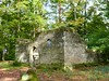
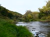

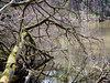
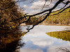
The above images may not be of the site on this page, but were taken nearby. They are loaded from Flickr so please click on them for image credits.
Click here to see more info for this site
Nearby sites
Click here to view sites on an interactive map of the areaKey: Red: member's photo, Blue: 3rd party photo, Yellow: other image, Green: no photo - please go there and take one, Grey: site destroyed
Download sites to:
KML (Google Earth)
GPX (GPS waypoints)
CSV (Garmin/Navman)
CSV (Excel)
To unlock full downloads you need to sign up as a Contributory Member. Otherwise downloads are limited to 50 sites.
Turn off the page maps and other distractions
Nearby sites listing. In the following links * = Image available
8.6km SSE 154° Historisches Museum Bamberg* Museum
14.7km ESE 119° Lietzendorf Grabhügel Barrow Cemetery
19.1km ESE 104° Jungfernhoehle (Virgin's cave)* Cave or Rock Shelter
20.3km NE 44° Staffelberg* Hillfort
21.1km W 269° Kleiner Knetzberg Hillfort
22.5km NNE 20° Püchitz Neolithic Village Ancient Village or Settlement
25.1km WSW 236° Hünerstein Ebrach Standing Stone (Menhir)
27.3km WSW 242° Ebracher Bildstein* Sculptured Stone
32.2km ESE 120° Langenstein Streitberg Natural Stone / Erratic / Other Natural Feature
35.4km SE 139° Walberla* Hillfort
36.7km SSE 155° Mark-forst Grabhügel Artificial Mound
38.1km SSW 207° Oasen der Sinne* Museum
38.2km ENE 78° Turmberg Hillfort Hillfort
38.7km N 354° Saarbach Hünengrab Not Known (by us)
39.6km ESE 122° Esperhöhle Leutzdorf Cave or Rock Shelter
39.6km S 169° Kosbacher Altar* Round Barrow(s)
41.7km E 100° Neubürg* Ancient Village or Settlement
42.0km N 358° Poststein Rock Art
42.9km WSW 256° Grabstele Volkach Standing Stone (Menhir)
44.3km ENE 59° Schamelstein Sculptured Stone
47.0km WSW 237° Schwanberg Hillfort Hillfort
47.5km WSW 258° Vogelburg Hillfort
50.7km NNE 30° Marterstein Sonneberg* Standing Stone (Menhir)
51.0km NNW 338° Gräberfeld Merzelbachwald (1)* Round Barrow(s)
51.1km NNW 338° Gräberfeld Merzelbachwald (2)* Round Barrow(s)
View more nearby sites and additional images


 We would like to know more about this location. Please feel free to add a brief description and any relevant information in your own language.
 Wir möchten mehr über diese Stätte erfahren. Bitte zögern Sie nicht, eine kurze Beschreibung und relevante Informationen in Deutsch hinzuzufügen.
 Nous aimerions en savoir encore un peu sur les lieux. S'il vous plaît n'hesitez pas à ajouter une courte description et tous les renseignements pertinents dans votre propre langue.
 Quisieramos informarnos un poco más de las lugares. No dude en añadir una breve descripción y otros datos relevantes en su propio idioma.