<< Text Pages >> Steina Monolith - Natural Stone / Erratic / Other Natural Feature in Germany in Lower Saxony, Bremen
Submitted by KaiHofmann on Saturday, 04 October 2014 Page Views: 921
Natural PlacesSite Name: Steina MonolithCountry: Germany
NOTE: This site is 16.59 km away from the location you searched for.
Land: Lower Saxony, Bremen Type: Natural Stone / Erratic / Other Natural Feature
Nearest Town: Bad Sachsa Nearest Village: Steina
Latitude: 51.589150N Longitude: 10.526731E
Condition:
| 5 | Perfect |
| 4 | Almost Perfect |
| 3 | Reasonable but with some damage |
| 2 | Ruined but still recognisable as an ancient site |
| 1 | Pretty much destroyed, possibly visible as crop marks |
| 0 | No data. |
| -1 | Completely destroyed |
| 5 | Superb |
| 4 | Good |
| 3 | Ordinary |
| 2 | Not Good |
| 1 | Awful |
| 0 | No data. |
| 5 | Can be driven to, probably with disabled access |
| 4 | Short walk on a footpath |
| 3 | Requiring a bit more of a walk |
| 2 | A long walk |
| 1 | In the middle of nowhere, a nightmare to find |
| 0 | No data. |
| 5 | co-ordinates taken by GPS or official recorded co-ordinates |
| 4 | co-ordinates scaled from a detailed map |
| 3 | co-ordinates scaled from a bad map |
| 2 | co-ordinates of the nearest village |
| 1 | co-ordinates of the nearest town |
| 0 | no data |
Internal Links:
External Links:
Natural Stone / Erratic / Other Natural Feature in Lower Saxony, Bremen
A 4m long stone pillar is lying on the top of a hill south of Steina. It looks like a menhir but it´s probably a natural boulder.
For more information see the website by Johannes Groht.
You may be viewing yesterday's version of this page. To see the most up to date information please register for a free account.
Do not use the above information on other web sites or publications without permission of the contributor.
Nearby Images from Flickr

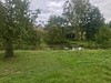

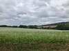
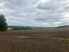
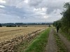
The above images may not be of the site on this page, but were taken nearby. They are loaded from Flickr so please click on them for image credits.
Click here to see more info for this site
Nearby sites
Click here to view sites on an interactive map of the areaKey: Red: member's photo, Blue: 3rd party photo, Yellow: other image, Green: no photo - please go there and take one, Grey: site destroyed
Download sites to:
KML (Google Earth)
GPX (GPS waypoints)
CSV (Garmin/Navman)
CSV (Excel)
To unlock full downloads you need to sign up as a Contributory Member. Otherwise downloads are limited to 50 sites.
Turn off the page maps and other distractions
Nearby sites listing. In the following links * = Image available
9.9km WNW 301° Einhornhoehle* Cave or Rock Shelter
11.4km WNW 295° Steinkirche* Cave or Rock Shelter
15.0km W 270° Rhumequelle* Holy Well or Sacred Spring
16.0km N 356° Dreibrodesteine* Natural Stone / Erratic / Other Natural Feature
17.3km NNE 15° Jemerstein* Rock Outcrop
17.7km NNW 332° Hanskühnenburg-Klippe* Rock Outcrop
19.6km NNE 19° Hexentreppe Wurmberg* Ancient Trackway
20.5km WNW 301° Jettenhöhle* Cave or Rock Shelter
20.8km NW 308° Teufelsloch Osterode* Holy Well or Sacred Spring
22.0km SE 144° Nohra Hünstein* Standing Stone (Menhir)
24.6km SSE 167° Helbeburg Causewayed Enclosure
26.7km SSE 165° Mittelholz Artificial Mound
28.3km SE 136° Grasgarten Sechslinden Artificial Mound
28.6km WNW 302° Lichtensteinhöhle* Cave or Rock Shelter
28.6km SE 142° Heiliger Berg Misc. Earthwork
31.2km N 355° Kästeklippen* Rock Outcrop
31.7km SE 138° Frauenberg Causewayed Enclosure
32.3km NNE 27° Altenrode* Stone Circle
32.3km NNE 33° Summstein Sonnenstein Modern Stone Circle etc
32.6km NW 322° Hübichstein* Rock Outcrop
33.7km SE 128° Am wilden Mann Artificial Mound
34.3km SSE 162° Holzsußra Artificial Mound
34.5km NNE 32° Knabenstein Early Christian Sculptured Stone
34.7km SE 142° Ölmüllersberg Causewayed Enclosure
35.5km ESE 113° Hoher Stein Berga* Standing Stone (Menhir)
View more nearby sites and additional images


 We would like to know more about this location. Please feel free to add a brief description and any relevant information in your own language.
 Wir möchten mehr über diese Stätte erfahren. Bitte zögern Sie nicht, eine kurze Beschreibung und relevante Informationen in Deutsch hinzuzufügen.
 Nous aimerions en savoir encore un peu sur les lieux. S'il vous plaît n'hesitez pas à ajouter une courte description et tous les renseignements pertinents dans votre propre langue.
 Quisieramos informarnos un poco más de las lugares. No dude en añadir una breve descripción y otros datos relevantes en su propio idioma.