<< Our Photo Pages >> Castelletto - Carving in Italy in Veneto
Submitted by Klingon on Sunday, 14 October 2018 Page Views: 938
Multi-periodSite Name: CastellettoCountry: Italy
NOTE: This site is 27.158 km away from the location you searched for.
Region: Veneto Type: Carving
Nearest Town: Verona Nearest Village: Magugnano
Latitude: 45.708550N Longitude: 10.767090E
Condition:
| 5 | Perfect |
| 4 | Almost Perfect |
| 3 | Reasonable but with some damage |
| 2 | Ruined but still recognisable as an ancient site |
| 1 | Pretty much destroyed, possibly visible as crop marks |
| 0 | No data. |
| -1 | Completely destroyed |
| 5 | Superb |
| 4 | Good |
| 3 | Ordinary |
| 2 | Not Good |
| 1 | Awful |
| 0 | No data. |
| 5 | Can be driven to, probably with disabled access |
| 4 | Short walk on a footpath |
| 3 | Requiring a bit more of a walk |
| 2 | A long walk |
| 1 | In the middle of nowhere, a nightmare to find |
| 0 | No data. |
| 5 | co-ordinates taken by GPS or official recorded co-ordinates |
| 4 | co-ordinates scaled from a detailed map |
| 3 | co-ordinates scaled from a bad map |
| 2 | co-ordinates of the nearest village |
| 1 | co-ordinates of the nearest town |
| 0 | no data |
Internal Links:
External Links:
I have visited· I would like to visit
Klingon visited on 3rd Oct 2018 - their rating: Cond: 5 Amb: 3 Access: 5
")
Bronze Age carvings, exhibited in an official building. The office is only open on Mondays and Wednesdays mornings.
You may be viewing yesterday's version of this page. To see the most up to date information please register for a free account.
")
")
")
")
Do not use the above information on other web sites or publications without permission of the contributor.
Nearby Images from Flickr
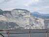
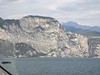
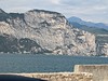
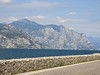
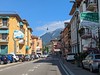
The above images may not be of the site on this page, but were taken nearby. They are loaded from Flickr so please click on them for image credits.
Click here to see more info for this site
Nearby sites
Click here to view sites on an interactive map of the areaKey: Red: member's photo, Blue: 3rd party photo, Yellow: other image, Green: no photo - please go there and take one, Grey: site destroyed
Download sites to:
KML (Google Earth)
GPX (GPS waypoints)
CSV (Garmin/Navman)
CSV (Excel)
To unlock full downloads you need to sign up as a Contributory Member. Otherwise downloads are limited to 50 sites.
Turn off the page maps and other distractions
Nearby sites listing. In the following links * = Image available
9.1km SSW 208° Crero* Carving
15.7km SSW 206° Roccia delle Griselle* Carving
20.4km NNE 16° MAG Museo Alta Garda Museum
22.7km SW 222° La Rocca di Manerba* Ancient Temple
23.6km N 10° Monte San Martino, Campi, Riva Dell Garda* Ancient Temple
24.1km SW 224° Manerba del Garda Chambered Tombs Chambered Tomb
46.5km NW 317° Nadro Cup-Marked-Stone* Rock Art
46.6km NW 317° Foppe-Nadro Museum* Museum
46.9km NW 317° Nadro Ancient Road* Ancient Trackway
47.1km NW 317° Foppe-Nadro Stone* Standing Stone (Menhir)
47.2km NW 319° In Vall Rock Engravings Rock Art
47.2km NW 317° Foppe-Nadro Villaggio Prehistorico* Museum
47.3km NW 317° Sotto Roccia shelter II* Cave or Rock Shelter
47.4km NW 317° Foppe-Nadro Rock 1* Rock Art
47.4km NW 317° Foppe-Nadro Rock 23* Rock Art
47.4km NW 317° Foppe-Nadro Rock 21* Rock Art
47.4km NW 317° Foppe-Nadro Rock 4* Rock Art
47.5km NW 317° Foppe-Nadro Rock 29* Rock Art
47.5km NW 317° Foppe-Nadro Rock 26* Rock Art
47.5km NW 317° Foppe-Nadro Rock 6* Rock Art
47.5km NW 317° Foppe-Nadro Rock 22* Rock Art
47.5km NW 317° Foppe-Nadro Rock 24* Rock Art
47.5km NW 317° Foppe-Nadro Rock 25* Rock Art
47.5km NW 319° Castagneto Rock Art
47.6km NW 317° Foppe-Nadro Rock 34* Rock Art
View more nearby sites and additional images


 We would like to know more about this location. Please feel free to add a brief description and any relevant information in your own language.
 Wir möchten mehr über diese Stätte erfahren. Bitte zögern Sie nicht, eine kurze Beschreibung und relevante Informationen in Deutsch hinzuzufügen.
 Nous aimerions en savoir encore un peu sur les lieux. S'il vous plaît n'hesitez pas à ajouter une courte description et tous les renseignements pertinents dans votre propre langue.
 Quisieramos informarnos un poco más de las lugares. No dude en añadir una breve descripción y otros datos relevantes en su propio idioma.