

<< Our Photo Pages >> Foppe-Nadro Rock 34 - Rock Art in Italy in Lombardia
Submitted by AlexHunger on Monday, 17 March 2008 Page Views: 2813
Rock ArtSite Name: Foppe-Nadro Rock 34Country: Italy
NOTE: This site is 0.12 km away from the location you searched for.
Region: Lombardia Type: Rock Art
Nearest Town: Bergamo Nearest Village: Foppe-Nadro
Latitude: 46.023010N Longitude: 10.350900E
Condition:
| 5 | Perfect |
| 4 | Almost Perfect |
| 3 | Reasonable but with some damage |
| 2 | Ruined but still recognisable as an ancient site |
| 1 | Pretty much destroyed, possibly visible as crop marks |
| 0 | No data. |
| -1 | Completely destroyed |
| 5 | Superb |
| 4 | Good |
| 3 | Ordinary |
| 2 | Not Good |
| 1 | Awful |
| 0 | No data. |
| 5 | Can be driven to, probably with disabled access |
| 4 | Short walk on a footpath |
| 3 | Requiring a bit more of a walk |
| 2 | A long walk |
| 1 | In the middle of nowhere, a nightmare to find |
| 0 | No data. |
| 5 | co-ordinates taken by GPS or official recorded co-ordinates |
| 4 | co-ordinates scaled from a detailed map |
| 3 | co-ordinates scaled from a bad map |
| 2 | co-ordinates of the nearest village |
| 1 | co-ordinates of the nearest town |
| 0 | no data |
Internal Links:
External Links:
")
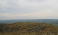
Series of Neolithic to middle ages petroglyphs on smooth exposed bedrock of mountain on about 6 Km long archeology circuit. Check in at local museum.
494 Meters Altitude
You may be viewing yesterday's version of this page. To see the most up to date information please register for a free account.
Do not use the above information on other web sites or publications without permission of the contributor.
Nearby Images from Flickr


The above images may not be of the site on this page, but were taken nearby. They are loaded from Flickr so please click on them for image credits.
Click here to see more info for this site
Nearby sites
Click here to view sites on an interactive map of the areaKey: Red: member's photo, Blue: 3rd party photo, Yellow: other image, Green: no photo - please go there and take one, Grey: site destroyed
Download sites to:
KML (Google Earth)
GPX (GPS waypoints)
CSV (Garmin/Navman)
CSV (Excel)
To unlock full downloads you need to sign up as a Contributory Member. Otherwise downloads are limited to 50 sites.
Turn off the page maps and other distractions
Nearby sites listing. In the following links * = Image available
70m S 188° Foppe-Nadro Rock 25* Rock Art
97m SSE 157° Foppe-Nadro Rock 26* Rock Art
103m S 190° Foppe-Nadro Rock 24* Rock Art
103m SSE 156° Foppe-Nadro Rock 29* Rock Art
151m S 180° Foppe-Nadro Rock 23* Rock Art
162m SSW 196° Foppe-Nadro Rock 22* Rock Art
174m S 189° Foppe-Nadro Rock 21* Rock Art
198m SSW 195° Foppe-Nadro Rock 4* Rock Art
214m SSW 203° Foppe-Nadro Rock 6* Rock Art
253m SSE 162° Sotto Roccia shelter II* Cave or Rock Shelter
275m S 189° Foppe-Nadro Rock 1* Rock Art
321m N 5° Campanine Bosc del Vicare Rock Art
334m NNW 331° Borno Stelae (4)* Rock Art
370m NNW 334° Cemmo 3* Rock Art
421m S 180° Foppe-Nadro Villaggio Prehistorico* Museum
464m NNE 23° Campanine Alta* Rock Art
530m S 175° Foppe-Nadro Stone* Standing Stone (Menhir)
535m N 355° Naquane* Rock Art
806m S 176° Nadro Ancient Road* Ancient Trackway
929m NNW 329° Museo Nazionale Della Preistoria Della Valle Camonica Museum
1.2km S 172° Foppe-Nadro Museum* Museum
1.3km NE 39° ´Al de Plaha* Rock Art
1.3km S 174° Nadro Cup-Marked-Stone* Rock Art
1.3km NW 314° Cemmo Stones* Rock Art
1.3km NNW 332° Seradina - Bedolina* Rock Art
View more nearby sites and additional images


 We would like to know more about this location. Please feel free to add a brief description and any relevant information in your own language.
 Wir möchten mehr über diese Stätte erfahren. Bitte zögern Sie nicht, eine kurze Beschreibung und relevante Informationen in Deutsch hinzuzufügen.
 Nous aimerions en savoir encore un peu sur les lieux. S'il vous plaît n'hesitez pas à ajouter une courte description et tous les renseignements pertinents dans votre propre langue.
 Quisieramos informarnos un poco más de las lugares. No dude en añadir una breve descripción y otros datos relevantes en su propio idioma.