<< Text Pages >> Grünenbach 'Der Stein' - Misc. Earthwork in Germany in Bavaria
Submitted by AlexHunger on Saturday, 18 February 2006 Page Views: 3331
Date UncertainSite Name: Grünenbach 'Der Stein'Country: Germany
NOTE: This site is 26.476 km away from the location you searched for.
Land: Bavaria Type: Misc. Earthwork
Nearest Town: Friedrichshafen Nearest Village: Grünenbach
Latitude: 47.632940N Longitude: 10.010730E
Condition:
| 5 | Perfect |
| 4 | Almost Perfect |
| 3 | Reasonable but with some damage |
| 2 | Ruined but still recognisable as an ancient site |
| 1 | Pretty much destroyed, possibly visible as crop marks |
| 0 | No data. |
| -1 | Completely destroyed |
| 5 | Superb |
| 4 | Good |
| 3 | Ordinary |
| 2 | Not Good |
| 1 | Awful |
| 0 | No data. |
| 5 | Can be driven to, probably with disabled access |
| 4 | Short walk on a footpath |
| 3 | Requiring a bit more of a walk |
| 2 | A long walk |
| 1 | In the middle of nowhere, a nightmare to find |
| 0 | No data. |
| 5 | co-ordinates taken by GPS or official recorded co-ordinates |
| 4 | co-ordinates scaled from a detailed map |
| 3 | co-ordinates scaled from a bad map |
| 2 | co-ordinates of the nearest village |
| 1 | co-ordinates of the nearest town |
| 0 | no data |
Internal Links:
External Links:
A 19 Meter by 20 Meter square henge with an internal square tumulus. Several trees grow out the top of this otherwise unknown object.
IMPORTANT NOTE: Position of site unknown, co-ordinates given for nearest village.
You may be viewing yesterday's version of this page. To see the most up to date information please register for a free account.
Do not use the above information on other web sites or publications without permission of the contributor.
Nearby Images from Flickr


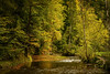
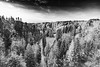
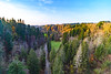
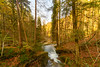
The above images may not be of the site on this page, but were taken nearby. They are loaded from Flickr so please click on them for image credits.
Click here to see more info for this site
Nearby sites
Click here to view sites on an interactive map of the areaKey: Red: member's photo, Blue: 3rd party photo, Yellow: other image, Green: no photo - please go there and take one, Grey: site destroyed
Download sites to:
KML (Google Earth)
GPX (GPS waypoints)
CSV (Garmin/Navman)
CSV (Excel)
To unlock full downloads you need to sign up as a Contributory Member. Otherwise downloads are limited to 50 sites.
Turn off the page maps and other distractions
Nearby sites listing. In the following links * = Image available
30.8km ENE 74° Dengelstein* Natural Stone / Erratic / Other Natural Feature
31.3km WNW 300° Haslachwald Grabhügelgruppe Barrow Cemetery
36.5km NW 315° Baindt Viereckschanze Ancient Village or Settlement
36.5km WNW 301° Dickenwald Grabhügelgruppe Barrow Cemetery
36.7km NW 316° Hartwald Grabhügelgruppe Barrow Cemetery
40.4km WSW 237° Holed Stone / Schalenstein Strich* Holed Stone
40.7km WSW 238° Holed Stone / Schalenstein Unter-Altenstein* Holed Stone
41.0km WSW 237° Rasplen Chindlistein* Rock Art
42.5km N 6° Tannheim Keltische Viereckschanze Ancient Village or Settlement
43.6km NW 311° Schreckensee Ancient Village or Settlement
43.9km SW 219° Kultstein Kirche St. Arbogast* Holed Stone
45.0km WSW 253° Fussstein* Rock Art
47.2km NNW 330° Olzreute-Enzisholz Ancient Village or Settlement
48.2km W 276° Reutenen Grabhügelgruppe Barrow Cemetery
51.4km NW 304° Gelbhart Grabhügelgruppe Barrow Cemetery
52.4km E 99° Summstein Lithophon* Modern Stone Circle etc
53.2km WNW 298° Illmensee Seeufersiedlung Ancient Village or Settlement
53.2km WNW 298° Sigmarinen Schloss Museum Museum
53.4km WNW 285° Monolith Leutkirch Natural Stone / Erratic / Other Natural Feature
53.4km NNW 336° Mittelbiberach Keltische Viereckschanze Ancient Village or Settlement
54.4km NNW 330° Siedlung Forschner Ancient Village or Settlement
55.1km NW 321° Schelmberg Wald Keltische Viereckschanze Ancient Village or Settlement
55.5km WNW 287° Salem Grabhügelgruppe Barrow Cemetery
55.7km SW 218° Borscht Prehistoric Settlements* Ancient Village or Settlement
56.4km SSW 200° Tschengla* Modern Stone Circle etc
View more nearby sites and additional images


 We would like to know more about this location. Please feel free to add a brief description and any relevant information in your own language.
 Wir möchten mehr über diese Stätte erfahren. Bitte zögern Sie nicht, eine kurze Beschreibung und relevante Informationen in Deutsch hinzuzufügen.
 Nous aimerions en savoir encore un peu sur les lieux. S'il vous plaît n'hesitez pas à ajouter une courte description et tous les renseignements pertinents dans votre propre langue.
 Quisieramos informarnos un poco más de las lugares. No dude en añadir una breve descripción y otros datos relevantes en su propio idioma.