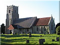
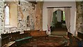
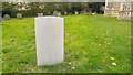
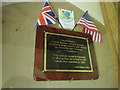
<< Our Photo Pages >> Iken Saxon Cross - Ancient Cross in England in Suffolk
Submitted by Ermine on Wednesday, 24 November 2004 Page Views: 10666
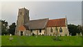
Early Medieval (Dark Age)Site Name: Iken Saxon CrossCountry: England
NOTE: This site is 10.091 km away from the location you searched for.
County: Suffolk Type: Ancient Cross
Nearest Town: Orford Nearest Village: Iken
Map Ref: TM412566
Latitude: 52.154952N Longitude: 1.524660E
Condition:
| 5 | Perfect |
| 4 | Almost Perfect |
| 3 | Reasonable but with some damage |
| 2 | Ruined but still recognisable as an ancient site |
| 1 | Pretty much destroyed, possibly visible as crop marks |
| 0 | No data. |
| -1 | Completely destroyed |
| 5 | Superb |
| 4 | Good |
| 3 | Ordinary |
| 2 | Not Good |
| 1 | Awful |
| 0 | No data. |
| 5 | Can be driven to, probably with disabled access |
| 4 | Short walk on a footpath |
| 3 | Requiring a bit more of a walk |
| 2 | A long walk |
| 1 | In the middle of nowhere, a nightmare to find |
| 0 | No data. |
| 5 | co-ordinates taken by GPS or official recorded co-ordinates |
| 4 | co-ordinates scaled from a detailed map |
| 3 | co-ordinates scaled from a bad map |
| 2 | co-ordinates of the nearest village |
| 1 | co-ordinates of the nearest town |
| 0 | no data |
Internal Links:
External Links:
I have visited· I would like to visit
PAB ermine have visited here
")
You may be viewing yesterday's version of this page. To see the most up to date information please register for a free account.
")
")
")
")
Do not use the above information on other web sites or publications without permission of the contributor.
Nearby Images from Geograph Britain and Ireland:
©2005(licence)
©2006(licence)
©2017(licence)
©2015(licence)
©2017(licence)
The above images may not be of the site on this page, they are loaded from Geograph.
Please Submit an Image of this site or go out and take one for us!
Click here to see more info for this site
Nearby sites
Key: Red: member's photo, Blue: 3rd party photo, Yellow: other image, Green: no photo - please go there and take one, Grey: site destroyed
Download sites to:
KML (Google Earth)
GPX (GPS waypoints)
CSV (Garmin/Navman)
CSV (Excel)
To unlock full downloads you need to sign up as a Contributory Member. Otherwise downloads are limited to 50 sites.
Turn off the page maps and other distractions
Nearby sites listing. In the following links * = Image available
14.7km WSW 240° Sutton Hoo* Artificial Mound (TM288487)
14.7km SW 221° Shottisham Monument Complex Henge (TM32004505)
19.2km NNE 21° Walberswick Burial Mounds* Round Barrow(s) (TM4718274820)
19.2km W 260° Burgh Enclosure Ancient Village or Settlement (TM224523)
19.3km WSW 237° Falcon Park Round Barrow(s) (TM25504534)
19.9km WSW 241° Martlesham Airfield Round Barrow(s) (TM24224616)
19.9km WSW 243° Martlesham Heath* Round Barrow(s) (TM238468)
19.9km NNE 14° Ladywell (Blythborough)* Holy Well or Sacred Spring (TM450762)
20.1km SW 236° Sheep Drift Farm Round Barrow(s) (TM2495444591)
20.2km SW 236° The Swale Round Barrow(s) (TM24954459)
20.3km WSW 241° Martlesham Bowl Barrow 2* Round Barrow(s) (TM23874598)
20.3km WSW 241° Martlesham Bowl Barrow 1* Round Barrow(s) (TM23864587)
21.0km WSW 239° Brightwell Heath* Barrow Cemetery (TM23634505)
21.7km WSW 244° Kesgrave Bowl Barrow 1* Round Barrow(s) (TM22074616)
21.8km WSW 244° Kesgrave Barrow* Round Barrow(s) (TM22074591)
23.2km SW 229° Levington Heath* Round Barrow(s) (TM244405)
23.4km SW 230° Levington Ring Ditches Barrow Cemetery (TM23864073)
24.1km SW 233° Seven Hills* Barrow Cemetery (TM225413)
24.6km SW 234° Purdis Farm Cursus Cursus (TM218413)
26.2km NW 316° Kesgrave Bowl Barrow 2 Round Barrow(s) (TM220745)
30.8km NW 314° St. Edmund's Cross Ancient Cross (TM1877)
31.6km NNW 343° Flixton Park Quarry Timber Circle (TM303863)
32.1km WNW 289° Mendlesham Preaching Stone* Natural Stone / Erratic / Other Natural Feature (TM103658)
33.9km N 350° Druid's Stone (Bungay)* Natural Stone / Erratic / Other Natural Feature (TM3366689739)
35.0km W 270° Lady Well, Badley Holy Well or Sacred Spring (TM06135517)
View more nearby sites and additional images


 We would like to know more about this location. Please feel free to add a brief description and any relevant information in your own language.
 Wir möchten mehr über diese Stätte erfahren. Bitte zögern Sie nicht, eine kurze Beschreibung und relevante Informationen in Deutsch hinzuzufügen.
 Nous aimerions en savoir encore un peu sur les lieux. S'il vous plaît n'hesitez pas à ajouter une courte description et tous les renseignements pertinents dans votre propre langue.
 Quisieramos informarnos un poco más de las lugares. No dude en añadir una breve descripción y otros datos relevantes en su propio idioma.