<< Text Pages >> Burgh Castle Shore Fort - Stone Fort or Dun in England in Norfolk
Submitted by larkwort on Tuesday, 22 February 2022 Page Views: 705
Multi-periodSite Name: Burgh Castle Shore Fort Alternative Name: Gariannonum, Cnobheresburg, Burgh Castle Roman Saxon ShoreCountry: England
NOTE: This site is 5.589 km away from the location you searched for.
County: Norfolk Type: Stone Fort or Dun
Nearest Town: Great Yarmouth Nearest Village: Burgh Castle
Map Ref: TG474044
Latitude: 52.581076N Longitude: 1.650327E
Condition:
| 5 | Perfect |
| 4 | Almost Perfect |
| 3 | Reasonable but with some damage |
| 2 | Ruined but still recognisable as an ancient site |
| 1 | Pretty much destroyed, possibly visible as crop marks |
| 0 | No data. |
| -1 | Completely destroyed |
| 5 | Superb |
| 4 | Good |
| 3 | Ordinary |
| 2 | Not Good |
| 1 | Awful |
| 0 | No data. |
| 5 | Can be driven to, probably with disabled access |
| 4 | Short walk on a footpath |
| 3 | Requiring a bit more of a walk |
| 2 | A long walk |
| 1 | In the middle of nowhere, a nightmare to find |
| 0 | No data. |
| 5 | co-ordinates taken by GPS or official recorded co-ordinates |
| 4 | co-ordinates scaled from a detailed map |
| 3 | co-ordinates scaled from a bad map |
| 2 | co-ordinates of the nearest village |
| 1 | co-ordinates of the nearest town |
| 0 | no data |
Internal Links:
External Links:
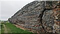
Burgh Castle is the site of one of nine Roman Saxon Shore forts constructed in England around the 3rd century AD, to hold troops as a defence against Saxon raids up the rivers of the east and south coasts of southern Britain. It is located on the summit of ground sloping steeply towards the estuary of the River Waveney, in the civil parish of Burgh Castle, in the county of Norfolk (but until 1974 in Suffolk).
This fort was possibly known as Gariannonum, although the single record that uses the name may perhaps be referring to the Roman site at Caister-on-Sea. Between the mid-7th and 9th centuries the site was possibly occupied by a monastic settlement, and in the 11th and 12th centuries a Norman motte and bailey castle existed there.
Address: Butt Lane, Burgh Castle , Great Yarmouth, Norfolk, NR31 9QB
Exact coordinates of Burgh Castle Fort: Latitude: 52.58644, Longitude: 1.65968
Official Website, with information sheets to download
You may be viewing yesterday's version of this page. To see the most up to date information please register for a free account.
Do not use the above information on other web sites or publications without permission of the contributor.
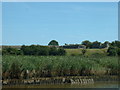
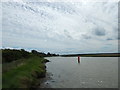
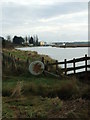
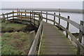
Nearby Images from Geograph Britain and Ireland:
©2005(licence)
©2017(licence)
©2011(licence)
©2023(licence)
©2007(licence)
The above images may not be of the site on this page, they are loaded from Geograph.
Please Submit an Image of this site or go out and take one for us!
Click here to see more info for this site
Nearby sites
Key: Red: member's photo, Blue: 3rd party photo, Yellow: other image, Green: no photo - please go there and take one, Grey: site destroyed
Download sites to:
KML (Google Earth)
GPX (GPS waypoints)
CSV (Garmin/Navman)
CSV (Excel)
To unlock full downloads you need to sign up as a Contributory Member. Otherwise downloads are limited to 50 sites.
Turn off the page maps and other distractions
Nearby sites listing. In the following links * = Image available
3.4km S 173° Mill Hill Round Barrow(s) (TG480010)
3.4km S 173° Bell Hill Round Barrow(s) (TG480010)
5.1km ESE 103° Gull Stones (Great Yarmouth) Sculptured Stone (TG524035)
12.6km SE 146° The Witches' Stones, Lowestoft Modern Stone Circle etc (TM5505294359)
13.1km SW 225° Stockton Stone* Standing Stone (Menhir) (TM386946)
18.4km SW 228° Broome Heath Long Barrow Long Barrow (TM344913)
20.0km SW 226° Druid's Stone (Bungay)* Natural Stone / Erratic / Other Natural Feature (TM3366689739)
23.4km W 277° Arminghall Henge* Henge (TG240060)
24.3km NNW 332° Devil's Ditch Ancient Trackway (TG347252)
24.3km W 271° Venta Icenorum* Ancient Village or Settlement (TG230034)
24.6km WNW 283° Norwich Castle Museum and Art Gallery* Museum (TG231085)
24.8km SW 226° Flixton Park Quarry Timber Circle (TM303863)
26.1km W 277° Eaton Heath Barrow Cemetery (TG21280605)
28.3km S 188° Ladywell (Blythborough)* Holy Well or Sacred Spring (TM450762)
28.5km WSW 256° Tasburgh Fort* Hillfort (TM201960)
28.7km NNW 344° Happisburgh Ancient Village or Settlement (TG379315)
29.5km S 183° Walberswick Burial Mounds* Round Barrow(s) (TM4718274820)
31.1km WNW 284° Roundwell* Holy Well or Sacred Spring (TG168104)
31.7km WNW 298° Horsford Woods Barrow Cemetary* Barrow Cemetery (TG18571780)
32.2km W 281° St Walstan's Well* Holy Well or Sacred Spring (TG15350878)
33.7km NNW 332° Knapton* Modern Stone Circle etc (TG3020433448)
35.7km NW 307° Maiden's Head* Holy Well or Sacred Spring (TG178246)
36.8km W 268° St Thomas's Well (Wymondham)* Holy Well or Sacred Spring (TG10550146)
37.2km WNW 295° Alderford Common Barrow Round Barrow(s) (TG12751828)
38.4km WNW 294° The Warren Barrow Round Barrow(s) (TG11371798)
View more nearby sites and additional images


 We would like to know more about this location. Please feel free to add a brief description and any relevant information in your own language.
 Wir möchten mehr über diese Stätte erfahren. Bitte zögern Sie nicht, eine kurze Beschreibung und relevante Informationen in Deutsch hinzuzufügen.
 Nous aimerions en savoir encore un peu sur les lieux. S'il vous plaît n'hesitez pas à ajouter une courte description et tous les renseignements pertinents dans votre propre langue.
 Quisieramos informarnos un poco más de las lugares. No dude en añadir una breve descripción y otros datos relevantes en su propio idioma.