<< Text Pages >> Kesgrave Bowl Barrow 2 - Round Barrow(s) in England in Suffolk
Submitted by JohnGinny on Sunday, 25 March 2012 Page Views: 4606
Neolithic and Bronze AgeSite Name: Kesgrave Bowl Barrow 2Country: England
NOTE: This site is 4.908 km away from the location you searched for.
County: Suffolk Type: Round Barrow(s)
Nearest Town: Ipswich Nearest Village: Kesgrave
Map Ref: TM220745
Latitude: 52.323667N Longitude: 1.256237E
Condition:
| 5 | Perfect |
| 4 | Almost Perfect |
| 3 | Reasonable but with some damage |
| 2 | Ruined but still recognisable as an ancient site |
| 1 | Pretty much destroyed, possibly visible as crop marks |
| 0 | No data. |
| -1 | Completely destroyed |
| 5 | Superb |
| 4 | Good |
| 3 | Ordinary |
| 2 | Not Good |
| 1 | Awful |
| 0 | No data. |
| 5 | Can be driven to, probably with disabled access |
| 4 | Short walk on a footpath |
| 3 | Requiring a bit more of a walk |
| 2 | A long walk |
| 1 | In the middle of nowhere, a nightmare to find |
| 0 | No data. |
| 5 | co-ordinates taken by GPS or official recorded co-ordinates |
| 4 | co-ordinates scaled from a detailed map |
| 3 | co-ordinates scaled from a bad map |
| 2 | co-ordinates of the nearest village |
| 1 | co-ordinates of the nearest town |
| 0 | no data |
Internal Links:
External Links:
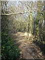
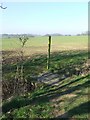
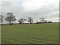
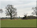
Although close to the other Bowl Barrow, this has a different feel.
This may be to do with it being grassed over and having mature trees growing on top.
Accessed by walking across an agricultural field, it is visited regularly as there is a gap in hedgerow, that runs alongside the old A12 that makes access.
Easier than walking along and down the side of the field.
You may be viewing yesterday's version of this page. To see the most up to date information please register for a free account.
Do not use the above information on other web sites or publications without permission of the contributor.
Nearby Images from Geograph Britain and Ireland:
©2008(licence)
©2008(licence)
©2015(licence)
©2015(licence)
©2008(licence)
The above images may not be of the site on this page, they are loaded from Geograph.
Please Submit an Image of this site or go out and take one for us!
Click here to see more info for this site
Nearby sites
Key: Red: member's photo, Blue: 3rd party photo, Yellow: other image, Green: no photo - please go there and take one, Grey: site destroyed
Download sites to:
KML (Google Earth)
GPX (GPS waypoints)
CSV (Garmin/Navman)
CSV (Excel)
To unlock full downloads you need to sign up as a Contributory Member. Otherwise downloads are limited to 50 sites.
Turn off the page maps and other distractions
Nearby sites listing. In the following links * = Image available
4.7km NW 305° St. Edmund's Cross Ancient Cross (TM1877)
11.6km WNW 301° Diss Museum* Museum (TM1171179980)
14.4km NE 38° Flixton Park Quarry Timber Circle (TM303863)
14.5km SW 236° Mendlesham Preaching Stone* Natural Stone / Erratic / Other Natural Feature (TM103658)
18.0km WNW 294° South Lopham Ox-Foot Stone* Natural Stone / Erratic / Other Natural Feature (TM05178098)
19.2km NE 40° Druid's Stone (Bungay)* Natural Stone / Erratic / Other Natural Feature (TM3366689739)
20.2km WNW 283° St. Mary's Well (Thelnetham)* Holy Well or Sacred Spring (TM0201578071)
20.8km NE 39° Broome Heath Long Barrow Long Barrow (TM344913)
21.6km N 358° Tasburgh Fort* Hillfort (TM201960)
22.2km S 182° Burgh Enclosure Ancient Village or Settlement (TM224523)
23.0km E 88° Ladywell (Blythborough)* Holy Well or Sacred Spring (TM450762)
23.4km NW 307° Vikings Mound* Artificial Mound (TM02678781)
23.7km W 266° Artificial Mound near Wrenshall Farm Artificial Mound (TL9836071843)
23.9km WNW 290° Home Covert Tumulus* Round Barrow(s) (TL99138177)
24.2km WNW 290° Devil's Ditch* Misc. Earthwork (TL9879281705)
24.4km WNW 290° Riddlesworth Tumulus Round Barrow(s) (TL98648180)
24.6km WNW 294° Soldier's Hill Round Barrow(s) (TL99008346)
24.7km WNW 296° East Harling Heath Tumulus* Round Barrow(s) (TL99238425)
25.0km SW 222° Lady Well, Badley Holy Well or Sacred Spring (TM06135517)
25.1km E 92° Walberswick Burial Mounds* Round Barrow(s) (TM4718274820)
25.7km WNW 296° West Harling Tumulus Round Barrow(s) (TL98438486)
25.8km NW 310° Gallows Hill Tumulus Round Barrow(s) (TM01419019)
26.0km NE 42° Stockton Stone* Standing Stone (Menhir) (TM386946)
26.2km SE 136° Iken Saxon Cross* Ancient Cross (TM412566)
26.7km SSE 168° Sutton Hoo* Artificial Mound (TM288487)
View more nearby sites and additional images


 We would like to know more about this location. Please feel free to add a brief description and any relevant information in your own language.
 Wir möchten mehr über diese Stätte erfahren. Bitte zögern Sie nicht, eine kurze Beschreibung und relevante Informationen in Deutsch hinzuzufügen.
 Nous aimerions en savoir encore un peu sur les lieux. S'il vous plaît n'hesitez pas à ajouter une courte description et tous les renseignements pertinents dans votre propre langue.
 Quisieramos informarnos un poco más de las lugares. No dude en añadir una breve descripción y otros datos relevantes en su propio idioma.