<< Other Photo Pages >> Norwich Castle Museum and Art Gallery - Museum in England in Norfolk
Submitted by Andy B on Monday, 21 August 2006 Page Views: 11338
MuseumsSite Name: Norwich Castle Museum and Art GalleryCountry: England
NOTE: This site is 3.82 km away from the location you searched for.
County: Norfolk Type: Museum
Nearest Town: Norwich
Map Ref: TG231085
Latitude: 52.628378N Longitude: 1.295088E
Condition:
| 5 | Perfect |
| 4 | Almost Perfect |
| 3 | Reasonable but with some damage |
| 2 | Ruined but still recognisable as an ancient site |
| 1 | Pretty much destroyed, possibly visible as crop marks |
| 0 | No data. |
| -1 | Completely destroyed |
| 5 | Superb |
| 4 | Good |
| 3 | Ordinary |
| 2 | Not Good |
| 1 | Awful |
| 0 | No data. |
| 5 | Can be driven to, probably with disabled access |
| 4 | Short walk on a footpath |
| 3 | Requiring a bit more of a walk |
| 2 | A long walk |
| 1 | In the middle of nowhere, a nightmare to find |
| 0 | No data. |
| 5 | co-ordinates taken by GPS or official recorded co-ordinates |
| 4 | co-ordinates scaled from a detailed map |
| 3 | co-ordinates scaled from a bad map |
| 2 | co-ordinates of the nearest village |
| 1 | co-ordinates of the nearest town |
| 0 | no data |
Internal Links:
External Links:
I have visited· I would like to visit
lichen visited on 7th Sep 2015 - their rating: Cond: 3 Amb: 3 Access: 5
DaygloViking have visited here
")
One of the city's most famous landmarks, Norwich Castle was built by the Normans as a Royal Palace 900 years ago.
Core Times (including Bank Holidays)
Mon to Fri 10am-4.30pm
Sat 10am-5pm
Sun 1pm-5pm
Open all year (check their web site)
Link to their Web Site
Note: 3,500-year-old Rudham Dirk, a ceremonial Middle Bronze Age dagger, at Norwich Castle, see comment.
You may be viewing yesterday's version of this page. To see the most up to date information please register for a free account.
")
")
Do not use the above information on other web sites or publications without permission of the contributor.
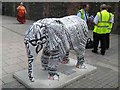
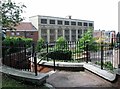
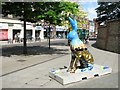
Nearby Images from Geograph Britain and Ireland:

©2006(licence)
©2008(licence)

©2018(licence)
©2018(licence)
©2018(licence)
The above images may not be of the site on this page, they are loaded from Geograph.
Please Submit an Image of this site or go out and take one for us!
Click here to see more info for this site
Nearby sites
Key: Red: member's photo, Blue: 3rd party photo, Yellow: other image, Green: no photo - please go there and take one, Grey: site destroyed
Download sites to:
KML (Google Earth)
GPX (GPS waypoints)
CSV (Garmin/Navman)
CSV (Excel)
To unlock full downloads you need to sign up as a Contributory Member. Otherwise downloads are limited to 50 sites.
Turn off the page maps and other distractions
Nearby sites listing. In the following links * = Image available
2.7km SSE 163° Arminghall Henge* Henge (TG240060)
3.0km SW 219° Eaton Heath Barrow Cemetery (TG21280605)
5.1km S 184° Venta Icenorum* Ancient Village or Settlement (TG230034)
6.6km WNW 289° Roundwell* Holy Well or Sacred Spring (TG168104)
7.7km W 275° St Walstan's Well* Holy Well or Sacred Spring (TG15350878)
10.3km NNW 337° Horsford Woods Barrow Cemetary* Barrow Cemetery (TG18571780)
12.8km SSW 196° Tasburgh Fort* Hillfort (TM201960)
14.2km NW 316° Alderford Common Barrow Round Barrow(s) (TG12751828)
14.3km WSW 243° St Thomas's Well (Wymondham)* Holy Well or Sacred Spring (TG10550146)
15.0km NW 312° The Warren Barrow Round Barrow(s) (TG11371798)
16.9km NNW 344° Maiden's Head* Holy Well or Sacred Spring (TG178246)
20.3km NE 37° Devil's Ditch Ancient Trackway (TG347252)
20.5km NW 318° Pettywell* Holy Well or Sacred Spring (TG086230)
20.5km SSE 149° Broome Heath Long Barrow Long Barrow (TM344913)
20.8km SE 135° Stockton Stone* Standing Stone (Menhir) (TM386946)
21.5km SSE 153° Druid's Stone (Bungay)* Natural Stone / Erratic / Other Natural Feature (TM3366689739)
23.3km SSE 165° Flixton Park Quarry Timber Circle (TM303863)
24.6km ESE 102° Burgh Castle Shore Fort Stone Fort or Dun (TG474044)
24.8km WNW 284° St Withburga's Well* Holy Well or Sacred Spring (TF9865213305)
25.9km NNE 18° Knapton* Modern Stone Circle etc (TG3020433448)
25.9km ESE 109° Bell Hill Round Barrow(s) (TG480010)
25.9km ESE 109° Mill Hill Round Barrow(s) (TG480010)
27.0km N 1° Roughton Cursus Cursus (TG222355)
27.3km NE 35° Happisburgh Ancient Village or Settlement (TG379315)
27.5km WNW 301° North Elmham Chapel* Ancient Temple (TF9888121640)
View more nearby sites and additional images


 We would like to know more about this location. Please feel free to add a brief description and any relevant information in your own language.
 Wir möchten mehr über diese Stätte erfahren. Bitte zögern Sie nicht, eine kurze Beschreibung und relevante Informationen in Deutsch hinzuzufügen.
 Nous aimerions en savoir encore un peu sur les lieux. S'il vous plaît n'hesitez pas à ajouter une courte description et tous les renseignements pertinents dans votre propre langue.
 Quisieramos informarnos un poco más de las lugares. No dude en añadir una breve descripción y otros datos relevantes en su propio idioma.