


<< Our Photo Pages >> Aylmerton Shrieking Pits - Misc. Earthwork in England in Norfolk
Submitted by willowman1 on Saturday, 08 October 2016 Page Views: 4430
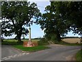
Multi-periodSite Name: Aylmerton Shrieking PitsCountry: England County: Norfolk Type: Misc. Earthwork
Nearest Village: Aylmerton
Map Ref: TG1823939072
Latitude: 52.904742N Longitude: 1.243735E
Condition:
| 5 | Perfect |
| 4 | Almost Perfect |
| 3 | Reasonable but with some damage |
| 2 | Ruined but still recognisable as an ancient site |
| 1 | Pretty much destroyed, possibly visible as crop marks |
| 0 | No data. |
| -1 | Completely destroyed |
| 5 | Superb |
| 4 | Good |
| 3 | Ordinary |
| 2 | Not Good |
| 1 | Awful |
| 0 | No data. |
| 5 | Can be driven to, probably with disabled access |
| 4 | Short walk on a footpath |
| 3 | Requiring a bit more of a walk |
| 2 | A long walk |
| 1 | In the middle of nowhere, a nightmare to find |
| 0 | No data. |
| 5 | co-ordinates taken by GPS or official recorded co-ordinates |
| 4 | co-ordinates scaled from a detailed map |
| 3 | co-ordinates scaled from a bad map |
| 2 | co-ordinates of the nearest village |
| 1 | co-ordinates of the nearest town |
| 0 | no data |
Internal Links:
External Links:
")
The whole area towards Weybourne, Runton and Beeston Regis was once pockmarked by these depressions, where they were known as 'Hills and Holes'.
Here, they are called the 'Shrieking Pits', from the legend that they are haunted by a woman in white who wanders around and peers into them, all the while moaning and wailing. Her jealous husband was said to have murdered her baby - whose body she is searching for - as he didn't believe that he was the father, and he afterward killed his wife.
A water-filled pit with the same origin and the same name but a different legend exists a few miles to the east, at Northrepps.
You may be viewing yesterday's version of this page. To see the most up to date information please register for a free account.
")
Do not use the above information on other web sites or publications without permission of the contributor.
Nearby Images from Geograph Britain and Ireland:
©2009(licence)
©2018(licence)
©2015(licence)
©2007(licence)
©2007(licence)
The above images may not be of the site on this page, they are loaded from Geograph.
Please Submit an Image of this site or go out and take one for us!
Click here to see more info for this site
Nearby sites
Key: Red: member's photo, Blue: 3rd party photo, Yellow: other image, Green: no photo - please go there and take one, Grey: site destroyed
Download sites to:
KML (Google Earth)
GPX (GPS waypoints)
CSV (Garmin/Navman)
CSV (Excel)
To unlock full downloads you need to sign up as a Contributory Member. Otherwise downloads are limited to 50 sites.
Turn off the page maps and other distractions
Nearby sites listing. In the following links * = Image available
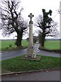
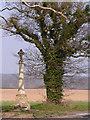
328m SSW 213° Aylmerton Cross* Ancient Cross (TG18073879)
3.1km NNW 339° Calves Well* Holy Well or Sacred Spring (TG170419)
4.7km NW 308° Church Conduit* Holy Well or Sacred Spring (TG144418)
5.2km WNW 294° Howe’s Hill Oval Barrow* Round Barrow(s) (TG1340941007)
5.3km SE 135° Roughton Cursus Cursus (TG222355)
10.8km WNW 291° Salthouse Heath* Barrow Cemetery (TG07974241)
12.4km WNW 290° The Hangs* Round Barrow(s) (TG06304270)
13.2km ESE 118° Knapton* Modern Stone Circle etc (TG3020433448)
14.5km S 184° Maiden's Head* Holy Well or Sacred Spring (TG178246)
17.0km WNW 288° Blakeney Downs Barrows Round Barrow(s) (TG01864365)
18.7km SSW 213° Pettywell* Holy Well or Sacred Spring (TG086230)
21.0km ESE 114° Happisburgh Ancient Village or Settlement (TG379315)
21.3km S 182° Horsford Woods Barrow Cemetary* Barrow Cemetery (TG18571780)
21.5km SE 133° Devil's Ditch Ancient Trackway (TG347252)
21.5km SSW 197° Alderford Common Barrow Round Barrow(s) (TG12751828)
22.1km W 278° Fiddler's Hill (Norfolk)* Round Barrow(s) (TF96134105)
22.2km SSW 201° The Warren Barrow Round Barrow(s) (TG11371798)
23.9km W 277° Warham Camp* Hillfort (TF94374089)
24.7km W 267° Little Walsingham Holy Well* Holy Well or Sacred Spring (TF93603678)
24.7km W 268° Our Lady of Walsingham Holy Well* Holy Well or Sacred Spring (TF9355136894)
26.0km SW 231° North Elmham Chapel* Ancient Temple (TF9888121640)
28.7km S 185° Roundwell* Holy Well or Sacred Spring (TG168104)
30.4km S 188° St Walstan's Well* Holy Well or Sacred Spring (TG15350878)
30.6km WSW 242° Whissonsett wheel-head cross* Ancient Cross (TF91922334)
30.9km S 174° Norwich Castle Museum and Art Gallery* Museum (TG231085)
View more nearby sites and additional images


 We would like to know more about this location. Please feel free to add a brief description and any relevant information in your own language.
 Wir möchten mehr über diese Stätte erfahren. Bitte zögern Sie nicht, eine kurze Beschreibung und relevante Informationen in Deutsch hinzuzufügen.
 Nous aimerions en savoir encore un peu sur les lieux. S'il vous plaît n'hesitez pas à ajouter une courte description et tous les renseignements pertinents dans votre propre langue.
 Quisieramos informarnos un poco más de las lugares. No dude en añadir una breve descripción y otros datos relevantes en su propio idioma.