

<< Text Pages >> Ermin Way Stone - Sculptured Stone in England in Berkshire
Submitted by Anonymous on Monday, 12 November 2018 Page Views: 1033
Multi-periodSite Name: Ermin Way Stone Alternative Name: Ermin Way Bull StoneCountry: England County: Berkshire Type: Sculptured Stone
Nearest Town: Newbury Nearest Village: Stockcross
Latitude: 51.250006N Longitude: 1.222662E
Condition:
| 5 | Perfect |
| 4 | Almost Perfect |
| 3 | Reasonable but with some damage |
| 2 | Ruined but still recognisable as an ancient site |
| 1 | Pretty much destroyed, possibly visible as crop marks |
| 0 | No data. |
| -1 | Completely destroyed |
| 5 | Superb |
| 4 | Good |
| 3 | Ordinary |
| 2 | Not Good |
| 1 | Awful |
| 0 | No data. |
| 5 | Can be driven to, probably with disabled access |
| 4 | Short walk on a footpath |
| 3 | Requiring a bit more of a walk |
| 2 | A long walk |
| 1 | In the middle of nowhere, a nightmare to find |
| 0 | No data. |
| 5 | co-ordinates taken by GPS or official recorded co-ordinates |
| 4 | co-ordinates scaled from a detailed map |
| 3 | co-ordinates scaled from a bad map |
| 2 | co-ordinates of the nearest village |
| 1 | co-ordinates of the nearest town |
| 0 | no data |
Internal Links:
External Links:
Sculptured Stone in Berkshire
Large megalithic bull size and shaped stone, facing due east.
You may be viewing yesterday's version of this page. To see the most up to date information please register for a free account.
Do not use the above information on other web sites or publications without permission of the contributor.
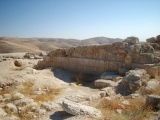
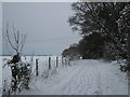
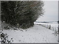
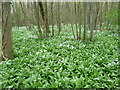
Nearby Images from Geograph Britain and Ireland:
©2010(licence)
©2010(licence)
©2015(licence)
©2015(licence)
©2015(licence)
The above images may not be of the site on this page, they are loaded from Geograph.
Please Submit an Image of this site or go out and take one for us!
Click here to see more info for this site
Nearby sites
Click here to view sites on an interactive map of the areaKey: Red: member's photo, Blue: 3rd party photo, Yellow: other image, Green: no photo - please go there and take one, Grey: site destroyed
Download sites to:
KML (Google Earth)
GPX (GPS waypoints)
CSV (Garmin/Navman)
CSV (Excel)
To unlock full downloads you need to sign up as a Contributory Member. Otherwise downloads are limited to 50 sites.
Turn off the page maps and other distractions
Nearby sites listing. In the following links * = Image available
3.0km SW 228° Adisham Timber Circle (TR22885294)
4.6km SE 124° Eastry Barrow* Round Barrow(s) (TR28965259)
4.7km SE 140° Nonington Barrow Cemetary Barrow Cemetery (TR28185160)
4.7km ESE 120° Shingleton Barrows* Round Barrow(s) (TR29185290)
5.0km ENE 73° Ringlemere* Barrow Cemetery (TR297567)
5.2km WNW 289° Bekesbourne* Holy Well or Sacred Spring (TR20005646)
5.4km S 185° Rubury Butts* Barrow Cemetery (TR24724962)
5.4km SW 216° Barham Downs Barrows Round Barrow(s) (TR21995047)
5.5km SW 232° Barham Downs earthwork Misc. Earthwork (TR20785149)
5.6km SW 236° Barham Downs Bowl Barrow Round Barrow(s) (TR20515170)
5.8km SW 223° Rectory Lane Bowl Barrow* Round Barrow(s) (TR21225065)
6.0km WSW 255° Barham Downs Barrow Round Barrow(s) (TR19295324)
6.1km WSW 253° Bishopsbourne Barrows Barrow Cemetery (TR19225296)
6.2km NW 311° Arrianes Well Holy Well or Sacred Spring (TR201589)
6.4km W 260° Hanging Hill Barrow Cemetary Barrow Cemetery (TR18725363)
7.4km SW 218° Breach Downs Barrows* Round Barrow(s) (TR20674900)
7.5km W 268° Bridge Iron Age Settlement* Ancient Village or Settlement (TR175545)
8.0km WNW 302° Fordwich Paleolithic Site Not Known (by us) (TR180590)
8.2km NW 307° Our Lady's Well (Fordwich) Holy Well or Sacred Spring (TR18225970)
8.4km WSW 252° Gorsley Wood Barrows Round Barrow(s) (TR17095201)
8.9km SSE 148° White Caps Barrow Round Barrow(s) (TR30034766)
8.9km WSW 250° Gorsley Wood Mound Artificial Mound (TR167516)
9.2km S 169° Stonehall Deneholes Ancient Mine, Quarry or other Industry (TR27104603)
9.5km W 263° Whitehill Wood Barrow Round Barrow(s) (TR156535)
9.8km WSW 244° Bursted Wood Barrow Round Barrow(s) (TR16345036)
View more nearby sites and additional images


 We would like to know more about this location. Please feel free to add a brief description and any relevant information in your own language.
 Wir möchten mehr über diese Stätte erfahren. Bitte zögern Sie nicht, eine kurze Beschreibung und relevante Informationen in Deutsch hinzuzufügen.
 Nous aimerions en savoir encore un peu sur les lieux. S'il vous plaît n'hesitez pas à ajouter une courte description et tous les renseignements pertinents dans votre propre langue.
 Quisieramos informarnos un poco más de las lugares. No dude en añadir una breve descripción y otros datos relevantes en su propio idioma.