<< Text Pages >> Alderford Common Barrow - Round Barrow(s) in England in Norfolk
Submitted by coldrum on Monday, 18 June 2012 Page Views: 4326
Neolithic and Bronze AgeSite Name: Alderford Common BarrowCountry: England
NOTE: This site is 0.626 km away from the location you searched for.
County: Norfolk Type: Round Barrow(s)
Map Ref: TG12751828
Latitude: 52.720316N Longitude: 1.148725E
Condition:
| 5 | Perfect |
| 4 | Almost Perfect |
| 3 | Reasonable but with some damage |
| 2 | Ruined but still recognisable as an ancient site |
| 1 | Pretty much destroyed, possibly visible as crop marks |
| 0 | No data. |
| -1 | Completely destroyed |
| 5 | Superb |
| 4 | Good |
| 3 | Ordinary |
| 2 | Not Good |
| 1 | Awful |
| 0 | No data. |
| 5 | Can be driven to, probably with disabled access |
| 4 | Short walk on a footpath |
| 3 | Requiring a bit more of a walk |
| 2 | A long walk |
| 1 | In the middle of nowhere, a nightmare to find |
| 0 | No data. |
| 5 | co-ordinates taken by GPS or official recorded co-ordinates |
| 4 | co-ordinates scaled from a detailed map |
| 3 | co-ordinates scaled from a bad map |
| 2 | co-ordinates of the nearest village |
| 1 | co-ordinates of the nearest town |
| 0 | no data |
Be the first person to rate this site - see the 'Contribute!' box in the right hand menu.
Internal Links:
External Links:
I have visited· I would like to visit
Spiderdrone visited on 14th Dec 2021 - their rating: Cond: 2 Amb: 2 Access: 4
From Pastscape:
"A bowl barrow 23.0m N-S by 16.0m transversely and 2.0m in height.
It is covered by bracken and gorse and the E segment has been
destroyed by quarrying. The top and SW side have been dug into.
A BA Food Vessel and a RB pot found in this barrow are in the BM.
A polished axe in the Norwich Castle Museum is said to have come from
the barrow in 1855."
Read More at Pastscape.
You may be viewing yesterday's version of this page. To see the most up to date information please register for a free account.
")
Do not use the above information on other web sites or publications without permission of the contributor.
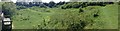
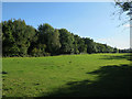
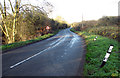
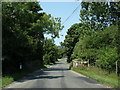
Nearby Images from Geograph Britain and Ireland:
©2014(licence)
©2017(licence)
©2014(licence)
©2020(licence)
©2014(licence)
The above images may not be of the site on this page, they are loaded from Geograph.
Please Submit an Image of this site or go out and take one for us!
Click here to see more info for this site
Nearby sites
Key: Red: member's photo, Blue: 3rd party photo, Yellow: other image, Green: no photo - please go there and take one, Grey: site destroyed
Download sites to:
KML (Google Earth)
GPX (GPS waypoints)
CSV (Garmin/Navman)
CSV (Excel)
To unlock full downloads you need to sign up as a Contributory Member. Otherwise downloads are limited to 50 sites.
Turn off the page maps and other distractions
Nearby sites listing. In the following links * = Image available
1.4km W 260° The Warren Barrow Round Barrow(s) (TG11371798)
5.8km E 97° Horsford Woods Barrow Cemetary* Barrow Cemetery (TG18571780)
6.3km NW 321° Pettywell* Holy Well or Sacred Spring (TG086230)
8.1km NE 41° Maiden's Head* Holy Well or Sacred Spring (TG178246)
8.8km SSE 155° Roundwell* Holy Well or Sacred Spring (TG168104)
9.8km SSE 167° St Walstan's Well* Holy Well or Sacred Spring (TG15350878)
14.2km SE 136° Norwich Castle Museum and Art Gallery* Museum (TG231085)
14.2km WNW 286° North Elmham Chapel* Ancient Temple (TF9888121640)
14.9km SSE 148° Eaton Heath Barrow Cemetery (TG21280605)
14.9km WSW 253° St Withburga's Well* Holy Well or Sacred Spring (TF9865213305)
16.6km SE 140° Arminghall Henge* Henge (TG240060)
16.9km S 190° St Thomas's Well (Wymondham)* Holy Well or Sacred Spring (TG10550146)
18.0km W 265° St Agnes Well, Longham* Holy Well or Sacred Spring (TF94831586)
18.0km SSE 148° Venta Icenorum* Ancient Village or Settlement (TG230034)
19.6km NNE 31° Roughton Cursus Cursus (TG222355)
21.2km NNE 17° Aylmerton Cross* Ancient Cross (TG18073879)
21.4km WNW 286° Whissonsett wheel-head cross* Ancient Cross (TF91922334)
21.5km NNE 17° Aylmerton Shrieking Pits* Misc. Earthwork (TG1823939072)
22.7km N 4° Howe’s Hill Oval Barrow* Round Barrow(s) (TG1340941007)
22.9km ENE 75° Devil's Ditch Ancient Trackway (TG347252)
23.1km NE 51° Knapton* Modern Stone Circle etc (TG3020433448)
23.4km SSE 164° Tasburgh Fort* Hillfort (TM201960)
23.6km N 7° Church Conduit* Holy Well or Sacred Spring (TG144418)
24.0km NNE 13° Calves Well* Holy Well or Sacred Spring (TG170419)
24.6km N 351° Salthouse Heath* Barrow Cemetery (TG07974241)
View more nearby sites and additional images


 We would like to know more about this location. Please feel free to add a brief description and any relevant information in your own language.
 Wir möchten mehr über diese Stätte erfahren. Bitte zögern Sie nicht, eine kurze Beschreibung und relevante Informationen in Deutsch hinzuzufügen.
 Nous aimerions en savoir encore un peu sur les lieux. S'il vous plaît n'hesitez pas à ajouter une courte description et tous les renseignements pertinents dans votre propre langue.
 Quisieramos informarnos un poco más de las lugares. No dude en añadir una breve descripción y otros datos relevantes en su propio idioma.