<< Our Photo Pages >> St Thomas's Well (Wymondham) - Holy Well or Sacred Spring in England in Norfolk
Submitted by holywell on Tuesday, 12 September 2006 Page Views: 9001
Springs and Holy WellsSite Name: St Thomas's Well (Wymondham)Country: England
NOTE: This site is 0.442 km away from the location you searched for.
County: Norfolk Type: Holy Well or Sacred Spring
Nearest Town: Wymondham
Map Ref: TG10550146
Latitude: 52.570192N Longitude: 1.105479E
Condition:
| 5 | Perfect |
| 4 | Almost Perfect |
| 3 | Reasonable but with some damage |
| 2 | Ruined but still recognisable as an ancient site |
| 1 | Pretty much destroyed, possibly visible as crop marks |
| 0 | No data. |
| -1 | Completely destroyed |
| 5 | Superb |
| 4 | Good |
| 3 | Ordinary |
| 2 | Not Good |
| 1 | Awful |
| 0 | No data. |
| 5 | Can be driven to, probably with disabled access |
| 4 | Short walk on a footpath |
| 3 | Requiring a bit more of a walk |
| 2 | A long walk |
| 1 | In the middle of nowhere, a nightmare to find |
| 0 | No data. |
| 5 | co-ordinates taken by GPS or official recorded co-ordinates |
| 4 | co-ordinates scaled from a detailed map |
| 3 | co-ordinates scaled from a bad map |
| 2 | co-ordinates of the nearest village |
| 1 | co-ordinates of the nearest town |
| 0 | no data |
Internal Links:
External Links:
I have visited· I would like to visit
PAB has visited here
 (PID:28681)")
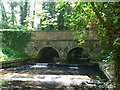
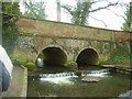
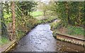
This was associated with the Abbey, whose part ruins and church are nearby. It is said to be visited by thousands of pilgrims in the Middle Ages and held in great veneration by them.
Now on private land, but traditionally access was given and thought within living memory, said to be curative. It can just be seen down a lane into the garden near the Abbey.
You may be viewing yesterday's version of this page. To see the most up to date information please register for a free account.
 (PID:28707)")
 (PID:28706)")
Do not use the above information on other web sites or publications without permission of the contributor.
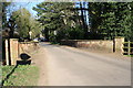
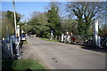
Nearby Images from Geograph Britain and Ireland:
©2011(licence)
©2011(licence)
©2009(licence)
©2008(licence)
©2012(licence)
The above images may not be of the site on this page, they are loaded from Geograph.
Please Submit an Image of this site or go out and take one for us!
Click here to see more info for this site
Nearby sites
Key: Red: member's photo, Blue: 3rd party photo, Yellow: other image, Green: no photo - please go there and take one, Grey: site destroyed
Download sites to:
KML (Google Earth)
GPX (GPS waypoints)
CSV (Garmin/Navman)
CSV (Excel)
To unlock full downloads you need to sign up as a Contributory Member. Otherwise downloads are limited to 50 sites.
Turn off the page maps and other distractions
Nearby sites listing. In the following links * = Image available
8.7km NE 36° St Walstan's Well* Holy Well or Sacred Spring (TG15350878)
10.9km NE 37° Roundwell* Holy Well or Sacred Spring (TG168104)
11.0km ESE 122° Tasburgh Fort* Hillfort (TM201960)
11.6km ENE 69° Eaton Heath Barrow Cemetery (TG21280605)
12.6km E 84° Venta Icenorum* Ancient Village or Settlement (TG230034)
14.1km ENE 74° Arminghall Henge* Henge (TG240060)
14.3km ENE 63° Norwich Castle Museum and Art Gallery* Museum (TG231085)
14.5km SW 221° Gallows Hill Tumulus Round Barrow(s) (TM01419019)
15.7km SSW 212° Vikings Mound* Artificial Mound (TM02678781)
16.5km N 5° The Warren Barrow Round Barrow(s) (TG11371798)
16.8km NW 317° St Withburga's Well* Holy Well or Sacred Spring (TF9865213305)
16.9km N 10° Alderford Common Barrow Round Barrow(s) (TG12751828)
18.2km NNE 29° Horsford Woods Barrow Cemetary* Barrow Cemetery (TG18571780)
18.8km SW 232° Larling Heath Tumulus Round Barrow(s) (TL96268912)
20.5km SW 222° Mickelmoor Hill Settlement Ancient Village or Settlement (TL974857)
20.5km SW 219° West Harling Tumulus Round Barrow(s) (TL98438486)
20.6km SW 216° East Harling Heath Tumulus* Round Barrow(s) (TL99238425)
21.1km W 266° Merton Stone* Natural Stone / Erratic / Other Natural Feature (TL895991)
21.2km SSW 197° South Lopham Ox-Foot Stone* Natural Stone / Erratic / Other Natural Feature (TM05178098)
21.3km NW 315° St Agnes Well, Longham* Holy Well or Sacred Spring (TF94831586)
21.4km SW 215° Soldier's Hill Round Barrow(s) (TL99008346)
21.5km WNW 283° Devil's Dyke (Norfolk)* Misc. Earthwork (TF8934705200)
21.5km S 179° Diss Museum* Museum (TM1171179980)
21.6km N 357° Pettywell* Holy Well or Sacred Spring (TG086230)
22.3km SW 232° Peddars Way* Ancient Trackway (TL9341287119)
View more nearby sites and additional images


 We would like to know more about this location. Please feel free to add a brief description and any relevant information in your own language.
 Wir möchten mehr über diese Stätte erfahren. Bitte zögern Sie nicht, eine kurze Beschreibung und relevante Informationen in Deutsch hinzuzufügen.
 Nous aimerions en savoir encore un peu sur les lieux. S'il vous plaît n'hesitez pas à ajouter une courte description et tous les renseignements pertinents dans votre propre langue.
 Quisieramos informarnos un poco más de las lugares. No dude en añadir una breve descripción y otros datos relevantes en su propio idioma.