<< Text Pages >> Pilgrims Way 9 - Ancient Trackway in England in Kent
Submitted by coldrum on Thursday, 13 August 2009 Page Views: 3535
Multi-periodSite Name: Pilgrims Way 9Country: England
NOTE: This site is 1.875 km away from the location you searched for.
County: Kent Type: Ancient Trackway
Nearest Village: Shalmsford Street
Map Ref: TR090552
Latitude: 51.257640N Longitude: 0.993939E
Condition:
| 5 | Perfect |
| 4 | Almost Perfect |
| 3 | Reasonable but with some damage |
| 2 | Ruined but still recognisable as an ancient site |
| 1 | Pretty much destroyed, possibly visible as crop marks |
| 0 | No data. |
| -1 | Completely destroyed |
| 5 | Superb |
| 4 | Good |
| 3 | Ordinary |
| 2 | Not Good |
| 1 | Awful |
| 0 | No data. |
| 5 | Can be driven to, probably with disabled access |
| 4 | Short walk on a footpath |
| 3 | Requiring a bit more of a walk |
| 2 | A long walk |
| 1 | In the middle of nowhere, a nightmare to find |
| 0 | No data. |
| 5 | co-ordinates taken by GPS or official recorded co-ordinates |
| 4 | co-ordinates scaled from a detailed map |
| 3 | co-ordinates scaled from a bad map |
| 2 | co-ordinates of the nearest village |
| 1 | co-ordinates of the nearest town |
| 0 | no data |
Be the first person to rate this site - see the 'Contribute!' box in the right hand menu.
Internal Links:
External Links:
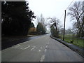
Ancient Trackway in Kent
Stretch of a prehistoric trackway later used by Pilgrims traveling to Canterbury.
The North Downs way follows the Pilgrims way along most of it's route. Some stretches are now tarmacked roads.
http://en.wikipedia.org/wiki/Pilgrims%27_Way
http://www.ramblers.org.uk/info/paths/name/n/northdowns.htm
You may be viewing yesterday's version of this page. To see the most up to date information please register for a free account.
")
Do not use the above information on other web sites or publications without permission of the contributor.
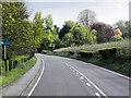
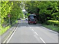
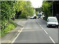
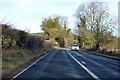
Nearby Images from Geograph Britain and Ireland:
©2013(licence)
©2013(licence)
©2013(licence)
©2018(licence)
©2011(licence)
The above images may not be of the site on this page, they are loaded from Geograph.
Please Submit an Image of this site or go out and take one for us!
Click here to see more info for this site
Nearby sites
Key: Red: member's photo, Blue: 3rd party photo, Yellow: other image, Green: no photo - please go there and take one, Grey: site destroyed
Download sites to:
KML (Google Earth)
GPX (GPS waypoints)
CSV (Garmin/Navman)
CSV (Excel)
To unlock full downloads you need to sign up as a Contributory Member. Otherwise downloads are limited to 50 sites.
Turn off the page maps and other distractions
Nearby sites listing. In the following links * = Image available
2.4km SW 215° Julliberrie's Grave* Long Barrow (TR077532)
2.7km S 172° Denge Wood Earthworks Misc. Earthwork (TR095525)
3.1km S 176° Denge Wood Tumulus Round Barrow(s) (TR0933852069)
3.5km NE 50° Bigbury Camp* Hillfort (TR116576)
4.5km ESE 107° Iffin Wood Bowl Barrow Round Barrow(s) (TR13335407)
4.5km SSE 168° Eggringe Wood East Bowl Barrow* Round Barrow(s) (TR10115083)
4.6km S 174° Eggringe Wood Barrow Cemetery* Barrow Cemetery (TR097507)
4.6km SSE 168° Eggringe Wood Round Barrow* Round Barrow(s) (TR10155079)
4.6km SSE 151° Mounts Wood Barrow* Round Barrow(s) (TR11455126)
4.8km S 175° Eggringe Wood Western Bowl Barrow* Round Barrow(s) (TR09655041)
4.8km NE 56° Black Prince's Well* Holy Well or Sacred Spring (TR129581)
4.9km S 174° Pennypot Lane Bowl Barrow* Round Barrow(s) (TR09675035)
5.0km SSE 164° Mounts Wood Barrow Round Barrow(s) (TR10615043)
5.4km S 175° Eggringe Wood Bowl Barrow Round Barrow(s) (TR09664979)
5.6km S 171° Buckholt Farm Barrows Round Barrow(s) (TR10114972)
6.2km ENE 72° Dane John Mound* Artificial Mound (TR14785737)
6.3km ENE 68° Museum of Canterbury* Museum (TR1472257767)
6.5km ENE 69° Sunwin's Well Holy Well or Sacred Spring (TR15015784)
6.6km ENE 68° St. Thomas Becket's Well Holy Well or Sacred Spring (TR150579)
6.6km ENE 69° St Thomas's Well (Canterbury)* Holy Well or Sacred Spring (TR151578)
6.7km ENE 65° St Rhadegund's Bath Holy Well or Sacred Spring (TR150583)
6.8km SW 230° Kings Wood Barrow* Round Barrow(s) (TR04005060)
6.8km ESE 107° Whitehill Wood Barrow Round Barrow(s) (TR156535)
6.9km SSW 195° Warren Wood Saucer Barrow Round Barrow(s) (TR07444852)
6.9km ENE 71° St Augustine's Abbey Standing Stone* Ancient Cross (TR1541857755)
View more nearby sites and additional images


 We would like to know more about this location. Please feel free to add a brief description and any relevant information in your own language.
 Wir möchten mehr über diese Stätte erfahren. Bitte zögern Sie nicht, eine kurze Beschreibung und relevante Informationen in Deutsch hinzuzufügen.
 Nous aimerions en savoir encore un peu sur les lieux. S'il vous plaît n'hesitez pas à ajouter une courte description et tous les renseignements pertinents dans votre propre langue.
 Quisieramos informarnos un poco más de las lugares. No dude en añadir una breve descripción y otros datos relevantes en su propio idioma.