


<< Other Photo Pages >> Fordham Puddingstone - Marker Stone in England in Essex
Submitted by Thorgrim on Tuesday, 18 January 2005 Page Views: 5520
Multi-periodSite Name: Fordham PuddingstoneCountry: England
NOTE: This site is 2.101 km away from the location you searched for.
County: Essex Type: Marker Stone
Nearest Town: Colchester Nearest Village: Fordham
Map Ref: TL9348028891
Latitude: 51.924906N Longitude: 0.812405E
Condition:
| 5 | Perfect |
| 4 | Almost Perfect |
| 3 | Reasonable but with some damage |
| 2 | Ruined but still recognisable as an ancient site |
| 1 | Pretty much destroyed, possibly visible as crop marks |
| 0 | No data. |
| -1 | Completely destroyed |
| 5 | Superb |
| 4 | Good |
| 3 | Ordinary |
| 2 | Not Good |
| 1 | Awful |
| 0 | No data. |
| 5 | Can be driven to, probably with disabled access |
| 4 | Short walk on a footpath |
| 3 | Requiring a bit more of a walk |
| 2 | A long walk |
| 1 | In the middle of nowhere, a nightmare to find |
| 0 | No data. |
| 5 | co-ordinates taken by GPS or official recorded co-ordinates |
| 4 | co-ordinates scaled from a detailed map |
| 3 | co-ordinates scaled from a bad map |
| 2 | co-ordinates of the nearest village |
| 1 | co-ordinates of the nearest town |
| 0 | no data |
Internal Links:
External Links:
I have visited· I would like to visit
Autun visited on 16th Aug 2022 - their rating: Cond: 4 Amb: 3 Access: 5 An easily accessed and quite impressive Puddingstone, situated right next to a small road... It is situated outside of the property gates, and can therefore be admired with ease.
willowman1 visited on 15th Jul 2016 - their rating: Cond: 4 Amb: 3 Access: 5
Average ratings for this site from all visit loggers: Condition: 4 Ambience: 3 Access: 5
")
Large broken boulder in the yard of Ram's Farm. Site No. 21 on the Puddingstone Trail.
You may be viewing yesterday's version of this page. To see the most up to date information please register for a free account.
")
")
")
Do not use the above information on other web sites or publications without permission of the contributor.
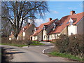
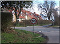
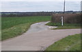
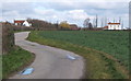
Nearby Images from Geograph Britain and Ireland:

©2008(licence)
©2008(licence)
©2008(licence)
©2008(licence)
©2008(licence)
The above images may not be of the site on this page, they are loaded from Geograph.
Please Submit an Image of this site or go out and take one for us!
Click here to see more info for this site
Nearby sites
Key: Red: member's photo, Blue: 3rd party photo, Yellow: other image, Green: no photo - please go there and take one, Grey: site destroyed
Download sites to:
KML (Google Earth)
GPX (GPS waypoints)
CSV (Garmin/Navman)
CSV (Excel)
To unlock full downloads you need to sign up as a Contributory Member. Otherwise downloads are limited to 50 sites.
Turn off the page maps and other distractions
Nearby sites listing. In the following links * = Image available
2.4km SW 217° Fordstreet Puddingstone* Marker Stone (TL921269)
3.1km E 90° Pitchbury Ramparts Hillfort (TL966290)
3.8km NNW 346° Little Horkesley Cursus Cursus (TL924325)
4.0km NNW 344° Wormingford Cursus (TL922327)
4.0km NNW 344° Wormingford Cursus Cursus (TL92243274)
4.1km NNW 344° Little Horkesley Cursus Cursus (TL922328)
4.3km NNE 28° Little Horkesley Cursus (TL954328)
4.5km NW 325° Mount Bures Puddingstone* Natural Stone / Erratic / Other Natural Feature (TL907325)
4.6km NNW 342° Bures St. Mary Cursus Cursus (TL91883325)
4.6km NNW 334° Mount Bures Long Barrow (TL913330)
4.7km ESE 116° Lexden Dyke* Ancient Village or Settlement (TL978270)
4.7km NNW 335° Mount Bures Cursus Cursus (TL913331)
4.9km NNW 333° Bures Cursus (TL911332)
4.9km NNW 333° Mount Bures Cursus Cursus (TL911332)
5.2km SSE 147° Triple Dyke Ancient Village or Settlement (TL965246)
5.6km SSW 207° Marks Tey Puddingstone* Natural Stone / Erratic / Other Natural Feature (TL911238)
5.8km SE 138° Lexden Tumulus* Artificial Mound (TL9753724712)
5.9km NE 39° Great Horkesley Cursus (TL970336)
5.9km NE 39° Great Horkesley Cursus Cursus (TL97003364)
6.2km SE 125° Sheepden Dyke Ancient Village or Settlement (TL987255)
6.7km SSE 164° Stanway Gravel Pit Ancient Village or Settlement (TL956225)
7.0km SSE 154° Gosbecks Archaeological Park* Ancient Village or Settlement (TL968227)
7.1km W 271° Earl's Colne Pudding stone Natural Stone / Erratic / Other Natural Feature (TL864288)
7.3km ESE 122° Colchester Castle Museum* Museum (TL998253)
7.4km SE 127° St John's Green (Colchester) Cairn (TL99642468)
View more nearby sites and additional images


 We would like to know more about this location. Please feel free to add a brief description and any relevant information in your own language.
 Wir möchten mehr über diese Stätte erfahren. Bitte zögern Sie nicht, eine kurze Beschreibung und relevante Informationen in Deutsch hinzuzufügen.
 Nous aimerions en savoir encore un peu sur les lieux. S'il vous plaît n'hesitez pas à ajouter une courte description et tous les renseignements pertinents dans votre propre langue.
 Quisieramos informarnos un poco más de las lugares. No dude en añadir una breve descripción y otros datos relevantes en su propio idioma.