


<< Our Photo Pages >> Ladyspring - Holy Well or Sacred Spring in England in East Sussex
Submitted by jamesrattue on Thursday, 15 October 2015 Page Views: 3445
Springs and Holy WellsSite Name: LadyspringCountry: England
NOTE: This site is 1.367 km away from the location you searched for.
County: East Sussex Type: Holy Well or Sacred Spring
Nearest Village: Ashburnham
Map Ref: TQ689140
Latitude: 50.900775N Longitude: 0.400608E
Condition:
| 5 | Perfect |
| 4 | Almost Perfect |
| 3 | Reasonable but with some damage |
| 2 | Ruined but still recognisable as an ancient site |
| 1 | Pretty much destroyed, possibly visible as crop marks |
| 0 | No data. |
| -1 | Completely destroyed |
| 5 | Superb |
| 4 | Good |
| 3 | Ordinary |
| 2 | Not Good |
| 1 | Awful |
| 0 | No data. |
| 5 | Can be driven to, probably with disabled access |
| 4 | Short walk on a footpath |
| 3 | Requiring a bit more of a walk |
| 2 | A long walk |
| 1 | In the middle of nowhere, a nightmare to find |
| 0 | No data. |
| 5 | co-ordinates taken by GPS or official recorded co-ordinates |
| 4 | co-ordinates scaled from a detailed map |
| 3 | co-ordinates scaled from a bad map |
| 2 | co-ordinates of the nearest village |
| 1 | co-ordinates of the nearest town |
| 0 | no data |
Internal Links:
External Links:
")
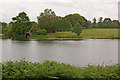
The Ladyspring Grotto is approached by one of two routes up a short gully leading uphill from the edge of the Broad Water lake south of Ashburnham House: either a high path along the eastern edge, or a lower path along the bottom of the gully. The upper path curves in around the top of the gully past a collection of massive boulders and stone steps. In both cases the Grotto is more or less hidden from view almost until the visitor reaches it. It consists of a well-chamber about five feet square by seven feet high, set into the bank, with a flagged stone floor and plastered walls, and a semi-circular arched roof; the walls are of very substantial stone blocks and the arch is constructed from thin clay tiles. The water pours from an outlet in the back wall into a stone trough raised above the floor.
Nothing is known for certain about the Ladyspring’s history. Information available at Ashburnham ascribes it to Capability Brown’s landscaping of the gardens in the 1760s and ‘70s, but if so it would be an item unique in his entire oeuvre. My guess is that, even though it may date from that sort of time, the real responsibility will have lain not with Brown but with the incumbent Earl who may have had a taste for antiquities. The Grotto seems to be an attempt to recreate a Graeco-Roman nymphaeum or shrine, and may be ascribed to the academically-inclined third Earl, George, who was a Fellow of the Society of Antiquaries and trustee of the British Museum. He was in charge of Ashburnham between 1812 and 1830, admittedly a bit late for the sort of Romantic folly-making the Grotto represents.
The origin of the name is mysterious too. The Ashburnham Place guidebook and various information boards around the grounds ascribe it to a painting on the plaster at the rear of the well-chamber, depicting, as variously stated, one or three ‘ladies’. The image is supposed to be visible when water is thrown on the plaster – though, even allowing imagination the greatest latitude, I couldn’t make out anything more than random stains of mould – or under infra-red photography. An estate map of 1638 shows a ‘Lady’ field name to the north of the house, so the title had some pre-existing local usage, and a ‘Lady Spring’ might have existed before the creation of the Grotto, even if the name did not refer to the Virgin Mary (the church is dedicated to St Peter).
You may be viewing yesterday's version of this page. To see the most up to date information please register for a free account.
Do not use the above information on other web sites or publications without permission of the contributor.
Nearby Images from Geograph Britain and Ireland:
©2023(licence)
©2011(licence)
©2023(licence)
©2011(licence)
©2011(licence)
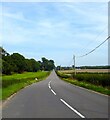
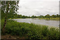
The above images may not be of the site on this page, they are loaded from Geograph.
Please Submit an Image of this site or go out and take one for us!
Click here to see more info for this site
Nearby sites
Key: Red: member's photo, Blue: 3rd party photo, Yellow: other image, Green: no photo - please go there and take one, Grey: site destroyed
Download sites to:
KML (Google Earth)
GPX (GPS waypoints)
CSV (Garmin/Navman)
CSV (Excel)
To unlock full downloads you need to sign up as a Contributory Member. Otherwise downloads are limited to 50 sites.
Turn off the page maps and other distractions
Nearby sites listing. In the following links * = Image available
141m NW 317° Ironspring* Holy Well or Sacred Spring (TQ688141)
8.4km SSE 148° Bexhill Museum Museum (TQ736070)
9.4km WSW 256° Amberstone Marker Stone (TQ598114)
12.9km ESE 108° St. Andrew's Spa Holy Well or Sacred Spring (TQ813104)
13.2km SW 217° Shinewater Park Ancient Trackway (TQ612032)
13.9km ESE 111° Hastings Castle* Hillfort (TQ821095)
14.0km ESE 109° St Clements Caves Cave or Rock Shelter (TQ823098)
14.8km ESE 108° East Hill Settlement Ancient Village or Settlement (TQ832099)
15.8km SSW 207° The Redoubt Fortress and The Pavilion* Museum (TV62259963)
16.0km SW 224° Butts Lane Hollows* Misc. Earthwork (TQ58180212)
16.2km SW 224° Cold Crouch Tumulus* Round Barrow(s) (TQ5796602062)
16.2km SW 226° The Combe Tumuli* Barrow Cemetery (TQ577023)
16.4km SW 222° Babylon Down Tumuli* Barrow Cemetery (TQ582015)
16.4km SW 226° Combe West (Tumulus B)* Artificial Mound (TQ5736502230)
16.5km SW 226° Combe Hill Enclosure* Causewayed Enclosure (TQ574021)
16.6km NW 324° St Dunstan's Well Holy Well or Sacred Spring (TQ587271)
17.1km SW 222° Borne Hill secondary tumulus* Round Barrow(s) (TQ57730098)
17.2km SW 222° Bourne Hill Tumulus* Round Barrow(s) (TQ57700096)
17.2km SW 221° Bourne to Foxholes Tumuli group* Artificial Mound (TQ58010070)
17.2km SW 220° Fox Holes Tumuli* Barrow Cemetery (TQ58100052)
17.3km SW 231° Folkington Hill Round Barrow(s) (TQ55720279)
17.3km SW 235° Hunters Burgh Long Barrow* Long Barrow (TQ54980365)
17.3km SW 220° Foxholes-Beachy intermediate tumulus* Round Barrow(s) (TQ58090042)
17.4km SW 222° Bourne South West (Possible Tumulus)* Misc. Earthwork (TQ57580079)
17.4km SW 232° Hill Barn Tumuli* Barrow Cemetery (TQ55390293)
View more nearby sites and additional images


 We would like to know more about this location. Please feel free to add a brief description and any relevant information in your own language.
 Wir möchten mehr über diese Stätte erfahren. Bitte zögern Sie nicht, eine kurze Beschreibung und relevante Informationen in Deutsch hinzuzufügen.
 Nous aimerions en savoir encore un peu sur les lieux. S'il vous plaît n'hesitez pas à ajouter une courte description et tous les renseignements pertinents dans votre propre langue.
 Quisieramos informarnos un poco más de las lugares. No dude en añadir una breve descripción y otros datos relevantes en su propio idioma.