

<< Text Pages >> The Flower Mound - Natural Stone / Erratic / Other Natural Feature in United States in The Southwest
Submitted by Andy B on Friday, 01 November 2019 Page Views: 3637
Natural PlacesSite Name: The Flower MoundCountry: United States Region: The Southwest Type: Natural Stone / Erratic / Other Natural Feature
Nearest Town: Flower Mound
Latitude: 33.014490N Longitude: 97.06696W
Condition:
| 5 | Perfect |
| 4 | Almost Perfect |
| 3 | Reasonable but with some damage |
| 2 | Ruined but still recognisable as an ancient site |
| 1 | Pretty much destroyed, possibly visible as crop marks |
| 0 | No data. |
| -1 | Completely destroyed |
| 5 | Superb |
| 4 | Good |
| 3 | Ordinary |
| 2 | Not Good |
| 1 | Awful |
| 0 | No data. |
| 5 | Can be driven to, probably with disabled access |
| 4 | Short walk on a footpath |
| 3 | Requiring a bit more of a walk |
| 2 | A long walk |
| 1 | In the middle of nowhere, a nightmare to find |
| 0 | No data. |
| 5 | co-ordinates taken by GPS or official recorded co-ordinates |
| 4 | co-ordinates scaled from a detailed map |
| 3 | co-ordinates scaled from a bad map |
| 2 | co-ordinates of the nearest village |
| 1 | co-ordinates of the nearest town |
| 0 | no data |
Internal Links:
External Links:
The Flower Mound is located at 2400 Flower Mound Road, in the town of Flower Mound, Texas, on the northeast corner of the FM3040 and FM2499 crossroads. This historic site is a 12.576-acre native Tall Grass Prairie segment of the Great American Black Land Prairie. Nineteenth century settlers named this landmark, The Flower Mound, for the profusion of wildflowers that grow there.
On January 11, 1984, The Texas State Historical Commission approved The Flower Mound as a State of Texas Historic site.
The Flower Mound was created some 66- to 144-million years ago during the Cretaceous Period. Once the oceans receded from this region, The Mound towered some 50 feet above the adjoining Blackland Prairie.
Myths abound about The Mound, including that it was built by an Ancient Culture or is an Indian Burial Mound. Edward Marcus had several locations on The Mound excavated by SMU Archeologists, but no Indian remains were found.
Shards of pottery dated 700 AD were found at the base of The Mound by Sweetie Bowman in the 1970s. Wichita Indians were the primary Native Americans in Flower Mound, but several other tribes lived in the area, as well.
The Mound was sacred for the Wichita Indians and possibly other tribes. Wichita’s buried their dead in sacred ground, and often in high ground. The Mound could be a resting place for some Native Americans.
Source and more information at The Flower Mound Foundation
You may be viewing yesterday's version of this page. To see the most up to date information please register for a free account.
Do not use the above information on other web sites or publications without permission of the contributor.
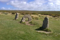
Nearby Images from Flickr
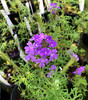
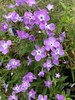
The above images may not be of the site on this page, but were taken nearby. They are loaded from Flickr so please click on them for image credits.
Click here to see more info for this site
Nearby sites
Click here to view sites on an interactive map of the areaKey: Red: member's photo, Blue: 3rd party photo, Yellow: other image, Green: no photo - please go there and take one, Grey: site destroyed
Download sites to:
KML (Google Earth)
GPX (GPS waypoints)
CSV (Garmin/Navman)
CSV (Excel)
To unlock full downloads you need to sign up as a Contributory Member. Otherwise downloads are limited to 50 sites.
Turn off the page maps and other distractions
Nearby sites listing. In the following links * = Image available
29.3km S 184° Caelum Moor* Modern Stone Circle etc
196.7km E 98° Kelsey Creek Dam site Ancient Village or Settlement
239.5km SE 131° Caddo Mounds* Ancient Village or Settlement
242.1km SSW 193° Debra L. Friedkin Ancient Mine, Quarry or other Industry
242.9km SSW 193° Gault Site Ancient Village or Settlement
293.6km SSW 206° Nightengale Archaeological Center* Ancient Village or Settlement
311.0km NE 47° Heavener Rune Stone* Carving
324.5km SSW 211° Enchanted Rock* Natural Stone / Erratic / Other Natural Feature
331.5km ENE 69° Ka-Do-Ha* Museum
343.6km NE 41° Spiro Mounds Archaeological Park* Ancient Village or Settlement
353.3km NE 43° Cavanaugh* Artificial Mound
356.8km SSW 194° Spring Lake Ancient Village or Settlement
387.0km SSW 213° Stonehenge II (Ingram, TX)* Modern Stone Circle etc
392.5km SW 214° Stonehenge II (Original Location)* Modern Stone Circle etc
399.3km SSE 156° Houston Museum of Natural Science* Museum
414.0km E 94° Hedgepeth Mounds Artificial Mound
422.3km NNE 26° Spavinaw Creek Ancient Village or Settlement
432.4km E 92° Scott Place Mounds* Artificial Mound
446.9km N 0° Etzanoa* Ancient Village or Settlement
448.0km ENE 57° Petit Jean State Park* Rock Art
456.6km NNW 331° Badger Hole (Oklahoma)* Ancient Mine, Quarry or other Industry
467.5km E 97° Watson Brake* Artificial Mound
471.5km E 98° Filhiol Mound Artificial Mound
482.1km E 98° Landerneau Mounds Artificial Mound
484.4km E 101° Wade Landing Mound Artificial Mound
View more nearby sites and additional images


 We would like to know more about this location. Please feel free to add a brief description and any relevant information in your own language.
 Wir möchten mehr über diese Stätte erfahren. Bitte zögern Sie nicht, eine kurze Beschreibung und relevante Informationen in Deutsch hinzuzufügen.
 Nous aimerions en savoir encore un peu sur les lieux. S'il vous plaît n'hesitez pas à ajouter une courte description et tous les renseignements pertinents dans votre propre langue.
 Quisieramos informarnos un poco más de las lugares. No dude en añadir una breve descripción y otros datos relevantes en su propio idioma.