<< Text Pages >> Blood Run - Rock Art in United States in The Plains
Submitted by KaiHofmann on Friday, 28 September 2012 Page Views: 3043
Rock ArtSite Name: Blood RunCountry: United States
NOTE: This site is 80.437 km away from the location you searched for.
Region: The Plains Type: Rock Art
Nearest Town: Sioux Falls Nearest Village: Granite
Latitude: 43.463759N Longitude: 96.599126W
Condition:
| 5 | Perfect |
| 4 | Almost Perfect |
| 3 | Reasonable but with some damage |
| 2 | Ruined but still recognisable as an ancient site |
| 1 | Pretty much destroyed, possibly visible as crop marks |
| 0 | No data. |
| -1 | Completely destroyed |
| 5 | Superb |
| 4 | Good |
| 3 | Ordinary |
| 2 | Not Good |
| 1 | Awful |
| 0 | No data. |
| 5 | Can be driven to, probably with disabled access |
| 4 | Short walk on a footpath |
| 3 | Requiring a bit more of a walk |
| 2 | A long walk |
| 1 | In the middle of nowhere, a nightmare to find |
| 0 | No data. |
| 5 | co-ordinates taken by GPS or official recorded co-ordinates |
| 4 | co-ordinates scaled from a detailed map |
| 3 | co-ordinates scaled from a bad map |
| 2 | co-ordinates of the nearest village |
| 1 | co-ordinates of the nearest town |
| 0 | no data |
Be the first person to rate this site - see the 'Contribute!' box in the right hand menu.
Internal Links:
External Links:
Rock Art in Lyon County,Iowa.
Cup-marked stone, burial and effigy mounds and settlement, probably built 8.500 years ago by people of the Oneota Culture and occupied by descendant historic tribes (Ioway, Otoe, Missouri, Quapaw, Kansa, Osage, Omaha).
The cup-marked stone is presumed to be associated with fertility and other spiritual rights.
link for further information
The Blood Run site is a National Histoical Landmark.
You may be viewing yesterday's version of this page. To see the most up to date information please register for a free account.
Do not use the above information on other web sites or publications without permission of the contributor.
Nearby Images from Flickr
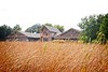
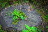
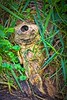
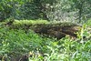


The above images may not be of the site on this page, but were taken nearby. They are loaded from Flickr so please click on them for image credits.
Click here to see more info for this site
Nearby sites
Click here to view sites on an interactive map of the areaKey: Red: member's photo, Blue: 3rd party photo, Yellow: other image, Green: no photo - please go there and take one, Grey: site destroyed
Download sites to:
KML (Google Earth)
GPX (GPS waypoints)
CSV (Garmin/Navman)
CSV (Excel)
To unlock full downloads you need to sign up as a Contributory Member. Otherwise downloads are limited to 50 sites.
Turn off the page maps and other distractions
Nearby sites listing. In the following links * = Image available
41.3km NE 52° Blue Mounds Equinox Stone Alignment Stone Row / Alignment
65.0km NNE 20° Pipestone National Monument Ancient Mine, Quarry or other Industry
116.4km SE 133° Sanford Museum* Museum
119.6km WNW 285° Mitchell Site* Ancient Village or Settlement
120.7km SE 135° Pilot Rock (Cherokee)* Natural Stone / Erratic / Other Natural Feature
142.5km ENE 60° Jeffers Petroglyphs* Rock Art
171.9km NNE 29° Peterson Bison Kill Natural Stone / Erratic / Other Natural Feature
322.8km NE 45° Mahnomen Mounds Barrow Cemetery
325.5km SE 129° The Palace Ancient Village or Settlement
326.9km ENE 59° Indian Mounds Regional Park* Artificial Mound
333.0km SE 129° Yellow Banks Park* Artificial Mound
343.6km ENE 61° Rattlesnake Mound Artificial Mound
350.4km ENE 67° Bow and Arrow Rock Art
400.8km NE 51° Trade Lake Mound* Artificial Mound
403.4km NNW 346° Standing Rock State Historic Site* Artificial Mound
428.3km NNE 14° Itasca Bison Kill* Natural Stone / Erratic / Other Natural Feature
429.3km E 88° Fish Farm Mounds State Preserve Artificial Mound
434.0km NNE 14° Itasca Burial Mounds* Barrow Cemetery
440.2km E 94° Effigy Mounds National Monument* Artificial Mound
447.7km E 95° Wyalusing Mounds* Artificial Mound
452.7km E 92° Larsen Cave, Crawford Co* Rock Art
472.2km E 89° Tainter Cave Cave or Rock Shelter
478.7km E 81° Fort McCoy Artificial Mound
490.0km SE 137° Thousand Hills Petroglyphs* Rock Art
494.9km S 170° Truckhenge* Modern Stone Circle etc
View more nearby sites and additional images


 We would like to know more about this location. Please feel free to add a brief description and any relevant information in your own language.
 Wir möchten mehr über diese Stätte erfahren. Bitte zögern Sie nicht, eine kurze Beschreibung und relevante Informationen in Deutsch hinzuzufügen.
 Nous aimerions en savoir encore un peu sur les lieux. S'il vous plaît n'hesitez pas à ajouter une courte description et tous les renseignements pertinents dans votre propre langue.
 Quisieramos informarnos un poco más de las lugares. No dude en añadir una breve descripción y otros datos relevantes en su propio idioma.