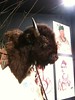
<< Other Photo Pages >> Old Fort (Miami, MO) - Artificial Mound in United States in Great Lakes Midwest
Submitted by AKFisher on Sunday, 10 September 2023 Page Views: 222
Pre-ColumbianSite Name: Old Fort (Miami, MO) Alternative Name: 23 SA 104Country: United States
NOTE: This site is 35.426 km away from the location you searched for.
Region: Great Lakes Midwest Type: Artificial Mound
Nearest Town: Miami, MO
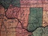
Latitude: 39.259040N Longitude: 93.26228W
Condition:
| 5 | Perfect |
| 4 | Almost Perfect |
| 3 | Reasonable but with some damage |
| 2 | Ruined but still recognisable as an ancient site |
| 1 | Pretty much destroyed, possibly visible as crop marks |
| 0 | No data. |
| -1 | Completely destroyed |
| 5 | Superb |
| 4 | Good |
| 3 | Ordinary |
| 2 | Not Good |
| 1 | Awful |
| 0 | No data. |
| 5 | Can be driven to, probably with disabled access |
| 4 | Short walk on a footpath |
| 3 | Requiring a bit more of a walk |
| 2 | A long walk |
| 1 | In the middle of nowhere, a nightmare to find |
| 0 | No data. |
| 5 | co-ordinates taken by GPS or official recorded co-ordinates |
| 4 | co-ordinates scaled from a detailed map |
| 3 | co-ordinates scaled from a bad map |
| 2 | co-ordinates of the nearest village |
| 1 | co-ordinates of the nearest town |
| 0 | no data |
Internal Links:
External Links:
 (PID:263614)")
It was added to the National Register of Historic Places in 1972.[1]
History:
The park and surrounding lands were once the home of the Native American tribe known to French settlers as “Oumessourit,” or Missouri Indians. Signs of the land's first occupants include the remnants of a Native American village, known as the Utz Site,[5] a sizeable earthworks named Old Fort,[6] and a mound field. Source: Wikipedia (see link below).
References:
1. National Register Information System". National Register of Historic Places. National Park Service. July 9, 2010.
2. Missouri Archaeological Society (January 2007). "National Register of Historic Places Inventory Nomination Form: Old Fort (23SA104)".
5. Missouri Archaeological Society. Retrieved 2017-02-01. "Description of Uzt site and finds". December 18, 2012. Retrieved October 16, 2015.
6. Old Fort - Van Meter State Park. Waymarking. Groundspeak, Inc. Retrieved October 16, 2015
Further reading and information:
Wikipedia
Missouri State Parks
Directions: From Miami, MO via MO-41 S and Green Ave, 7.1 mi.
You may be viewing yesterday's version of this page. To see the most up to date information please register for a free account.
Do not use the above information on other web sites or publications without permission of the contributor.
Nearby Images from Flickr


The above images may not be of the site on this page, but were taken nearby. They are loaded from Flickr so please click on them for image credits.
Click here to see more info for this site
Nearby sites
Click here to view sites on an interactive map of the areaKey: Red: member's photo, Blue: 3rd party photo, Yellow: other image, Green: no photo - please go there and take one, Grey: site destroyed
Download sites to:
KML (Google Earth)
GPX (GPS waypoints)
CSV (Garmin/Navman)
CSV (Excel)
To unlock full downloads you need to sign up as a Contributory Member. Otherwise downloads are limited to 50 sites.
Turn off the page maps and other distractions
Nearby sites listing. In the following links * = Image available
74.0km ESE 119° Big Moniteau Rock Art
90.2km ESE 123° BoatHenge, Missouri* Modern Stone Circle etc
116.2km NNE 27° Thousand Hills Petroglyphs* Rock Art
150.8km ESE 105° Graham Cave* Cave or Rock Shelter
174.8km ENE 65° Indian Mounds Park* Artificial Mound
175.1km SSW 195° Big Eddy* Ancient Mine, Quarry or other Industry
194.0km SE 138° UMR Stonehenge* Modern Stone Circle etc
203.1km W 265° Truckhenge* Modern Stone Circle etc
229.4km ENE 77° Elizabeth Mound Complex* Barrow Cemetery
229.6km ESE 102° Schwendemann Farm Mound Artificial Mound
232.8km E 81° Montezuma Mound Group* Artificial Mound
236.8km E 97° Pere Marquette State Park* Artificial Mound
243.2km ESE 105° Blake Mound Artificial Mound
244.5km SSW 192° Horseshoe Fossil Spring Ancient Village or Settlement
255.5km N 356° Yellow Banks Park* Artificial Mound
258.8km N 354° The Palace Ancient Village or Settlement
259.5km ESE 120° Washington State Park Petroglyphs* Rock Art
267.4km E 98° Piasa Bird* Rock Art
267.9km ESE 111° Mastodon State Historic Site* Museum
273.1km ESE 105° Sugarloaf Mound, Missouri* Artificial Mound
274.7km ESE 103° Big Mound (St Louis)* Artificial Mound
277.6km ESE 103° East Saint Louis Mound Center* Ancient Village or Settlement
280.5km ESE 103° Sam Chucalo Mound* Artificial Mound
282.0km NE 41° Toolesboro Mound Group* Artificial Mound
282.2km ESE 103° Cahokia - Powell Mound Artificial Mound
View more nearby sites and additional images


 We would like to know more about this location. Please feel free to add a brief description and any relevant information in your own language.
 Wir möchten mehr über diese Stätte erfahren. Bitte zögern Sie nicht, eine kurze Beschreibung und relevante Informationen in Deutsch hinzuzufügen.
 Nous aimerions en savoir encore un peu sur les lieux. S'il vous plaît n'hesitez pas à ajouter une courte description et tous les renseignements pertinents dans votre propre langue.
 Quisieramos informarnos un poco más de las lugares. No dude en añadir una breve descripción y otros datos relevantes en su propio idioma.