<< Text Pages >> Mahnomen Mounds - Barrow Cemetery in United States in The Plains
Submitted by bat400 on Wednesday, 15 September 2010 Page Views: 6578
Neolithic and Bronze AgeSite Name: Mahnomen MoundsCountry: United States
NOTE: This site is 76.771 km away from the location you searched for.
Region: The Plains Type: Barrow Cemetery
Nearest Town: St. Cloud, MN Nearest Village: Princeton, MN
Latitude: 45.496000N Longitude: 93.693W
Condition:
| 5 | Perfect |
| 4 | Almost Perfect |
| 3 | Reasonable but with some damage |
| 2 | Ruined but still recognisable as an ancient site |
| 1 | Pretty much destroyed, possibly visible as crop marks |
| 0 | No data. |
| -1 | Completely destroyed |
| 5 | Superb |
| 4 | Good |
| 3 | Ordinary |
| 2 | Not Good |
| 1 | Awful |
| 0 | No data. |
| 5 | Can be driven to, probably with disabled access |
| 4 | Short walk on a footpath |
| 3 | Requiring a bit more of a walk |
| 2 | A long walk |
| 1 | In the middle of nowhere, a nightmare to find |
| 0 | No data. |
| 5 | co-ordinates taken by GPS or official recorded co-ordinates |
| 4 | co-ordinates scaled from a detailed map |
| 3 | co-ordinates scaled from a bad map |
| 2 | co-ordinates of the nearest village |
| 1 | co-ordinates of the nearest town |
| 0 | no data |
Internal Links:
External Links:
I have visited· I would like to visit
MelissaBWrite would like to visit
Sherburne County.The Mahnomen burial mounds may be visited along a wildlife trail in the Sherburne National Wildlife Refuge. According to Sacred Sites of Minnesota, Paprock, 2004, the mounds are estimated to be 7000 years old. Interpretive signs on the trail. Note: Location given is general for the trail head of the Mahnomem trail. See the refuge headquarters for more information.
You may be viewing yesterday's version of this page. To see the most up to date information please register for a free account.
Do not use the above information on other web sites or publications without permission of the contributor.
Nearby Images from Flickr

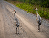

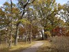
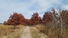
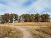
The above images may not be of the site on this page, but were taken nearby. They are loaded from Flickr so please click on them for image credits.
Click here to see more info for this site
Nearby sites
Click here to view sites on an interactive map of the areaKey: Red: member's photo, Blue: 3rd party photo, Yellow: other image, Green: no photo - please go there and take one, Grey: site destroyed
Download sites to:
KML (Google Earth)
GPX (GPS waypoints)
CSV (Garmin/Navman)
CSV (Excel)
To unlock full downloads you need to sign up as a Contributory Member. Otherwise downloads are limited to 50 sites.
Turn off the page maps and other distractions
Nearby sites listing. In the following links * = Image available
78.9km SE 141° Indian Mounds Regional Park* Artificial Mound
86.9km ENE 76° Trade Lake Mound* Artificial Mound
97.4km SE 133° Rattlesnake Mound Artificial Mound
135.5km SE 136° Bow and Arrow Rock Art
163.7km WSW 243° Peterson Bison Kill Natural Stone / Erratic / Other Natural Feature
189.4km SW 215° Jeffers Petroglyphs* Rock Art
222.7km NNW 329° Itasca Bison Kill* Natural Stone / Erratic / Other Natural Feature
226.1km NNW 330° Itasca Burial Mounds* Barrow Cemetery
265.2km SW 233° Pipestone National Monument Ancient Mine, Quarry or other Industry
281.9km SW 226° Blue Mounds Equinox Stone Alignment Stone Row / Alignment
288.3km ESE 124° Fort McCoy Artificial Mound
296.8km SE 139° Fish Farm Mounds State Preserve Artificial Mound
322.2km ESE 116° Cranberry Creek Mound Group Artificial Mound
322.8km SW 227° Blood Run Rock Art
328.8km NNE 16° Backcountry cache Ancient Mine, Quarry or other Industry
331.5km SE 134° Tainter Cave Cave or Rock Shelter
333.8km SE 142° Effigy Mounds National Monument* Artificial Mound
335.2km SE 140° Larsen Cave, Crawford Co* Rock Art
335.8km N 360° Grand Mound* Artificial Mound
336.7km N 1° McKinstry Mounds* Artificial Mound
339.4km SSW 207° Sanford Museum* Museum
344.9km SSW 206° Pilot Rock (Cherokee)* Natural Stone / Erratic / Other Natural Feature
347.3km SE 143° Wyalusing Mounds* Artificial Mound
351.8km N 355° Manitou Mounds* Barrow Cemetery
359.9km WNW 299° Standing Rock State Historic Site* Artificial Mound
View more nearby sites and additional images


 We would like to know more about this location. Please feel free to add a brief description and any relevant information in your own language.
 Wir möchten mehr über diese Stätte erfahren. Bitte zögern Sie nicht, eine kurze Beschreibung und relevante Informationen in Deutsch hinzuzufügen.
 Nous aimerions en savoir encore un peu sur les lieux. S'il vous plaît n'hesitez pas à ajouter une courte description et tous les renseignements pertinents dans votre propre langue.
 Quisieramos informarnos un poco más de las lugares. No dude en añadir una breve descripción y otros datos relevantes en su propio idioma.