<< Our Photo Pages >> Alligator Mounds (Clarksdale) - Artificial Mound in United States in The South
Submitted by stonetracker on Tuesday, 09 April 2024 Page Views: 66
Multi-periodSite Name: Alligator Mounds (Clarksdale) Alternative Name: 16-N-2Country: United States Region: The South Type: Artificial Mound
Nearest Town: Alligator MS
Latitude: 34.090380N Longitude: 90.73718W
Condition:
| 5 | Perfect |
| 4 | Almost Perfect |
| 3 | Reasonable but with some damage |
| 2 | Ruined but still recognisable as an ancient site |
| 1 | Pretty much destroyed, possibly visible as crop marks |
| 0 | No data. |
| -1 | Completely destroyed |
| 5 | Superb |
| 4 | Good |
| 3 | Ordinary |
| 2 | Not Good |
| 1 | Awful |
| 0 | No data. |
| 5 | Can be driven to, probably with disabled access |
| 4 | Short walk on a footpath |
| 3 | Requiring a bit more of a walk |
| 2 | A long walk |
| 1 | In the middle of nowhere, a nightmare to find |
| 0 | No data. |
| 5 | co-ordinates taken by GPS or official recorded co-ordinates |
| 4 | co-ordinates scaled from a detailed map |
| 3 | co-ordinates scaled from a bad map |
| 2 | co-ordinates of the nearest village |
| 1 | co-ordinates of the nearest town |
| 0 | no data |
Internal Links:
External Links:
I have visited· I would like to visit
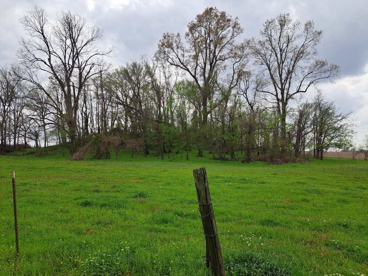
stonetracker visited on 1st Apr 2024 - their rating: Cond: 3 Amb: 3 Although there is no official parking pulloff, the road has enough shoulder to pull partially off it opposite Mound B. Mound B and C are clearly visible in a field behind a wire fence. Mound A is mostly blocked from view. Mounds D and E are in the middle of cultivated land and I was unable to definitely ID them.

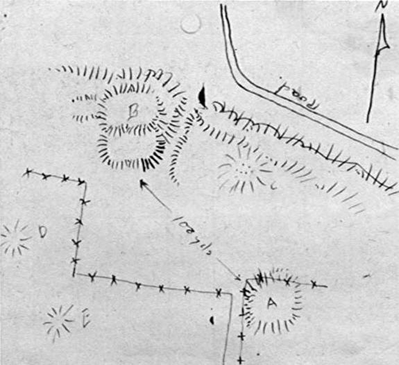
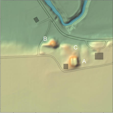
The Alligator site consists of five rectangular platform mounds (A through E) of varying size arranged around a central plaza. The site is positioned on the southern edge of Alligator Bayou. Cultural features have been discovered from both the Baytown (Late Woodland) and Mississippian periods, but the actual construction dates of the mounds are not known.
A modern home and various outbuildings are located among the mounds. Archaeologists Phillips, Ford, and Griffin (1951) reported five mounds at the site, three of which were much diminished from agricultural activity. Today only 2-3 of the mounds (A, B, and C) are well preserved. Mound A measures approximately 52m in diameter and 2.5m in height. Mound B measures approximately 35m in diameter and 3m in height. The remaining mounds rise about one meter above the surrounding landscape.
Location coordinates are given for Mound B, which is the mound closest to the road.
Source of description, maps, and survey history (in the Comments section of this article):
- Travis Cureton, Stephen Harris, Erica Carpenter, and Jay K. Johnson
2014: Mississippi Mound Trail, Northern Region: Phase I Investigations. Report submitted to the Mississippi Department of Archives and History, Jackson. Center for Archaeological Research, University of Mississippi, Oxford.
You may be viewing yesterday's version of this page. To see the most up to date information please register for a free account.


Do not use the above information on other web sites or publications without permission of the contributor.
Nearby Images from Flickr


The above images may not be of the site on this page, but were taken nearby. They are loaded from Flickr so please click on them for image credits.
Click here to see more info for this site
Nearby sites
Click here to view sites on an interactive map of the areaKey: Red: member's photo, Blue: 3rd party photo, Yellow: other image, Green: no photo - please go there and take one, Grey: site destroyed
Download sites to:
KML (Google Earth)
GPX (GPS waypoints)
CSV (Garmin/Navman)
CSV (Excel)
To unlock full downloads you need to sign up as a Contributory Member. Otherwise downloads are limited to 50 sites.
Turn off the page maps and other distractions
Nearby sites listing. In the following links * = Image available
23.3km NNE 13° Carson Mounds* Artificial Mound
27.8km ENE 60° Dunn Mounds* Artificial Mound
34.2km NE 46° Alcorn Cemetery Mound* Artificial Mound
39.2km NE 35° Salomon Mounds* Artificial Mound
42.1km SSW 212° Christmas Mound* Artificial Mound
45.5km NE 34° Barbee Mound* Artificial Mound
45.9km W 263° Menard-Hodges Site* Artificial Mound
55.8km S 188° Carter Mounds* Artificial Mound
56.2km NNE 26° West Mounds* Artificial Mound
67.6km NNE 28° Beaverdam Mounds* Artificial Mound
68.7km NNE 27° Evansville Mounds* Artificial Mound
73.3km SSW 199° Metcalfe Mounds Artificial Mound
73.6km SSW 204° Winterville* Artificial Mound
76.0km S 191° Leland Mounds* Artificial Mound
76.8km SSW 192° Stoneville Mounds Artificial Mound
79.9km NNE 25° Johnson Cemetery Mound* Artificial Mound
79.9km ENE 69° Batesville Mounds* Artificial Mound
83.3km NNE 24° Hollywood Mounds* Artificial Mound
87.2km NNE 22° Commerce Mounds* Artificial Mound
95.0km S 188° Arcola Mounds* Artificial Mound
97.7km SSE 166° Jaketown* Artificial Mound
110.2km NNE 28° Cheatham Mound* Artificial Mound
111.1km NNE 25° Edgefield Mounds* Artificial Mound
111.6km S 186° Magee Mounds* Artificial Mound
112.8km SSW 192° Swan Lake Mounds* Artificial Mound
View more nearby sites and additional images


 We would like to know more about this location. Please feel free to add a brief description and any relevant information in your own language.
 Wir möchten mehr über diese Stätte erfahren. Bitte zögern Sie nicht, eine kurze Beschreibung und relevante Informationen in Deutsch hinzuzufügen.
 Nous aimerions en savoir encore un peu sur les lieux. S'il vous plaît n'hesitez pas à ajouter une courte description et tous les renseignements pertinents dans votre propre langue.
 Quisieramos informarnos un poco más de las lugares. No dude en añadir una breve descripción y otros datos relevantes en su propio idioma.