<< Our Photo Pages >> St Chaoi's Holy Well (Kilkee) - Holy Well or Sacred Spring in Ireland (Republic of) in Co. Clare
Submitted by Sunny100 on Thursday, 06 January 2011 Page Views: 6714
Springs and Holy WellsSite Name: St Chaoi's Holy Well (Kilkee) Alternative Name: St Caoi's Well, St Chaoidhe's WellCountry: Ireland (Republic of)
NOTE: This site is 13.323 km away from the location you searched for.
County: Co. Clare Type: Holy Well or Sacred Spring
Nearest Town: Kilkee
Map Ref: Q868596
Latitude: 52.676113N Longitude: 9.674337W
Condition:
| 5 | Perfect |
| 4 | Almost Perfect |
| 3 | Reasonable but with some damage |
| 2 | Ruined but still recognisable as an ancient site |
| 1 | Pretty much destroyed, possibly visible as crop marks |
| 0 | No data. |
| -1 | Completely destroyed |
| 5 | Superb |
| 4 | Good |
| 3 | Ordinary |
| 2 | Not Good |
| 1 | Awful |
| 0 | No data. |
| 5 | Can be driven to, probably with disabled access |
| 4 | Short walk on a footpath |
| 3 | Requiring a bit more of a walk |
| 2 | A long walk |
| 1 | In the middle of nowhere, a nightmare to find |
| 0 | No data. |
| 5 | co-ordinates taken by GPS or official recorded co-ordinates |
| 4 | co-ordinates scaled from a detailed map |
| 3 | co-ordinates scaled from a bad map |
| 2 | co-ordinates of the nearest village |
| 1 | co-ordinates of the nearest town |
| 0 | no data |
Internal Links:
External Links:
I have visited· I would like to visit
rrmoser would like to visit
 (PID:72131)")
About 1 mile or so to the south west of Kilkee town on the coast road towards Castle Point is the little stone shrine and holy well of St Chaoi. It is painted white and just inside the narrow doorway a square-shaped healing well. On top of the little way-side shrine a cross is also painted white. Looks to be quite well cared for.
The water has long been a curative for sore eyes, but you must follow the instructions that are given. Firstly, recite 5 Our Fathers, then 5 Hail Marys, 5 Glory-Be's and 9 rounds of the well while reciting the rosary. By then, all being well, your sore eyes should be better! The little building stands upon a raised mound, so the well could go back to pre-Christian times.
Unfortunately nothing is known about St Chaoi, Caoi or Chaoidhe. The church in Kilkee is dedicated to him/her; the town being named after the saint.
You may be viewing yesterday's version of this page. To see the most up to date information please register for a free account.
Do not use the above information on other web sites or publications without permission of the contributor.
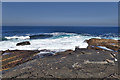
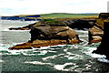
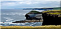
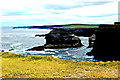
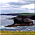
Nearby Images from Geograph Britain and Ireland:
©2018(licence)
©2012(licence)
©2012(licence)
©2012(licence)
©2012(licence)
The above images may not be of the site on this page, they are loaded from Geograph.
Please Submit an Image of this site or go out and take one for us!
Click here to see more info for this site
Nearby sites
Click here to view sites on an interactive map of the areaKey: Red: member's photo, Blue: 3rd party photo, Yellow: other image, Green: no photo - please go there and take one, Grey: site destroyed
Download sites to:
KML (Google Earth)
GPX (GPS waypoints)
CSV (Garmin/Navman)
CSV (Excel)
To unlock full downloads you need to sign up as a Contributory Member. Otherwise downloads are limited to 50 sites.
Turn off the page maps and other distractions
Nearby sites listing. In the following links * = Image available
12.2km S 171° Beale Middle Stone Row / Alignment (Q885475)
35.1km NNE 29° St. Brigid's Holy Well* Holy Well or Sacred Spring (R044900)
35.1km NE 40° Calluragh South* Burial Chamber or Dolmen (R101860)
41.0km SSE 150° Feavautia Stone Row / Alignment
43.7km NNE 26° Teergonean* Court Tomb (R068985)
44.2km NNE 14° O'Brien stone fort Stone Fort or Dun
45.7km SSW 211° Illauntannig Island Ancient Cross (Q621211)
45.7km N 8° Dún Chonchúir* Stone Fort or Dun
46.5km E 98° Tomdeely N Stone Row / Alignment (R329524)
46.9km SSW 213° Illaunimnal Stone Circle (Q600210)
47.1km NE 46° Ballyganner South* Wedge Tomb (R216915)
47.2km NE 37° Boghill Centre Modern Stone Circle etc
47.7km N 359° Dun Ducathair* Stone Fort or Dun (L870073)
48.2km NE 42° Ballykinvarga* Stone Fort or Dun (R201946)
48.3km ENE 57° St Tola's High Cross (Dysert O'Dea) Ancient Cross
49.4km SE 141° Tooreenglanahee Stone Row / Alignment (R174207)
50.2km N 358° Dun Eochla* Stone Fort or Dun (L863098)
50.2km N 358° Dún Eochla wedge tomb* Wedge Tomb (L8620409853)
50.3km N 357° Oghil Wedge Tomb* Wedge Tomb (L84980988)
50.4km N 353° Dun Aengus* Stone Fort or Dun (L817098)
50.7km N 359° Chiaráin stones* Holed Stone
50.8km N 354° Dún Aengus Inishmore Island Promontory Fort / Cliff Castle
50.9km N 354° Ogham stone at Kilmurvy* Standing Stone (Menhir) (L8241410412)
51.3km NE 50° Killinaboy Church Early Christian Sculptured Stone (R27139158)
51.5km NE 48° Parknabinnia 1* Wedge Tomb (R25749341)
View more nearby sites and additional images


 We would like to know more about this location. Please feel free to add a brief description and any relevant information in your own language.
 Wir möchten mehr über diese Stätte erfahren. Bitte zögern Sie nicht, eine kurze Beschreibung und relevante Informationen in Deutsch hinzuzufügen.
 Nous aimerions en savoir encore un peu sur les lieux. S'il vous plaît n'hesitez pas à ajouter une courte description et tous les renseignements pertinents dans votre propre langue.
 Quisieramos informarnos un poco más de las lugares. No dude en añadir una breve descripción y otros datos relevantes en su propio idioma.