<< Our Photo Pages >> Derrynafinchin - Stone Circle in Ireland (Republic of) in Co. Cork
Submitted by frogcottage42 on Tuesday, 08 October 2002 Page Views: 7148
Neolithic and Bronze AgeSite Name: DerrynafinchinCountry: Ireland (Republic of)
NOTE: This site is 3.107 km away from the location you searched for.
County: Co. Cork Type: Stone Circle
Nearest Village: Derrynafinchin
Map Ref: W04756218
Discovery Map Number: D85
Latitude: 51.804341N Longitude: 9.381602W
Condition:
| 5 | Perfect |
| 4 | Almost Perfect |
| 3 | Reasonable but with some damage |
| 2 | Ruined but still recognisable as an ancient site |
| 1 | Pretty much destroyed, possibly visible as crop marks |
| 0 | No data. |
| -1 | Completely destroyed |
| 5 | Superb |
| 4 | Good |
| 3 | Ordinary |
| 2 | Not Good |
| 1 | Awful |
| 0 | No data. |
| 5 | Can be driven to, probably with disabled access |
| 4 | Short walk on a footpath |
| 3 | Requiring a bit more of a walk |
| 2 | A long walk |
| 1 | In the middle of nowhere, a nightmare to find |
| 0 | No data. |
| 5 | co-ordinates taken by GPS or official recorded co-ordinates |
| 4 | co-ordinates scaled from a detailed map |
| 3 | co-ordinates scaled from a bad map |
| 2 | co-ordinates of the nearest village |
| 1 | co-ordinates of the nearest town |
| 0 | no data |
Internal Links:
External Links:
I have visited· I would like to visit
kith visited on 8th Dec 2012 - their rating: Cond: 2 Amb: 5 Access: 5 I pass close by frequently. Always give acknowledgement to it. A pity it is so close to the tared road and that the gorse encroaches so much. A lovely drive across the mountains from Kilgarvan though.
frogcottage42 have visited here
")
Cork CC have placed signs marking the townland names, large grey slates at the side of the road. When you reach the sign for Derrynafinchin on the right turn next to it and the circle is 60m on the right with a small lay-by 40m further on the left.
It is a shame that the council and the farmer here cannot come together to move the sheep fence a couple of metres to the East which would allow views and access to the whole monument.
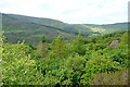
This road eventually brings you almost to the sites at Mill Little and Dromkeal and together with fantastic scenery linking these four monuments is a good day out.
You may be viewing yesterday's version of this page. To see the most up to date information please register for a free account.
")
")
Do not use the above information on other web sites or publications without permission of the contributor.
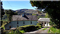
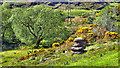
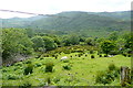
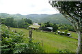
Nearby Images from Geograph Britain and Ireland:
©2018(licence)
©2018(licence)
©2013(licence)
©2013(licence)
©2013(licence)
The above images may not be of the site on this page, they are loaded from Geograph.
Please Submit an Image of this site or go out and take one for us!
Click here to see more info for this site
Nearby sites
Click here to view sites on an interactive map of the areaKey: Red: member's photo, Blue: 3rd party photo, Yellow: other image, Green: no photo - please go there and take one, Grey: site destroyed
Download sites to:
KML (Google Earth)
GPX (GPS waypoints)
CSV (Garmin/Navman)
CSV (Excel)
To unlock full downloads you need to sign up as a Contributory Member. Otherwise downloads are limited to 50 sites.
![]()
Turn off the page maps and other distractions
Nearby sites listing. In the following links * = Image available
2.7km S 182° Illane.* Stone Circle (W04595951)
3.5km ESE 105° Cappaboy Beg NW* Stone Circle (W0811961229)
3.8km S 185° Maughanasilly* Stone Row / Alignment (W0431958413)
5.0km S 190° Ahil More standing stone* Standing Stone (Menhir)
5.0km ESE 111° Cappaboy Beg Stone Row / Alignment (W0944060275)
5.1km ESE 110° Cappaboy Beg* Stone Circle (W09556031)
5.3km ESE 109° Cappaboy Beg SE* Stone Circle (W09786037)
6.1km SE 144° Cahermuckee* Standing Stones (W08245714)
6.6km S 173° Kealkil* Stone Circle (W0538155588)
6.8km SSW 203° Trawnamaddree Stone Row / Alignment (W01975597)
6.8km W 277° Coorleagh ring fort* Stone Fort or Dun
6.9km S 176° Breeney More* Stone Circle (W05085526)
7.0km WSW 244° Cooleenlemane rock scribing* Cave or Rock Shelter
7.1km ESE 113° Gortloughra Standing Stones (W11235924)
7.2km SE 144° Maughanclea SW* Stone Circle (W08945630)
7.3km SSE 149° Maughanaclea Centre* Stone Circle (W08385588)
7.3km SSE 150° Maughanaclea* Stone Circle (W08355580)
7.6km NW 316° Gullaba enclosure and boulder-burial* Ancient Village or Settlement
8.0km NE 54° Gortafludig Stone Row / Alignment (W11306673)
8.0km SE 134° Maughanclea NE* Stone Circle (W104565)
8.0km SSE 162° Ardrah Stone Row* Stone Row / Alignment (W0710854517)
8.1km SW 224° Mill Little Stone Row / Alignment (V98985653)
8.1km SW 225° Mill Little* Stone Circle (V989565)
8.3km SSE 153° Ardrah wedge tomb* Wedge Tomb
8.3km WNW 282° Feaghna* Rock Art (V966641)
View more nearby sites and additional images


 We would like to know more about this location. Please feel free to add a brief description and any relevant information in your own language.
 Wir möchten mehr über diese Stätte erfahren. Bitte zögern Sie nicht, eine kurze Beschreibung und relevante Informationen in Deutsch hinzuzufügen.
 Nous aimerions en savoir encore un peu sur les lieux. S'il vous plaît n'hesitez pas à ajouter une courte description et tous les renseignements pertinents dans votre propre langue.
 Quisieramos informarnos un poco más de las lugares. No dude en añadir una breve descripción y otros datos relevantes en su propio idioma.