<< Our Photo Pages >> Derreengreanagh wedge tomb - Wedge Tomb in Ireland (Republic of) in Co. Cork
Submitted by GaelicLaird on Tuesday, 18 July 2023 Page Views: 210
Neolithic and Bronze AgeSite Name: Derreengreanagh wedge tombCountry: Ireland (Republic of) County: Co. Cork Type: Wedge Tomb
Nearest Town: Bantry
Latitude: 51.670513N Longitude: 9.428832W
Condition:
| 5 | Perfect |
| 4 | Almost Perfect |
| 3 | Reasonable but with some damage |
| 2 | Ruined but still recognisable as an ancient site |
| 1 | Pretty much destroyed, possibly visible as crop marks |
| 0 | No data. |
| -1 | Completely destroyed |
| 5 | Superb |
| 4 | Good |
| 3 | Ordinary |
| 2 | Not Good |
| 1 | Awful |
| 0 | No data. |
| 5 | Can be driven to, probably with disabled access |
| 4 | Short walk on a footpath |
| 3 | Requiring a bit more of a walk |
| 2 | A long walk |
| 1 | In the middle of nowhere, a nightmare to find |
| 0 | No data. |
| 5 | co-ordinates taken by GPS or official recorded co-ordinates |
| 4 | co-ordinates scaled from a detailed map |
| 3 | co-ordinates scaled from a bad map |
| 2 | co-ordinates of the nearest village |
| 1 | co-ordinates of the nearest town |
| 0 | no data |
Internal Links:
External Links:
")
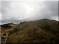
A wedge tomb in the townland of Derreengreanagh, officially recorded as site CO118-039----
On crest of Knocknaveagh hill above Bantry, 350m SW of summit. Ruined chamber (L 1.2m) aligned E-W, covered by single roof stone; N side formed of one slab, decreasing in height W->E; inset back stone at E end. Number of slabs lie in chamber area. No indications of mound. (Roberts 1988, Ch. 5, no. 9; Ó Nualláin 1989, 135).
The above description is derived from the published 'Archaeological Inventory of County Cork. Volume 1: West Cork' (Dublin: Stationery Office, 1992).
You may be viewing yesterday's version of this page. To see the most up to date information please register for a free account.
")
")
")
Do not use the above information on other web sites or publications without permission of the contributor.
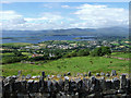
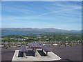
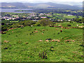
Nearby Images from Geograph Britain and Ireland:
©2011(licence)
©2007(licence)
©2010(licence)
©2005(licence)
©2005(licence)
The above images may not be of the site on this page, they are loaded from Geograph.
Please Submit an Image of this site or go out and take one for us!
Click here to see more info for this site
Nearby sites
Click here to view sites on an interactive map of the areaKey: Red: member's photo, Blue: 3rd party photo, Yellow: other image, Green: no photo - please go there and take one, Grey: site destroyed
Download sites to:
KML (Google Earth)
GPX (GPS waypoints)
CSV (Garmin/Navman)
CSV (Excel)
To unlock full downloads you need to sign up as a Contributory Member. Otherwise downloads are limited to 50 sites.
Turn off the page maps and other distractions
Nearby sites listing. In the following links * = Image available
1.2km ESE 109° Baurgaum.* Stone Circle (W02314695)
1.4km SSW 192° Doirín Grianach standing stone and stone group* Standing Stone (Menhir)
1.4km SSE 165° Baurgorm SW* Stone Circle (W01554595)
1.5km SSE 156° Cullomane West* Stone Row / Alignment (W0176546014)
1.7km SW 215° Scartbaun stone row* Stone Row / Alignment
2.7km W 272° St Brendan's Stone (Kilnaruane)* Early Christian Sculptured Stone
2.9km SW 220° Keilnascarta* Stone Row / Alignment (V99314521)
3.0km E 82° Trawlebane* Stone Circle (W04214773)
3.1km SE 128° Cullomane E* Stone Circle (W03634540)
3.5km SSW 205° Parkana Stone Row / Alignment (V99694423)
3.9km ESE 109° Inchybegga* Stone Circle (W04834600)
5.1km ESE 108° Dromore (Cork)* Standing Stone (Menhir)
5.1km SW 225° Maulinward Stone Row / Alignment (V975438)
5.2km SW 222° Ballycommane Standing Stones (V97634361)
6.0km N 2° Crossoge wedge tomb* Wedge Tomb
6.3km NNE 20° Cappanaboul* Stone Circle (W0343753265)
7.1km N 352° Dromkeal* Stone Circle (W00315445)
7.2km S 186° Derreennaclogh Rock Art* Rock Art
7.4km ENE 62° Coomanore South* Standing Stones
7.6km NNE 31° Derryarkane Stone Circle (W05255374)
8.6km N 4° Trawnamaddree Stone Row / Alignment (W01975597)
8.7km S 175° Ballybane* Rock Art (W0183738669)
8.8km NNE 25° Breeney More* Stone Circle (W05085526)
9.2km NNE 26° Kealkil* Stone Circle (W0538155588)
9.3km NE 38° Ardrah Stone Row* Stone Row / Alignment (W0710854517)
View more nearby sites and additional images


 We would like to know more about this location. Please feel free to add a brief description and any relevant information in your own language.
 Wir möchten mehr über diese Stätte erfahren. Bitte zögern Sie nicht, eine kurze Beschreibung und relevante Informationen in Deutsch hinzuzufügen.
 Nous aimerions en savoir encore un peu sur les lieux. S'il vous plaît n'hesitez pas à ajouter une courte description et tous les renseignements pertinents dans votre propre langue.
 Quisieramos informarnos un poco más de las lugares. No dude en añadir una breve descripción y otros datos relevantes en su propio idioma.